Clydebank (district)

Last updated • 2 min readFrom Wikipedia, The Free Encyclopedia

Coordinates: 55°58′N4°24′W / 55.96°N 4.40°W / 55.96; -4.40

Contents

Clydebank
District
West Dunbartonshire Council offices, Clydebank - geograph.org.uk - 626813.jpg
Council Offices, Clydebank
Population
  1991 [1] 45,717
History
  Created16 May 1975
  Abolished31 March 1996
  Succeeded by(Part of) West Dunbartonshire
GovernmentClydebank District Council
   HQ Clydebank

Clydebank (Scottish Gaelic: Bruach Chluaidh) was, from 1975 to 1996, one of nineteen local government districts in the Strathclyde region of Scotland, covering the town of Clydebank and adjoining areas to the north-west of the city of Glasgow. [2]

History

The district was created in 1975 under the Local Government (Scotland) Act 1973, which established a two-tier structure of local government across mainland Scotland comprising upper-tier regions and lower-tier districts. Clydebank was one of nineteen districts created within the region of Strathclyde. The district covered parts of two former districts from the historic county of Dunbartonshire, which were abolished at the same time: [3]

Clydebank was one of the smallest districts by area. The main urban area was Clydebank, but the district also included the settlements of Duntocher, Faifley, Hardgate and Old Kilpatrick, along with the Kilpatrick Hills rising steeply to the north, The River Clyde was the district's southern boundary. The urban area of Glasgow lay to the south-east, and there was a tract of farmland to the north-east on the border with Bearsden and Milngavie. To the west was the Dumbarton district.

The district was abolished in 1996 under the Local Government etc. (Scotland) Act 1994 which replaced regions and districts with unitary council areas. The Clydebank area merged with much of neighbouring Dumbarton district to become the West Dunbartonshire council area. The 1994 act originally named the new district "Dumbarton and Clydebank", but the shadow authority elected in 1995 requested a change of name to "West Dunbartonshire", which was agreed by the government before the new council area came into force. [4] [5] [6]

Political control

The first election to the district council was held in 1974, initially operating as a shadow authority alongside the outgoing authorities until it came into its powers on 16 May 1975. Political control of the council from 1975 was as follows: [7]

Party in controlYears
No overall control 1975–1980
Labour 1980–1996

Elections

Elections were held as follows: [7]

YearSeats Labour SNP Conservative Independent / Other Notes
1974 105410
1977 103511
1980 108011
1984 1211010
1988 1211010
1992 128211

Premises

The council was initially based at Clydebank Town Hall, which had been built in 1902 for the former Clydebank Town Council. Shortly after the new district's creation it built a new headquarters called Council Offices at the junction of Rosebery Place and Kilbowie Road, which was completed in 1979. [8] [9] After the council's abolition the Council Offices initially served as additional office space for West Dunbartonshire Council, which had its headquarters in Dumbarton. The Clydebank Council Offices were subsequently demolished in 2017. [10]

See also

Related Research Articles

<span class="mw-page-title-main">Argyll and Bute</span> Council area of Scotland

Argyll and Bute is one of 32 unitary council areas in Scotland and a lieutenancy area. The current lord-lieutenant for Argyll and Bute is Jane Margaret MacLeod. The administrative centre for the council area is in Lochgilphead at Kilmory Castle, a 19th-century Gothic Revival building and estate. The current council leader is Robin Currie, a councillor for Kintyre and the Islands.

<span class="mw-page-title-main">West Dunbartonshire</span> Council area of Scotland

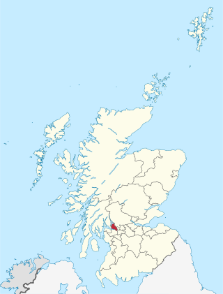
West Dunbartonshire is one of the 32 local government council areas of Scotland. The area lies to the north-west of the City of Glasgow and contains many of Glasgow's commuter towns and villages. West Dunbartonshire also borders Argyll and Bute, East Dunbartonshire, Renfrewshire and Stirling.

<span class="mw-page-title-main">North Lanarkshire</span> Council area of Scotland

North Lanarkshire is one of 32 council areas of Scotland. It borders the north-east of the City of Glasgow and contains many of Glasgow's suburbs and commuter towns and villages. It also borders East Dunbartonshire, Falkirk, Stirling, South Lanarkshire and West Lothian. The council area covers parts of the historic counties of Dunbartonshire, Lanarkshire and Stirlingshire. The council is based in Motherwell.

<span class="mw-page-title-main">Dunbartonshire</span> Historic county in Scotland

Dunbartonshire or the County of Dumbarton is a historic county, lieutenancy area and registration county in the west central Lowlands of Scotland lying to the north of the River Clyde. Dunbartonshire borders Perthshire to the north, Stirlingshire to the east, Lanarkshire and Renfrewshire to the south, and Argyllshire to the west.

<span class="mw-page-title-main">Clydebank</span> Town in Scotland

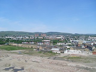
Clydebank is a town in West Dunbartonshire, Scotland. Situated on the north bank of the River Clyde, it borders the village of Old Kilpatrick to the west, and the Yoker and Drumchapel areas of the adjacent City of Glasgow immediately to the east. Depending on the definition of the town's boundaries, the suburban areas of Duntocher, Faifley and Hardgate either surround Clydebank to the north, or are its northern outskirts, with the Kilpatrick Hills beyond.

<span class="mw-page-title-main">Strathclyde</span> Former local government region of Scotland

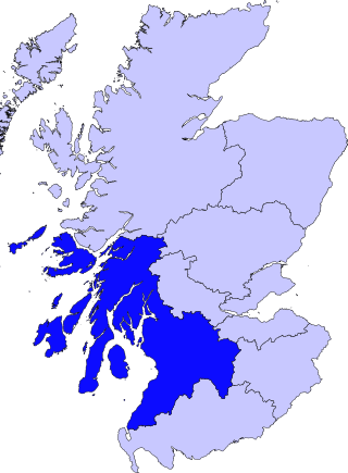
Strathclyde was one of nine former local government regions of Scotland created in 1975 by the Local Government (Scotland) Act 1973 and abolished in 1996 by the Local Government etc. (Scotland) Act 1994. The Strathclyde region had 19 districts. The region was named after the medieval Kingdom of Strathclyde but covered a broader geographic area than its namesake.

<span class="mw-page-title-main">Bearsden and Milngavie</span> Former government district in the Strathclyde region of Scotland

Bearsden and Milngavie was, from 1975 to 1996, one of nineteen local government districts in the Strathclyde region of Scotland, covering an area north of the City of Glasgow.

<span class="mw-page-title-main">Cumbernauld and Kilsyth (district)</span>

Cumbernauld and Kilsyth was one of nineteen local government districts in the Strathclyde region of Scotland between 1975 and 1996.

<span class="mw-page-title-main">Kilmarnock and Loudoun (district)</span> Scottish district in East Ayrshire, Scotland, UK

Kilmarnock and Loudoun was one of nineteen local government districts in the Strathclyde region of Scotland from 1975 to 1996.

<span class="mw-page-title-main">Strathkelvin</span>

Strathkelvin is the strath (valley) of the River Kelvin in west central Scotland, lying north-east of Glasgow. The name Strathkelvin was used between 1975 and 1996 for one of nineteen local government districts in the Strathclyde region.

<span class="mw-page-title-main">Hardgate</span> Human settlement in Scotland

Hardgate is a village in West Dunbartonshire, Scotland.

<span class="mw-page-title-main">Duntocher</span> Human settlement in Scotland

Duntocher is a village in West Dunbartonshire, Scotland. It has an estimated population of 6,850. The etymology of the name of the village indicates that its name means "the fort on the causeway".

<span class="mw-page-title-main">Faifley</span> Human settlement in Scotland

Faifley is a large estate forming part of the town of Clydebank, Scotland, adjoining the former village of Hardgate, with a population of approximately 5,001. Along with Duntocher and Hardgate, Faifley falls within West Dunbartonshire's Kilpatrick ward with a combined population of 12,719 in 2011.

<span class="mw-page-title-main">East Dunbartonshire (UK Parliament constituency)</span> Parliamentary constituency in the United Kingdom, 2005 onwards

East Dunbartonshire is a county constituency of the House of Commons of the Parliament of the United Kingdom (Westminster). It elects one Member of Parliament (MP) by the first past the post system of election. The seat is possibly best known for formerly being the constituency of Jo Swinson, the former Leader of the Liberal Democrats who was defeated at the 2019 general election. The current MP for the constituency is Amy Callaghan of the Scottish National Party (SNP).

<span class="mw-page-title-main">West Dunbartonshire (UK Parliament constituency)</span> Parliamentary constituency in the United Kingdom, 2005 onwards

West Dunbartonshire is a county constituency of the House of Commons of the Parliament of the United Kingdom. It elects one Member of Parliament (MP) by the first past the post system of election and covers the same area as the county of West Dunbartonshire.

<span class="mw-page-title-main">Dalmuir</span> Human settlement in Scotland

Dalmuir is an area nine miles northwest of Glasgow, Scotland, on the western side of Clydebank, and part of West Dunbartonshire Council Area. The name is a lowland Scots derivation of the Gaelic meaning Big Field. The area was originally two separate villages with Dalmuir Shore joining with Clydebank in 1886 and Dalmuir Village in 1906, during a period of rapid industrialization and expansion. Dalmuir is bounded by the village of Old Kilpatrick to the west, the Mountblow and Parkhall housing schemes to the north, and the Clydebank town centre area to the east. To the south is the River Clyde.

Central Dunbartonshire was a county constituency of the House of Commons of the Parliament of the United Kingdom (Westminster) from 1974 to 1983. It elected one Member of Parliament (MP) by the first past the post system of election.

<span class="mw-page-title-main">Dumbarton (district)</span> Former local government district in Scotland

Dumbarton was, from 1975 to 1996, one of nineteen local government districts in the Strathclyde region of Scotland, covering the town of Dumbarton and surrounding areas to the north-west of Glasgow.

<span class="mw-page-title-main">1995 West Dunbartonshire Council election</span>

The 1995 elections to West Dunbartonshire Council were held on the 6 April 1995 and were the first for the newly formed unitary authority, which was created under the Local Government etc (Scotland) Act 1994 and replaced the previous two-tier system of local government under Strathclyde Regional Council and Dumbarton and Clydebank District Councils.

References

  1. The Statesman's Year-Book 1997-8, page 1294; B. Hunter (ed); Springer, 2016; ISBN   9780230271265
  2. "Clydebank". Undiscovered Scotland. Retrieved 19 February 2023.
  3. "Local Government (Scotland) Act 1973", legislation.gov.uk , The National Archives, 1973 c. 65, retrieved 18 February 2023
  4. "Local Government etc. (Scotland) Act 1994", legislation.gov.uk , The National Archives, 1994 c. 39, retrieved 17 February 2023
  5. "Historical information from 1973 onwards". Boundary-Line support. Ordnance Survey. Retrieved 17 February 2023.
  6. Watson, Carrick. "Clydebank - Politics and Local Government". West Dunbartonshire Council. Retrieved 19 February 2023.
  7. 1 2 "Compositions calculator". The Elections Centre. Retrieved 19 February 2023.
  8. "Clydebank, 89 Kilbowie Road, Clydebank District Council Offices". Canmore. Historic Environment Scotland. Retrieved 19 February 2023.
  9. "West Dunbartonshire Council Offices". Dictionary of Scottish Architects. Retrieved 19 February 2023.
  10. "Former West Dunbartonshire Council offices". Alamy. Retrieved 19 February 2023.