Hardgate

Last updated

Hardgate
Hardgate from the air (geograph 3988302).jpg
An aerial view of the town of Hardgate
West Dunbartonshire UK location map.svg
Red pog.svg
Hardgate
Glasgow UK location map.svg
Red pog.svg
Hardgate
Location within Scotland
Scotland location map.svg
Red pog.svg
Hardgate
Hardgate (Scotland)
OS grid reference NS502725
Lieutenancy area
Country Scotland
Sovereign state United Kingdom
Post town Clyddebank
Postcode district G81
Dialling code 01389
Police Scotland
Fire Scottish
Ambulance Scottish
UK Parliament
Scottish Parliament
List of places
UK
Scotland
55°55′19″N4°24′11″W / 55.922°N 4.403°W / 55.922; -4.403

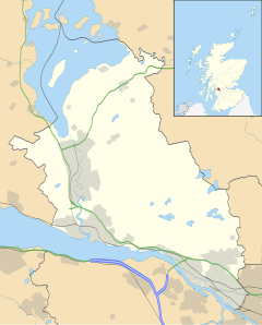
Hardgate is a village in West Dunbartonshire, Scotland.

Hardgate has probably been settled since neolithic times with a burial site at Knappers Farm, the Cochno Stone (a cup and ring marked stone), and a burial chamber near Cochno Loch providing evidence of this. [1]

Although it is a far older settlement, it is administratively part of nearby Clydebank along with the neighbouring village of Duntocher and now lies in the West Dunbartonshire local authority area. Along with Duntocher and Faifley, Hardgate falls within West Dunbartonshiire's Kilpatrick ward with a combined population of 12,719 in 2011. [2]

Dunn's Mills operated a cotton mill in the 19th century. It continued to produce thread and yarn until its destruction during the Clydebank Blitz in 1941. [3]

The village expanded due to house building by the Clydebank town council after World War II, and later by the Wimpey firm in the early 1970s on what had been green belt land.

The village has one non-denominational school, Goldenhill Primary School.
Related Research Articles

<span class="mw-page-title-main">West Dunbartonshire</span> Council area of Scotland

West Dunbartonshire is one of the 32 local government council areas of Scotland. The area lies to the north-west of the Glasgow City council area and contains many of Glasgow's commuter towns and villages. West Dunbartonshire also borders Argyll and Bute, East Dunbartonshire, Renfrewshire and Stirling.

<span class="mw-page-title-main">Dunbartonshire</span> Historic county in Scotland

Dunbartonshire or the County of Dumbarton is a historic county, lieutenancy area and registration county in the west central Lowlands of Scotland lying to the north of the River Clyde. Dunbartonshire borders Perthshire to the north, Stirlingshire to the east, Lanarkshire and Renfrewshire to the south, and Argyllshire to the west.

<span class="mw-page-title-main">Clydebank</span> Town in Scotland

Clydebank is a town in West Dunbartonshire, Scotland. Situated on the north bank of the River Clyde, it borders the village of Old Kilpatrick to the west, and the Yoker and Drumchapel areas of the adjacent City of Glasgow immediately to the east. Depending on the definition of the town's boundaries, the suburban areas of Duntocher, Faifley and Hardgate either surround Clydebank to the north, or are its northern outskirts, with the Kilpatrick Hills beyond.

<span class="mw-page-title-main">Bearsden</span> Town in East Dunbartonshire, Scotland

Bearsden is a town in East Dunbartonshire, Scotland, on the northwestern fringe of Greater Glasgow, approximately six miles from the city centre.

<span class="mw-page-title-main">Duntocher</span> Human settlement in Scotland

Duntocher is a village in West Dunbartonshire, Scotland. It has an estimated population of 6,850. The etymology of the name of the village indicates that its name means "the fort on the causeway".

<span class="mw-page-title-main">Faifley</span> Human settlement in Scotland

Faifley is a large estate forming part of the town of Clydebank, Scotland, adjoining the former village of Hardgate, with a population of approximately 5,001. Along with Duntocher and Hardgate, Faifley falls within West Dunbartonshire's Kilpatrick ward with a combined population of 12,719 in 2011.

<span class="mw-page-title-main">Old Kilpatrick</span> Village in West Dunbartonshire, Scotland

Old Kilpatrick, is a village in West Dunbartonshire, Scotland. The name Old Kilpatrick is said to be derived from St. Patrick ostensibly being born here. It has an estimated population of 4,820. It belonged to the parish of Old Kilpatrick which itself was only a few thousand people strong.

<span class="mw-page-title-main">Bowling, West Dunbartonshire</span> Human settlement in Scotland

Bowling is a village in West Dunbartonshire, Scotland, with a population of 740 (2015).

<span class="mw-page-title-main">Clydebank and Milngavie (Scottish Parliament constituency)</span> Region or constituency of the Scottish Parliament

Clydebank and Milngavie is a constituency of the Scottish Parliament covering part of the council areas of East Dunbartonshire and West Dunbartonshire. It elects one Member of the Scottish Parliament (MSP) by the first past the post method of election. It is also one of ten constituencies in the West Scotland electoral region, which elects seven additional members, in addition to the ten constituency MSPs, to produce a form of proportional representation for the region as a whole.

<span class="mw-page-title-main">Dalmuir</span> Human settlement in Scotland

Dalmuir is an area nine miles northwest of Glasgow, Scotland, on the western side of Clydebank, and part of West Dunbartonshire Council Area. The name is a lowland Scots derivation of the Gaelic meaning Big Field. The area was originally two separate villages with Dalmuir Shore joining with Clydebank in 1886 and Dalmuir Village in 1906, during a period of rapid industrialisation and expansion. Dalmuir is bounded by the village of Old Kilpatrick to the west, the Mountblow and Parkhall housing schemes to the north, and the Clydebank town centre area to the east. To the south is the River Clyde.

<span class="mw-page-title-main">New Kilpatrick</span> Parish in Dunbartonshire, Scotland

New Kilpatrick, is an ecclesiastical Parish and former Civil Parish in Dunbartonshire. It was formed in 1649 from the eastern half of the parish of Kilpatrick, the western half forming Old Kilpatrick. New Kilpatrick is also a disused name for the town of Bearsden.

<span class="mw-page-title-main">Clydebank (district)</span> Former local gov district in Scotland

Clydebank was, from 1975 to 1996, one of nineteen local government districts in the Strathclyde region of Scotland, covering the town of Clydebank and adjoining areas to the north-west of the city of Glasgow.

<span class="mw-page-title-main">Kilpatrick Hills</span> Range of hills in central Scotland

The Kilpatrick Hills are a range of hills in central Scotland, stretching from Dumbarton in the west to Strathblane in the east.

<span class="mw-page-title-main">St Columba's High School, Clydebank</span> State school in Clydebank, West Dunbartonshire, Scotland

St Columba's High School was a Roman Catholic comprehensive school in Drumry, Clydebank, West Dunbartonshire, Scotland. It was one of two denominational schools in the town which merged in 2009 to become St Peter the Apostle High School. The school had an inspection by Her Majesty's Inspectorate of Education (HMIE) in 2006 and received positive results.

<span class="mw-page-title-main">St Peter the Apostle High School</span> Comprehensive school in Clydebank, West Dunbartonshire, Scotland

St Peter the Apostle High School is a Roman Catholic high school in Drumry, Clydebank, Scotland. It was formed as an amalgamation of the former St Columba's High School and St Andrew's High School. St Peter the Apostle High School is one of two Roman Catholic secondary schools in West Dunbartonshire.

Clydebank RFC is a rugby union side based in Clydebank, West Dunbartonshire, Scotland. The club was founded in 1969. They play their home games at Dean Street in the Clydebank Community Sports Hub; a purpose built facility which opened in 2018,featuring several rugby pitches.

<span class="mw-page-title-main">Kilpatrick (ward)</span>

Kilpatrick is one of the six wards used to elect members of the West Dunbartonshire Council. It elects three Councillors.

<span class="mw-page-title-main">Clydebank Waterfront (ward)</span>

Clydebank Waterfront is one of the six wards used to elect members of the West Dunbartonshire Council. It elects four Councillors.

<span class="mw-page-title-main">Douglas McAllister</span> Scottish Labour Party politician

Douglas McAllister is a Scottish Labour Party politician who has served as the Member of Parliament (MP) for West Dunbartonshire since July 2024.

References

  1. "The Leading The Clydebank Story Site on the Net". TheClydebankStory.com. Retrieved 18 June 2014.
  2. Kilpatrick Central Ward - Area Profile, West Dunbartonshire Council
  3. Hood, John. Old Bowling, Duntocher, Hardgate, Milton and Old Kilpatrick. Stenlake Publishing. p. 45. ISBN   1840333197.

Commons-logo.svg Media related to Hardgate, West Dunbartonshire at Wikimedia Commons