This article includes a list of references, related reading, or external links, but its sources remain unclear because it lacks inline citations .(August 2020) |
Ile aux Hérons | |
|---|---|
 Heron Island | |
| Geography | |
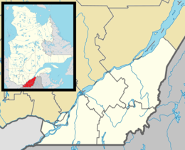
| Location | Saint Lawrence River |
| Coordinates | 45°25′23″N73°34′45″W / 45.42306°N 73.57917°W |
| Archipelago | Hochelaga Archipelago |
| Area | 0.49 km2 (0.19 sq mi) |
| Administration | |
Canada | |
| Province | Quebec |
| City | Sainte-Catherine |
Heron Island is a small island of approximately 129 acres in the Saint Lawrence River and part of Sainte-Catherine, Quebec, Canada. The northern tip of the island is located in the Lachine rapids. It is one of "Saint-Laurent, Vision 2000" 37 protected sites. In 2002, Hydro Quebec donated the land to The Nature Conservancy of Canada (NCC) which manages the site as a wildlife reserve.