Hochelaga Archipelago

Last updated

Hochelaga Archipelago
Native name:
Archipel d'Hochelaga
Archipel Hochelaga.PNG
Map of the Hochelaga Archipelago
Geography
Location Saint Lawrence River
Coordinates 45°32′58″N73°39′02″W / 45.54944°N 73.65056°W / 45.54944; -73.65056
Total islands234
Major islands Île de Montréal, Île Jésus, Île Perrot, Île Bizard
Highest elevation234 m (768 ft)
Highest point Mount Royal (Island of Montreal)
Administration
Canada
Province Quebec
City Montreal
Additional information
Discovered in 1535 by Jacques Cartier
Dorval Island as painted by Frances Anne Hopkins, 1866. FAH Ile Dorval.jpg
Dorval Island as painted by Frances Anne Hopkins, 1866.
Nuns' Island at dusk. Ile des Soeurs.JPG
Nuns' Island at dusk.
Small island near Saint-Eustache in the Riviere des Mille Iles. Terre Des Patriotes St-Eustache Quebec.jpg
Small island near Saint-Eustache in the Rivière des Mille Îles.

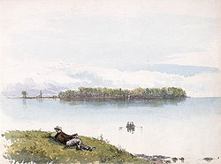
The Hochelaga Archipelago (French : Archipel d'Hochelaga), also known as the Montreal Islands, is a group of islands at the confluence of the Saint Lawrence and Ottawa rivers in the southwestern part of the province of Quebec, Canada.

Contents

Population

As of 1 July 2021, the Hochelaga Archipelago officially had 2,556,040 inhabitants in the following municipalities:

Population of the Hochelaga Archipelago:
MunicipalityPopulation (2021) [1] Island of each municipality
Montréal 1,825,208 Île Bizard
Île de Montréal (part)
Île Sainte-Hélène
Île Notre-Dame
Île des Sœurs
Laval 441,929 Île Jésus
Îles Laval (île Bigras, île Pariseau, île Ronde et île Verte)
Île Paton
Dollard-Des Ormeaux 50,302 Île de Montréal (part)
Côte-Saint-Luc 35,117 Île de Montréal (part)
Pointe-Claire 33,714 Île de Montréal (part)
Mount Royal 21,844 Île de Montréal (part)
Westmount 21,152 Île de Montréal (part)
Kirkland 20,046 Île de Montréal (part)
Beaconsfield 19,942 Île de Montréal (part)
Dorval 19,907 Île de Montréal (part)
Pincourt 15,109 Île Perrot (part)
L'Île-Perrot 11,455 Île Perrot (part)
Notre-Dame-de-l'Île-Perrot 11,366 Île Perrot (part)
Hampstead 7,472 Île de Montréal (part)
Montréal-Ouest 5,300 Île de Montréal (part)
Sainte-Anne-de-Bellevue 5,048 Île de Montréal (part)
Montréal-Est 4,094 Île de Montréal (part)
Baie-D'Urfé 3,944 Île de Montréal (part)
Terrasse-Vaudreuil 1,985 Île Perrot (part)
Senneville 973 Île de Montréal (part)
L'Île-Cadieux 128 Île Cadieux
L'Île-Dorval 30 Île Dorval
Total2,556,040Hochelaga Archipelago

Size

Estimates of the number of islands in the archipelago vary. The most widely accepted number seems to be 234, [2] although the number has been put as high as 325. [3]

Islands

The largest island in the group is the Island of Montreal, which contains most of the city of Montreal and the central section of its metropolitan area. The city has jurisdiction over 74 smaller islands in the archipelago, most notably Nuns' Island (also known as Île des Sœurs in French), Île Bizard, and the two islands that served as the site of Expo 67, namely Saint Helen's Island (in French Île Sainte-Hélène) and the artificial Île Notre-Dame.

The second-largest island in the archipelago is Île Jésus, which along with the Îles Laval and several smaller islands makes up the city of Laval.

Other islands include the Îles de Boucherville, featuring a Québec National Park, Île Perrot, Salaberry-de-Valleyfield and the neighbouring Grande-Île, as well as the smaller Dorval Island and Dowker Island.

List of named islands

Name

The archipelago takes its name from Hochelaga, an Iroquoian settlement on the Island of Montreal that was later settled by the French and grew to become the modern city of Montreal.

See also

Related Research Articles

<span class="mw-page-title-main">Island of Montreal</span> Island in Quebec, Canada

The Island of Montreal is a large island in southwestern Quebec, Canada, that is the site of a number of municipalities, including most of the city of Montreal, and is the most populous island in Canada. It is the main island of the Hochelaga Archipelago at the confluence of the Saint Lawrence and Ottawa rivers.

<span class="mw-page-title-main">Sainte-Anne-de-Bellevue</span> City in Quebec, Canada

Sainte-Anne-de-Bellevue is an on-island suburb located at the western tip of the Island of Montreal in southwestern Quebec, Canada. It is the second oldest community in Montreal's West Island, having been founded as a parish in 1703. The oldest, Dorval, was founded in 1667.

<span class="mw-page-title-main">Île Perrot</span> Island in Quebec, Canada

Île Perrot is an island west of the island of Montreal in the Canadian province of Quebec. Part of the Hochelaga Archipelago, the island lies between Lake Saint-Louis and Lac des Deux-Montagnes. The island was granted by the Intendant Talon of New France to its founder François-Marie Perrot then-Governor of Montreal on 28 October 1672.

<span class="mw-page-title-main">Rivière des Prairies</span> River in Quebec, Canada

The Rivière des Prairies, called the Back River in English, is a delta channel of the Ottawa River in southwestern Quebec, Canada. The Kanien'kehá:ka called it Skowanoti, meaning "River behind the island". The river separates the cities of Laval and Montreal.

<span class="mw-page-title-main">West Island</span> Settlements in Quebec, Canada

<span class="mw-page-title-main">Île Bizard</span> Island in Montreal, Quebec, Canada

Île Bizard is an island near the Island of Montreal in the Hochelaga Archipelago region. It is one of the three populated islands within the city of Montreal, along with the Island of Montreal and Nuns' Island. The island is served by buses 207 and 407.

<span class="mw-page-title-main">Saint Helen's Island</span> Island in Canada

Saint Helen's Island is an island in the Saint Lawrence River, in the territory of the city of Montreal, Quebec, Canada. It forms part of the Hochelaga Archipelago. It is situated immediately offshore from Old Montreal on the southeastern side of the Island of Montreal in southwestern Quebec, and is part of the central borough of Ville-Marie. The Le Moyne Channel separates it from Notre Dame Island. Saint Helen's Island and Notre Dame Island together make up Jean-Drapeau Park.

<span class="mw-page-title-main">Urban agglomeration of Montreal</span> Administrative region in Quebec, Canada

Montréal is one of the administrative regions of the Canadian province of Quebec. It is also a territory equivalent to a regional county municipality (TE) and a census division (CD), for both of which its geographical code is 66. Prior to the merger of the municipalities in Region 06 in 2002, the administrative region was co-extensive with the Montreal Urban Community.

<span class="mw-page-title-main">Nuns' Island</span> Neighbourhood in Montreal, Quebec, Canada

Nuns' Island is an island located in the Saint Lawrence River that forms a part of the city of Montreal, Quebec. It is part of the borough of Verdun.

The 2000–2006 municipal reorganization in Quebec resulted in large-scale amalgamation of smaller municipalities in Quebec into larger cities. It was undertaken by one administration, and modified and partially undone by its successor.

<span class="mw-page-title-main">Îles Laval</span>

The Îles Laval are an island grouping in the Rivière des Prairies in southwestern Quebec, part of the Hochelaga Archipelago.

The Montreal Public Libraries Network is the public library system on the Island of Montreal in Quebec, Canada. It is the largest French language public library system in North America, and also has items in English and other languages. Its central branch closed in March 2005 and its collections incorporated into the collections of the Grande Bibliothèque.

<span class="mw-page-title-main">Centre de services scolaire Marguerite-Bourgeoys</span> Canadian school board

The Centre de services scolaire Marguerite-Bourgeoys is an autonomous school service centre on Montreal Island, Quebec, Canada, appointed by the Ministry of Education.

Dowker Island is an uninhabited island in Lake Saint Louis, a widening of the Saint Lawrence River south of Montreal Island, Quebec. It is in the municipality of Notre-Dame-de-l'Île-Perrot which intends to preserve its natural state.

<span class="mw-page-title-main">François-Saturnin Lascaris d'Urfé</span>

François-Saturnin Lascaris d'Urfé, S.S. was a French nobleman and Sulpician priest who became the first resident pastor of the parish of Saint-Louis-du-Haut-de-l'Île on the Island of Montreal in New France.

<span class="mw-page-title-main">Commission scolaire Marguerite-Bourgeoys</span> Canadian school board

The Marguerite-Bourgeoys School Board was a French language public School Board on Montreal Island, Quebec, Canada. Its headquarters was in the Saint-Laurent borough of Montreal. Its education centre was in LaSalle, also in Montreal. It was named after Marguerite Bourgeoys (1620–1700), a French nun who helped start education infrastructure in the new colony.

References

  1. "Décret de population - Organisation municipale - Ministère des Affaires municipales et de l'Occupation du territoire". www.mamrot.gouv.qc.ca (in French). Retrieved 2022-01-31.
  2. "Encyclopædia Britannica". Online encyclopedia. Retrieved 2008-01-11.
  3. "International Council on Monuments and Sites". 2000 Report on Canada. Retrieved 2008-01-11.