
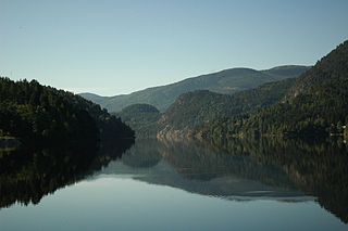
Telemark is a traditional region, a former county, and a current electoral district in southern Norway. In 2020, Telemark merged with the former county of Vestfold to form the county of Vestfold og Telemark. Telemark borders the traditional regions and former counties of Vestfold, Buskerud, Hordaland, Rogaland and Aust-Agder.

Nissedal is a rural municipality in Telemark region of Vestfold og Telemark county, Norway. It is part of the traditional regions of Upper Telemark and Vest-Telemark. The administrative centre of the municipality is the village of Treungen. Other villages in Nissedal include Kyrkjebygda and Felle.

Hjartdal is a municipality in Vestfold og Telemark county, Norway. It is located in the traditional district of Upper Telemark and Aust-Telemark. The administrative centre of the municipality is the village of Sauland. Other villages in the municipality include Tuddal and Hjartdalsbygda.
Kviteseid is a municipality in Vestfold og Telemark county, Norway. It is located in the traditional districts of Vest-Telemark and Upper Telemark. The administrative centre of the municipality is the village of Kviteseidbyen. Other villages in Kviteseid include Åsgrend, Brunkeberg, Eidstod, Fjågesund, Kilen, Morgedal, and Vrådal.
Seljord is a municipality in Vestfold og Telemark county, Norway. It is located in the traditional districts of Upper Telemark and Vest-Telemark. The administrative centre of the municipality is the village of Seljord. Other villages in the municipality include Flatdal and Åmotsdal.

Drangedal is a municipality in Vestfold og Telemark county, Norway. It is located in the traditional district of Grenland. The administrative centre of the municipality is the village of Prestestranda. Other villages in Drangedal include Bø i Tørdal, Bostrak, Gautefall, Henseid, and Neslandsvatn.
Bø is a former municipality in Telemark county, Norway. It was part of the traditional region of Midt-Telemark, but was historically regarded as part of Grenland. The 263-square-kilometre (102 sq mi) municipality existed from 1838 until its dissolution in 2020. The area is now part of Midt-Telemark Municipality. The administrative centre was the village of Bø i Telemark. Other villages in the municipality included Folkestad and Nordbøåsane.
Bamble is a municipality in Vestfold og Telemark county, Norway. It is part of the traditional region of Grenland. The administrative centre of the municipality is the village of Langesund.
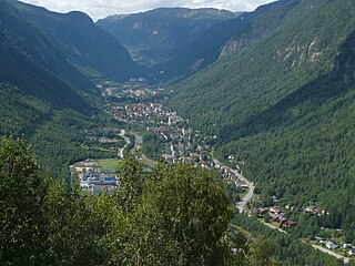
Tinn is a municipality in Vestfold og Telemark county, Norway. It is located in the traditional districts of Aust-Telemark and Upper Telemark. The administrative centre of the municipality is the town of Rjukan. Some of the villages in Tinn include Atrå, Austbygde, Hovin, and Miland.

Sogndal is a municipality in Vestland county, Norway. It is located on the northern shore of the Sognefjorden in the traditional district of Sogn. The village of Hermansverk is the administrative center of Sogndal municipality. Other villages include Kaupanger, Kjørnes, Fimreite, Nornes, and Fjærland. Sogndal Airport, Haukåsen is located 10 kilometres (6.2 mi) southwest of Kaupanger.

Nome is a municipality in Vestfold og Telemark county, Norway. It is located in the traditional district of Midt-Telemark and historically part of the Grenland region. The administrative centre of the municipality is the village of Ulefoss. Other villages include Bjervamoen, Ulefoss, Helgja, Flåbygd, and Svenseid.
Grenland is a traditional district in the county of Vestfold og Telemark, in the south-east of Norway. Located in the southeastern part of the county, Grenland is composed of the municipalities Skien, Porsgrunn, Bamble, and Siljan. Sometimes the municipalities Kragerø and Drangedal of the smaller Vestmar region are also considered to be part of the area. The region encompasses 1,794 km2 and has 122,978 inhabitants (2004), which translates as 12% of the area and 64% of the population of Telemark.

Stathelle is a town in the municipality of Bamble in the county of Telemark, Norway.
Ulefoss is the administrative centre of Nome Municipality in Vestfold og Telemark county, Norway. The village is located along the northwest shore of the large lake Norsjø. The village occupies both sides of Ulefoss falls on the river Eidselva, just before it flows into the lake Norsjø. The village of Helgja lies about 7 kilometres (4.3 mi) to the southeast, the village of Bjervamoen lies about 10 kilometres (6.2 mi) to the west, and the village of Gvarv lies about 13 kilometres (8.1 mi) to the northwest.

Ødegården Verk, alternate names Ødegården Apatittgruver and Bamble Apatittgruver, was a series of primarily apatite shaft mines and quarries located in the Bamble municipality of Norway. At its peak, Ødegården Verk was one of the largest apatite mines in the country, mining up to 10,000 metric tons of the mineral per year, and some sources estimate its peak operating workforce at over 800 men.

is a town in Notodden Municipality in Vestfold og Telemark county, Norway. It is also the administrative centre of the municipality. The town is located at the north end of the lake Heddalsvatnet, at the mouth of the river Tinnelva. The villages of Heddal and Yli lie about 5 kilometres (3.1 mi) to the west of the town. The villages of Hjuksebø and Hjuksevelta both lie about 8 kilometres (5.0 mi) to the south of the town. The town of Kongsberg is located about 28 kilometres (17 mi) to the east of the town. The village of Bolkesjø is located about 20 kilometres (12 mi) to the north of the town.

Herre Church is a parish church of the Church of Norway in Bamble Municipality in Vestfold og Telemark county, Norway. It is located in the village of Herre. It is one of the churches for the Bamble og Herre parish which is part of the Bamble prosti (deanery) in the Diocese of Agder og Telemark. The white, wooden church was built in a long church design in 1905 using plans drawn up by the architect Haldor Larsen Børve. The church seats about 275 people.

Midt-Telemark is a municipality in Vestfold og Telemark county, Norway. It is located in the traditional district of Midt-Telemark. The administrative centre of the municipality is the village of Bø i Telemark. Other villages in the municipality include Akkerhaugen, Folkestad, Gvarv, Holtsås, Nordagutu, Nordbøåsane, and Sauherad.
Botten is a village in Bamble Municipality in Vestfold og Telemark county, Norway. The village is located about 5 kilometres (3.1 mi) to the north of the village of Valle, about 8 kilometres (5.0 mi) southwest of the village of Bamble, and about 2 kilometres (1.2 mi) to the south of the European route E18 highway. The village is mainly a residential area.


