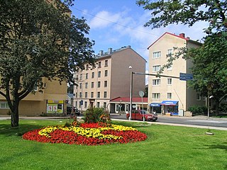
The IV District, also known as Martti, is one of the central districts of Turku, Finland. It is located on the east side of the river Aura, between Tervahovinkatu in the west and Betaniankatu and Martinkatu in the east. The district is one of the smallest in Turku, and is centred on the Martinkirkko church, named after the reformer Martin Luther. Martti is also one of the most expensive areas to live in Turku.

European route E1 is a series of roads in Europe, part of the United Nations International E-road network, running from Larne, Northern Ireland to Seville, Spain. There is a sea crossing between Rosslare Harbour, in Ireland, and Ferrol, but no ferry service. The road also passes through Portugal – past the city of Porto, through the capital, Lisbon, and then south to the Algarve, passing Faro before reaching the Spanish border west of Huelva.

Kinder is an unincorporated community in White River Township, Johnson County, Indiana.
The Rural Municipality of Lansdowne is a former rural municipality (RM) in the Canadian province of Manitoba. It was originally incorporated as a rural municipality on December 22, 1883. It ceased on January 1, 2015 as a result of its provincially mandated amalgamation with the RM of Glenella to form the Municipality of Glenella – Lansdowne.
Chak Shadi is a village and union council of Jhelum District in the Punjab Province of Pakistan. It is located near the town of Pinanwal and is a part of Pind Dadan Khan Tehsil, and is located at 32°39'40N 73°15'20E with an altitude of 206 metres. Almost the entire population is Muslim, and belong to the Jalap tribe.

Dziaduszyce is a village in the administrative district of Gmina Słaboszów, within Miechów County, Lesser Poland Voivodeship, in southern Poland. It lies approximately 2 kilometres (1 mi) west of Słaboszów, 17 km (11 mi) east of Miechów, and 43 km (27 mi) north-east of the regional capital Kraków.
Diament is a village in the administrative district of Gmina Jędrzejów, within Jędrzejów County, Świętokrzyskie Voivodeship, in south-central Poland. It lies approximately 4 kilometres (2 mi) south-west of Jędrzejów and 40 km (25 mi) south-west of the regional capital Kielce.
Xaspolad is a village in the municipality of Zərqava in the Quba Rayon of Azerbaijan.
Nowy Dwór is a village in the administrative district of Gmina Lubomia, within Wodzisław County, Silesian Voivodeship, in southern Poland. It lies approximately 4 kilometres (2 mi) north-west of Lubomia, 16 km (10 mi) north-west of Wodzisław Śląski, and 58 km (36 mi) west of the regional capital Katowice.
Juszkowo is a village in the administrative district of Gmina Pruszcz Gdański, within Gdańsk County, Pomeranian Voivodeship, in northern Poland. It lies approximately 3 kilometres (2 mi) south-west of Pruszcz Gdański and 13 km (8 mi) south of the regional capital Gdańsk.
Choćmirówko is a village in the administrative district of Gmina Główczyce, within Słupsk County, Pomeranian Voivodeship, in northern Poland. It lies approximately 8 kilometres (5 mi) west of Główczyce, 21 km (13 mi) north-east of Słupsk, and 93 km (58 mi) west of the regional capital Gdańsk.
Wronki Wielkie is a village in the administrative district of Gmina Gołdap, within Gołdap County, Warmian-Masurian Voivodeship, in northern Poland, close to the border with the Kaliningrad Oblast of Russia.
Zaroślak is a settlement in the administrative district of Gmina Ruciane-Nida, within Pisz County, Warmian-Masurian Voivodeship, in northern Poland. It lies approximately 12 kilometres (7 mi) south of Ruciane-Nida, 21 km (13 mi) south-west of Pisz, and 73 km (45 mi) east of the regional capital Olsztyn.

Bishop Hodges Higher Secondary School', is under C.S.I. Madhya Kerala Diocese in Alleppey District. The school is located at the heart of Mavelikara town.

Mihajlovac is a village in the municipality of Smederevo, Serbia. According to the 2011 census, the village has a population of 2,674 people.

Linhai station is a Metro station of Shenzhen Metro Line 5. It opened on 22 June 2011. This station is an underground station.

Delyo Glacier is the 8 km long and 2.7 km wide glacier on the east side of the main crest of north-central Sentinel Range in Ellsworth Mountains, Antarctica. It is situated northwest of Rumyana Glacier and south of Burdenis Glacier. The glacier drains the north slopes of Mount Giovinetto and the east slopes of Mount Viets, flows northeastwards and together with Burdenis Glacier and Gerila Glacier joins upper Ellen Glacier north of Bruguière Peak.

Trepetlika Glacier is the 8 km long and 3.5 km wide glacier on the south side of Sonketa Ridge in the west foothills of Detroit Plateau on Danco Coast in Graham Land, Antarctica. It drains the northwest slopes of Razhana Buttress, flows westwards and enters Brialmont Cove north of the terminus of Mouillard Glacier.
Moenville is an extinct town in Haakon County, in the U.S. state of South Dakota. The GNIS classifies it as a populated place.
Brooklands is a suburb in the north of Nelson, New Zealand. It lies on State Highway 6 on the shore of Nelson Haven, between Atawhai and central Nelson. Nelson's largest cemetery, Wakapuaka Cemetery, is located in Brooklands.