
The Pennsylvania Turnpike, sometimes shortened to Penna Turnpike or PA Turnpike, is a controlled-access toll road which is operated by the Pennsylvania Turnpike Commission (PTC) in Pennsylvania. It runs for 360 miles (580 km) across the southern part of the state, connecting Pittsburgh and Philadelphia, and passes through four tunnels as it crosses the Appalachian Mountains. A component of the Interstate Highway System, it is part of Interstate 76 (I-76) between the Ohio state line and Valley Forge. I-70 runs concurrently with I-76 between New Stanton and Breezewood, Interstate 276 (I-276) between Valley Forge and Bristol Township, and I-95 from Bristol Township to the New Jersey state line.

Lake Stevens is a city in Snohomish County, Washington, United States, that is named for the lake it surrounds. It is located 6 miles (9.7 km) east of Everett and borders the cities of Marysville to the northwest and Snohomish to the south. The city's population was 35,630 at the 2020 census.

Marysville is a city in Snohomish County, Washington, United States, part of the Seattle metropolitan area. The city is located 35 miles (56 km) north of Seattle, adjacent to Everett on the north side of the Snohomish River delta. It is the second-largest city in Snohomish County after Everett, with a population of 70,714 at the time of the 2020 U.S. census. As of 2015, Marysville was also the fastest-growing city in Washington state, growing at an annual rate of 2.5 percent.

The Garden State Parkway (GSP) is a controlled-access toll road that stretches the north–south length of eastern New Jersey from the state's southernmost tip near Cape May north to the New York state line at Montvale. Its name refers to New Jersey's nickname, the "Garden State". The parkway has an unsigned reference number of Route 444 by the New Jersey Department of Transportation (NJDOT). At its north end, the road becomes the Garden State Parkway Connector, a component of the New York State Thruway system that connects to the Thruway mainline in Ramapo, New York.

State Route 99 (SR 99), also known as the Pacific Highway, is a state highway in the Seattle metropolitan area, part of the U.S. state of Washington. It runs 49 miles (79 km) from Fife to Everett, passing through the cities of Federal Way, SeaTac, Seattle, Shoreline, and Lynnwood. The route primarily follows arterial streets, including Aurora Avenue, and has several freeway segments, including the tolled SR 99 Tunnel in Downtown Seattle. SR 99 was officially named the William P. Stewart Memorial Highway by the state legislature in 2016, after a campaign to replace an unofficial moniker honoring Confederate president Jefferson Davis.

State Route 526 (SR 526), also known as the Boeing Freeway, is a state highway in Snohomish County, Washington, United States. The east–west highway travels 4.52 miles (7.27 km) and connects SR 525 in Mukilteo to Interstate 5 (I-5) in southern Everett. The highway serves the Boeing Everett Factory and Paine Field; it also serves as a main route to the city of Mukilteo and the state-run ferry to Whidbey Island.

Interstate 405 (I-405) is a north–south auxiliary Interstate Highway serving the Seattle region of Washington, United States. It bypasses Seattle east of Lake Washington, traveling through the Eastside area of King and Snohomish counties, providing an alternate route to I-5. The 30-mile (48 km) freeway serves the cities of Renton, Bellevue, Kirkland, and Bothell. I-405 terminates at I-5 in Tukwila and Lynnwood, and also intersects several major highways, including SR 167, I-90, SR 520, and SR 522.

The Dolphin East–West Expressway is a 15.4-mile (24.8 km) freeway, with the westernmost 14 miles (23 km) as an all-electronic tollway signed as State Road 836, and the easternmost 1.292 miles (2.079 km) between Interstate 95 (I-95) and SR A1A cosigned as Interstate 395 (I-395).
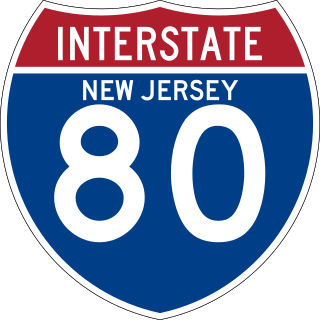
Interstate 80 (I-80) is a major interstate highway in the United States, running from San Francisco, California, eastward to the New York metropolitan area. In New Jersey, I-80 runs for 68.3 miles (109.9 km) from the Delaware Water Gap Toll Bridge at the Pennsylvania state line to its eastern terminus at the interchange with the New Jersey Turnpike (I-95) in Teaneck, Bergen County. I-95 continues from the end of I-80 to the George Washington Bridge for access to New York City. The highway runs parallel to US 46 through rural areas of Warren and Sussex counties before heading into more suburban surroundings in Morris County. As the road continues into Passaic and Bergen counties, it heads into more urban areas. The New Jersey Department of Transportation identifies I-80 within the state as the Christopher Columbus Highway.
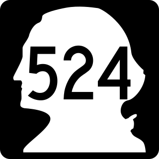
State Route 524 (SR 524) is a suburban state highway in the U.S. state of Washington, located entirely within Snohomish County. It begins at SR 104 in Edmonds and travels east past SR 99, Interstate 5 (I-5), under I-405, past SR 527 and SR 9 to end at SR 522 in Maltby. The road also has two spur routes, one connecting to SR 104 in Edmonds and another connecting to I-5 in Lynnwood.

State Route 530 (SR 530) is a state highway in western Washington, United States. It serves Snohomish and Skagit counties, traveling 50.52 miles (81.30 km) from an interchange with Interstate 5 (I-5) southwest of Arlington past SR 9 in Arlington and Darrington to end at SR 20 in Rockport. Serving the communities of Arlington, Arlington Heights, Oso, Darrington and Rockport, the roadway travels parallel to a fork of the Stillaguamish River from Arlington to Darrington, the Sauk River from Darrington to Rockport and the Whitehorse Trail from Arlington to Darrington.

State Route 527 is a state highway in Snohomish County, Washington. It travels 9 miles (14 km) from north to south, connecting the northern Seattle suburbs of Bothell, Mill Creek, and Everett. The highway intersects Interstate 405 (I-405) at its southern terminus, SR 96 in northern Mill Creek, and I-5 at an interchange with SR 99 and SR 526 in Everett.
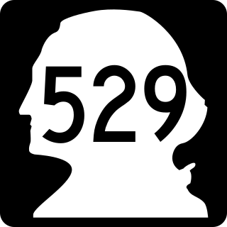
State Route 529 is a Washington state highway that connects the cities of Everett and Marysville. The 7.88-mile-long (12.68 km) roadway extends north from an interchange with Interstate 5 (I-5), numbered exit 193, past the western terminus of U.S. Route 2 (US 2), its spur route, Downtown Everett and Naval Station Everett to cross the Snohomish River onto Smith Island. After crossing the Steamboat Slough, the road encounters an interchange with I-5, numbered exit 198, before crossing the Ebey Slough and entering Marysville. In Marysville, SR 529 ends at SR 528. Before being realigned in 1991, SR 529 started at exit 192 of I-5 and traveled north as Broadway through Downtown Everett to Marysville.

State Route 204 (SR 204) is a short state highway in Snohomish County, Washington, United States. It connects U.S. Route 2 (US 2) at the eastern end of the Hewitt Avenue Trestle to the city of Lake Stevens, terminating at a junction with SR 9. The highway runs for a total length of 2.4 miles (3.9 km) and passes through several suburban neighborhoods.

State Route 531 (SR 531) is a short state highway in Snohomish County, Washington, United States. It runs from west to east along 172nd Street between Wenberg County Park on Lake Goodwin to a junction with SR 9 in southern Arlington, with an intermediate interchange with Interstate 5 (I-5) in Smokey Point. The highway is the primary access point for the Arlington Municipal Airport and the Smokey Point retail corridor.
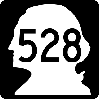
State Route 528 (SR 528) is an east–west state highway in Snohomish County, Washington, located entirely within the city of Marysville. It travels 3.5 miles (5.6 km) from an interchange with Interstate 5 (I-5) in downtown Marysville to a junction with SR 9. The four-lane highway uses two local streets—4th Street and 64th Street—and primarily functions as a commuter route to the eastern outskirts of Marysville.

State Route 532 (SR 532) is a short Washington state highway in Island and Snohomish counties, located in the United States. It connects Camano Island and Stanwood to a junction with Interstate 5 (I-5) northwest of Arlington.

Interstate 5 (I-5) is an Interstate Highway on the West Coast of the United States that serves as the region's primary north–south route. It spans 277 miles (446 km) across the state of Washington, from the Oregon state border at Vancouver, through the Puget Sound region, to the Canadian border at Blaine. Within the Seattle metropolitan area, the freeway connects the cities of Tacoma, Seattle, and Everett.

U.S. Route 2 (US 2) is a component of the United States Numbered Highway System that connects the city of Everett in the U.S. state of Washington to the Upper Peninsula of Michigan, with a separate segment that runs from Rouses Point, New York, to Houlton, Maine. Within Washington, the highway travels on a 326-mile-long (525 km) route that connects the western and eastern regions of the state as a part of the state highway system and the National Highway System. US 2 forms parts of two National Scenic Byways, the Stevens Pass Greenway from Monroe to Cashmere and the Coulee Corridor Scenic Byway near Coulee City, and an All-American Road named the International Selkirk Loop within Newport.

Everett is the county seat and most populous city of Snohomish County, Washington, United States. It is 25 miles (40 km) north of Seattle and is one of the main cities in the metropolitan area and the Puget Sound region. Everett is the seventh-most populous city in the state by population, with 110,629 residents as of the 2020 census. The city is primarily situated on a peninsula at the mouth of the Snohomish River along Port Gardner Bay, an inlet of Possession Sound, and extends to the south and west.

