Related Research Articles

Chingford is a town in north-east London, England, within the ceremonial county of Greater London and the ancient county of Essex. Adjoining the edge of Epping Forest, with Waltham Abbey to the north, Woodford Green and Buckhurst Hill to the east, Walthamstow to the south, and the River Lea to the west, the town is situated 8.6 miles (13.8 km) north-east of Charing Cross. It contains the areas of Chingford Hatch, Chingford Mount, Friday Hill, Hale End, Highams Park, North Chingford and South Chingford, and had a population of 66,211 at the 2011 census.

Walthamstow is a large town in east London, England, within the ceremonial county of Greater London and the ancient county of Essex. Situated 7.5 miles (12.1 km) north-east of Charing Cross, the town borders Chingford to the north, Snaresbrook and South Woodford to the east, Leyton and Leytonstone to the south, and Tottenham to the west. At the 2011 census, the town had a population of approximately 109,424.
The London Borough of Waltham Forest is a London borough in north-east London, England. Its population is estimated to be 276,983 in 2019. It borders five other London boroughs: Enfield to the north-west, Haringey to the west, Hackney to the south-west, Newham to the south-east and Redbridge to the east, as well as the non-metropolitan county of Essex to the north.

Coombe is a place in the London Borough of Croydon, situated south-east of central Croydon, between Addiscombe, Selsdon and Upper Shirley. It is located in the historic county of Surrey. Formerly a hamlet, since the growth of suburban development the area has become swallowed into the London conurbation and often does not appear on modern map.

Walthamstow, // is a constituency created in 1974 represented in the House of Commons of the UK Parliament since 2010 by Stella Creasy, a member of the Labour Co-op party. An earlier version of the constituency existed covering a significantly different area (1885–1918) and was among the vast majority by that time returning one member to the House of Commons.
Woodford County High School For Girls, formerly Woodford County High School (WCHS) is a secondary all-girls selective grammar school in Woodford Green of the London Borough of Redbridge, England. The school opened in 1919. Woodford's brother school is Ilford County High School.

Highams Park is a district of Chingford in the London Borough of Waltham Forest, England. It is a suburban area adjacent to Epping Forest and situated 8.7 miles (14 km) north-east of Charing Cross.

Walthamstow was a local government district in southwest Essex, England from 1873 to 1965, around the town of Walthamstow. It was within the London suburbs, forming part of the London postal district and Metropolitan Police District. Its former area now corresponds to the central part of the London Borough of Waltham Forest in Greater London.
Walthamstow Football Club are a football club based in Walthamstow, who play in the Essex Senior League. They have played under a number of names and were known as Leyton Pennant up until the end of the 2002–03 season, and Waltham Forest until the end of the 2017-18 season.

Sketty Hall is a venue used for hosting social functions, business functions and conferences in Singleton Park, Swansea, south Wales. The original building was built in the early 18th century as a private house. Over the years it has seen a number of extensions, modifications and changes of use to its present-day role.
Walthamstow West was a borough constituency in what is now the London Borough of Waltham Forest, but was until 1965 the Walthamstow Urban District of Essex. It returned one Member of Parliament (MP) to the House of Commons of the Parliament of the United Kingdom.

Essex House was a house that fronted the Strand in London. Originally called Leicester House, it was built around 1575 for Robert Dudley, 1st Earl of Leicester, and was renamed Essex House after being inherited by his stepson, Robert Devereux, 2nd Earl of Essex, after Leicester's death in 1588. The poet Philip Sidney lived in Leicester House for some time.
Lewis Weston Dillwyn, FRS was a British porcelain manufacturer, naturalist and Whig Member of Parliament (MP).
Hatfield Peverel Priory was a Benedictine priory in Essex, England, founded as a secular college before 1087 and converted into priory as a cell of St Albans by William Peverel ante 1100. It is in the English Heritage Register of Parks and Gardens of Special Historic Interest in England and is located on the south side of the village of Hatfield Peverel, about 5 miles north-east of Chelmsford. At the Dissolution of the Monasteries, a timber-frame structure dominated the property.

West Essex Football Club is a football club based in Highams Park in the London Borough of Waltham Forest, England. They are currently members of the Essex Senior League and groundshare with Walthamstow at Wadham Lodge in Walthamstow.

The Warner Estate is an area of housing in Walthamstow and Highams Park, Waltham Forest in East London. The area was developed by Thomas Courtenay Warner and the Warner Company.

Prested Hall is a country house in Feering, Essex. It was built in the fourteenth century for the Weston family and passed through several notable families over the next six hundred years. Today it is a hotel and spa and caters for special events particularly weddings. It is a Grade II listed building.
Richard Dykes Alexander was a businessman based in Ipswich, Suffolk.

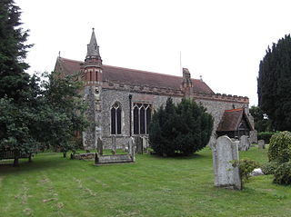
The Church of St Barnabas and St James the Greater, Walthamstow, is an Edwardian era Church of England parish church in Walthamstow, East London. It is a Grade II* listed building.

The Highams Estate is a housing estate in Waltham Forest in East London, near to Hale End and Woodford Green. The area was developed by Thomas Courtenay Warner, within the grounds of the former Highams Manor House in the 1930s.
References
- ↑ "The buildings have gone but the history remains". News Shopper (10 December 2001). Newsquest Media Group. 2001.
- ↑ 'Walthamstow: Manors ', in A History of the County of Essex: Volume 6, ed. W R Powell (London, 1973), pp. 253-263. British History Online http://www.british-history.ac.uk/vch/essex/vol6/pp253-263 [accessed 25 November 2019]
- 1 2 Bayliss, Bill. "Baird & Tatlock" (PDF). www.walthamstowmemories.net/. Retrieved 25 November 2019.