
The Basingstoke Canal is an English canal, completed in 1794, built to connect Basingstoke with the River Thames at Weybridge via the Wey Navigation.

Bramley is a village and parish in Hampshire, England. In the 2001 census it had a population of 3,348. It has a village shop, bakery, estate agency, pub – The Bramley Inn – and a railway station. Also, Bramley Camp houses an Army facility where military training and manoeuvres take place.

Bordon is a town in the East Hampshire district of Hampshire, England. It lies in the interior of the royal Woolmer Forest, about 5 miles (8.0 km) southeast of Alton. The town forms a part of the civil parish of Whitehill which is one of two contiguous villages, the other being Lindford. The civil parish is on the A325, and near the A3 road between London and Portsmouth, from which it is buffered by the rise of the wooded Woolmer Ranges. Bordon is twinned with Condé-sur-Vire in Normandy, France.

Hannington is a civil parish in the English county of Hampshire. It is situated between Basingstoke and Newbury, on the North Hampshire Downs in the North Wessex Downs Area of Outstanding Natural Beauty. In the 2001 census it had a population of 332 people, increasing to 493 at the 2011 Census.
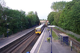
Aldermaston railway station serves the village of Aldermaston in Berkshire, England. The station is at nearby Aldermaston Wharf and about 2 miles (3 km) north of Aldermaston village. It is 44 miles 63 chains measured from London Paddington.

North West Hampshire is a constituency represented in the House of Commons of the UK Parliament since 2015 by Conservative Kit Malthouse, who served as Education Secretary in 2022.

Basingstoke is a constituency in Hampshire represented in the House of Commons of the UK Parliament since 2024 by Luke Murphy, a member of the Labour Party.
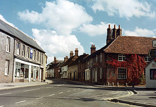
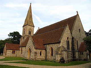
Kingsclere is a large village and civil parish in Hampshire, England.

Cliddesden is a village and a parish in Hampshire, England located 3 miles south of Basingstoke, close to the M3 motorway. In the 2001 census it had a population of 489, increasing to 497 at the 2011 Census. The land and housing are currently protected as it is within a Conservation Zone and has many areas of beauty and rolling countryside.
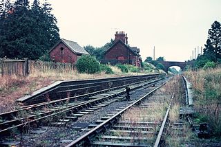
Litchfield is a village and former civil parish, now in the parish of Litchfield and Woodcott, in the Basingstoke and Deane district of Hampshire, England. It is closely bypassed by the A34 trunk road between Newbury and Whitchurch, which follows the course of the former Didcot, Newbury and Southampton Railway. Litchfield railway station, which closed in 1960, was on this line. The station is a private house, not owned by C.A.H Wills who owns Litchfield farms estate and lives in the village. The station was sold by Hampshire County Council in 1978 and has been restored. The approach road is now a private drive to the property. In 1976 the Litchfield - Whitchurch bypass was opened and made use of the DN&SR trackbed south of Litchfield towards Whitchurch for a distance of one mile. In 1931 the parish had a population of 88.

Rooksdown is a civil parish in the Basingstoke and Deane district of Hampshire, England. The parish was formed on 1 April 2004. It covers a small estate in the north-west of Basingstoke which was previously part of the parish of Sherborne St. John, itself originally part of the Vyne estate.
The Bordon Light Railway was a short-lived light railway line in Hampshire that connected the Army Camp at Bordon, as well as the villages of Bordon and Kingsley, with the national rail network at Bentley on the main Farnham-Alton line, a distance of 4.5 miles (7.2 km).
The Didcot, Newbury and Southampton Railway (DN&SR) was a cross-country railway running north–south between Didcot, Newbury and Winchester. Its promoters intended an independent route to Southampton and envisaged heavy traffic from the Midlands and North of England to the port, but they ran out of funds to complete the line to Southampton. The intended heavy through traffic never materialised, and the line was dependent on larger railways—the Great Western Railway and the London and South Western Railway—for support, which was not freely given. The line opened in two stages, in 1882 and 1885.

The Basingstoke and Alton Light Railway was opened in 1901, by the London and South Western Railway. It was the first English railway authorised under Light Railway legislation. It ran through unpromising, lightly populated terrain, and was probably built only to exclude competitors from building a line in the area. It had steep gradients and a line speed limit of 20 mph, later raised to 25 mph.

Old Burghclere is part of Burghclere in Hampshire, England, located south of the large town of Newbury near the A34 road. The village of Burghclere, but less so Old Burghclere, was once on the A34 and has now been by-passed, although this section is not really part of the Newbury bypass.
Burghclere railway station was a station on the Didcot, Newbury and Southampton Railway in England. It was further from the village of Burghclere than Highclere railway station but Burghclere station was relatively busy, serving the larger village of Kingsclere.
Woolton Hill is a village in Hampshire, England, in the civil parish of East Woodhay. The village lies approximately 4 miles (6 km) south-west of the centre of Newbury and encompasses the hamlet of Broad Layings on its northern edge.

Sydmonton is a small village, estate and former civil parish, now in the parish of Ecchinswell, Sydmonton and Bishops Green, in the Basingstoke and Deane district of Hampshire, England. Its nearest town is Newbury, which lies approximately 7 miles (11 km) north-west from the village. In 1931 the parish had a population of 139.
Highclere is a village and civil parish located in Hampshire, England.
The Berks and Hants Canal, incorporated as the Berkshire and Hampshire Junction Canal Company, was a proposed canal in the English counties of Berkshire and Hampshire. Proposals for the waterway originate after the completion of the Kennet and Avon Canal and the Basingstoke Canal in the 1790s, with a view to connecting the two canals.