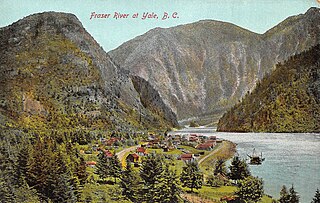
Yale is an unincorporated town in the Canadian province of British Columbia, which grew in importance during the Fraser Canyon Gold Rush.

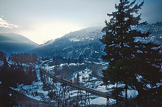
The Fraser Canyon is a major landform of the Fraser River where it descends rapidly through narrow rock gorges in the Coast Mountains en route from the Interior Plateau of British Columbia to the Fraser Valley. Colloquially, the term "Fraser Canyon" is often used to include the Thompson Canyon from Lytton to Ashcroft, since they form the same highway route which most people are familiar with, although it is actually reckoned to begin above Williams Lake at Soda Creek Canyon near the town of the same name.

The Fraser Canyon Gold Rush, began in 1858 after gold was discovered on the Thompson River in British Columbia at its confluence with the Nicoamen River a few miles upstream from the Thompson's confluence with the Fraser River at present-day Lytton. The rush overtook the region around the discovery and was centered on the Fraser Canyon from around Hope and Yale to Pavilion and Fountain, just north of Lillooet.

Boston Bar is an unincorporated community in the Fraser Canyon of the Canadian province of British Columbia.

McGowan's War was a bloodless war that took place in Yale, British Columbia in the fall of 1858. The conflict posed a threat to the newly established British authority on the British Columbia mainland, at the onset of the Fraser Canyon Gold Rush. It was called Ned McGowan's War after one of the conflict's main antagonists.
Edge Hills Provincial Park is a provincial park in British Columbia, Canada, located west of the town of Clinton. The Edge Hills flank the wall of the Fraser Canyon north of Moran Canyon and form a small fore-range between the river and the higher Marble Range just east. Access to the Edge Hills is via the Jesmond Road, which cuts north off the Pavilion Mountain Road at Kelly Lake. A spur road from the Jesmond Road west goes to an overlook atop the Edge Hills, known as Cougar Point.
Marble Range Provincial Park is a provincial park in British Columbia, Canada, located west of 100 Mile House and Clinton at the southwest edge of the Cariboo Plateau along the eastern edge of the Fraser Canyon south from Big Bar-Kostering and near Jesmond.

The Fraser Canyon War, also known as the Canyon War or the Fraser River War, was an incident between white miners and the indigenous Nlaka'pamux people in the newly declared Colony of British Columbia, which later became part of Canada, in 1858. It occurred during the Fraser Canyon Gold Rush, which brought many white settlers to the Fraser Canyon area. Largely ignored by Canadian historians, it was one of the seminal events of the founding of the colony. Although it ended relatively peacefully, it was a major test of the new administration's control over the goldfields, which were distant and difficult to access from the centre of colonial authority at Victoria in the Colony of Vancouver Island.

The Stswecem'c Xget'tem First Nation, formerly known as Canoe Creek Band/Dog Creek Indian Band, created as a result of merger of the Canoe Creek Band and Dog Creek Band is a First Nations government of the Secwepemc (Shuswap) Nation, located in the Fraser Canyon-Cariboo region of the Central Interior of the Canadian province of British Columbia. It was created when the government of the then-Colony of British Columbia established an Indian reserve system in the 1860s. It is a member government of the Northern Shuswap Tribal Council.
The High Bar First Nation is a First Nations government of the Secwepemc (Shuswap) Nation, located in the Fraser Canyon-Cariboo region of the Central Interior of the Canadian province of British Columbia. It was created when the government of the then-Colony of British Columbia established an Indian reserve system in the 1860s. It is one of three Secwepemc bands that is not a member of either the Shuswap Nation Tribal Council or the Northern Shuswap Tribal Council. The High Bar people are also partly Tsilhqot'in and have links with some Chilcotin First Nations.
The Lytton First Nation, a First Nations band government, has its headquarters at Lytton in the Fraser Canyon region of the Canadian province of British Columbia. While it is the largest of all Nlaka'pamux bands, unlike all other governments of the Nlaka'pamux (Thompson) people, it is not a member of any of the three Nlaka'pamux tribal councils, which are the Nicola Tribal Association, the Fraser Canyon Indian Administration and the Nlaka'pamux Nation Tribal Council.
The Red Bluff First Nation is a Dakelh First Nations government located in the northern Fraser Canyon region of the Canadian province of British Columbia. It is a member of the Carrier-Chilcotin Tribal Council, which includes both Tsilhqot'in and Carrier (Dakelh) communities.

Hat Creek is a tributary of the Bonaparte River in British Columbia, Canada, joining that stream at Carquile, which is also known as Lower Hat Creek and is the site of the Hat Creek Ranch heritage museum and visitor centre. The Hat Creek basin includes a broad upper plateau area encircled by the gentle but high summits of the Clear Range and, to its east, the Cornwall Hills; this area is known as Upper Hat Creek. Adjacent to Upper Hat Creek is the gateway to Marble Canyon and a rancherie of the Pavilion First Nation, who are both a St'at'imc and Secwepemc people. During the Fraser Canyon and Cariboo Gold Rushes an important trail northwards from the lower Fraser Canyon led from Foster Bar on the Fraser via Laluwissen Creek into Upper Hat Creek, then via the creek to the Bonaparte River. The economy of the basin is ranching-based and includes some of the oldest ranches in the British Columbia Interior. On the northwest edge of the Upper Hat Creek basin there is a large lignite deposit and several exploratory pits, some dating back to the 19th century but some more recent, part of an intended, but now shelved Hat Creek coal-thermal proposal.
North Bend is an unincorporated community in the Fraser Canyon region of British Columbia, Canada, located across the Fraser River from the town of Boston Bar. North Bend was originally known as Boston Bar, but that name moved across the Fraser River when the site was renamed North Bend.
Kanaka Bar is an unincorporated community and locality in the Fraser Canyon region of British Columbia, Canada, located near the town of Lytton. Named for a gold-bearing bar on the Fraser River below, which was mined by Hawaiians, Kanaka Bar is the home of the office and main rancherie of the Kanaka Bar Indian Band of the Nlaka'pamux peoples, and is also the source of the name of Kanaka Bar Indian Reserve No. 1A and Kanaka Bar Indian Reserve No. 2 which are governed by the band.

Anderson River is a tributary of the Fraser River in the Canadian province of British Columbia.

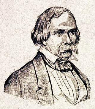
Edward McGowan was an American lawyer, Pennsylvania assemblyman, Judge of the California Court of Quarter Sessions, poet, Fraser Canyon gold seeker, adventurer, assistant sergeant-at-arms in the United States Congress, newspaper publisher and bon vivant instigator of the eponymous McGowan's War in colonial British Columbia.
Yale First Nation is a First Nations government located at Yale, British Columbia. Yale has 16 distinct reserves stretching from near Sawmill Creek to American Creek, with the most southern reserve situated at Ruby Creek in the District of Kent.
Emory City was a town on the Fraser River just 5 km south of Yale, British Columbia.
Boothroyd is a settlement in the Fraser Canyon region of British Columbia, just north of Boston Bar-North Bend. It sits on a flat, alluvial bench which is some of the only flat land in the Fraser Canyon. It was the site of a Cariboo Roadhouse, run by a man named Boothroyd. Later it was a camp for Canadian Pacific Railway Chinese construction workers from 1882 to 1884.


