
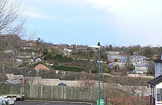
Hill Close Gardens is a group of 18 surviving Victorian detached gardens on a hillside in Warwick, Warwickshire, England. It is listed Grade II* in Historic England's Register of Parks and Gardens. [1]
Hill Close Gardens is a group of 18 surviving Victorian detached gardens on a hillside in Warwick, Warwickshire, England. It is listed Grade II* in Historic England's Register of Parks and Gardens. [1]
The gardens were set up in the 19th century on a hillside overlooking Warwick Racecourse to provide gardens for owners of townhouses which did not have their own gardens. They were generally owned staying in families for generations, although some were rented. Each was enclosed by either a wall or hedge, complete with lockable gate to ensure privacy.
Many of them had summer houses built so the family could spend the entire day in the garden, whatever the weather.
They fell into disuse in the 20th century with only one or two remaining in use after WWII.
In the 1950s the local council (Warwick Municipal Borough) started buying up the plots with a plan to re-develop the hillside and in the 1960s it was designated for social housing.
Planning permission was granted in the 1980s and then subsequently lapsed although some building was completed.
In 1994, 4 of the summer houses were 'listed' as being of historical interest and in 2000 a Trust was formed to restore the gardens to their Victorian status.
The gardens opened to the public at Easter 2007 and have been operated by the Trust since.

Warwick is a market town, civil parish and the county town of Warwickshire, England, adjacent to the River Avon. It is 9 miles (14 km) south of Coventry, and 19 miles (31 km) south-east of Birmingham. It is adjoined with Leamington Spa and Whitnash. It has ancient origins and an array of historic buildings, notably from the Medieval, Stuart and Georgian eras. It was a major fortified settlement from the early Middle Ages, the most notable relic of this period being Warwick Castle, a major tourist attraction. Much was destroyed in the Great Fire of Warwick in 1694 and then rebuilt with fine 18th century buildings, such as the Collegiate Church of St Mary and the Shire Hall.

Warwickshire is a county in the West Midlands region of England. The county town is Warwick, and the largest town is Nuneaton. The county is famous for being the birthplace of William Shakespeare at Stratford-upon-Avon and Victorian novelist George Eliot,, at Nuneaton. Other significant towns include Rugby, Leamington Spa, Bedworth, Kenilworth and Atherstone. The county offers a mix of historic towns and large rural areas. It is a popular destination for international and domestic tourists to explore both medieval and more recent history.

Warwick is a local government district of central Warwickshire in England. It borders the Borough of Rugby and Stratford-on-Avon District in Warwickshire as well as the West Midlands County. The City of Coventry is to the north and northeast, the Stratford-on-Avon District to the southwest and south, the Borough of Rugby to the east, and the Borough of Solihull to the west and northwest.

Baddesley Clinton is a moated manor house, about 8 miles (13 km) north-west of the town of Warwick, in the village of Baddesley Clinton, Warwickshire, England. The house probably originated in the 13th century, when large areas of the Forest of Arden were cleared for farmland. The site is a Scheduled Ancient Monument and the house is a Grade I listed building. The house, park and gardens are owned by the National Trust and open to the public; they lie in a civil parish of the same name.

Leek Wootton is a village in Warwickshire, England, approximately 2 miles south of Kenilworth and 2.5 miles north of Warwick. It lies in the triangle created by Kenilworth, Warwick and Leamington Spa.

Cossington is a village within the Soar Valley in Leicestershire, England. It lies between Sileby, Rothley, Ratcliffe-on-the-Wreake and Syston. The population of the civil parish at the 2011 census was 598.

Middleton is a small village in the North Warwickshire district of the county of Warwickshire, England. The population of the civil parish at the 2011 census was 630.
Lillington is a suburb of Leamington Spa in the Warwick District in Warwickshire, England. Historically a village which existed before the time of the Domesday Book (1086), it was incorporated into the borough of Leamington in 1890. Lillington is a ward of Warwick District Council and Royal Leamington Spa Town Council.

St Ann's is a large district of the city of Nottingham, in the English ceremonial county of Nottinghamshire. The population of the district at the time of the United Kingdom census, 2011 was 19,316.
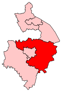
Kenilworth and Southam is a constituency in Warwickshire, England represented in the House of Commons of the UK Parliament since 2010 by Jeremy Wright, a Conservative who served as Culture Secretary until 24 July 2019, having previously served as Attorney General for England and Wales from 2014 to 2018.

Cubbington is a village and civil parish with a population of 3,929, adjoining the north-eastern outskirts of Leamington Spa, Warwickshire, England, approximately 3 miles from the town centre. Welsh Road, running through the village crossroads, was an old sheep drovers' route connecting London and Wales. Since the 1950s when the village expanded there have been two parts to the village: Cubbington proper which was the old village core, and New Cubbington which is to the west, although both are referred to as Cubbington. Topographically the highest point of the village sits about 100 metres (330 ft) above sea level while its lowest is about 60 metres (200 ft). For many years the electorate for Cubbington was represented in government by the MP for Warwick and Leamington but for the 2010 UK Elections it moved to the new Kenilworth & Southam constituency.

Gibbet Hill is the location of, and name for, the University of Warwick's southern campus, in the south of Coventry, England.

Sydenham is an eastern suburb of the town of Leamington Spa, Warwickshire, England.

Ratley is a village in the civil parish of Ratley and Upton, Stratford-on-Avon District, Warwickshire, England. The population of the civil parish in 2011 was 327. It is on the northwest side of the Edge Hill escarpment about 200 metres (660 ft) above sea level. The village is close to the county border with north Oxfordshire, some 7 miles northwest of Banbury, the closest town.
Birches Green is a small area of Tyburn in Birmingham, England, within the parliamentary constitiuency of Erdington. It is located between Gravelly Hill, Erdington and the M6 motorway.
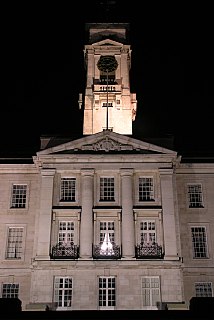
Percy Richard Morley Horder was an English architect who early in his career worked from offices in Stroud and later in London. His early work included public houses for the Godsell Brewery work included the designing of new country houses or partially rebuilding existing houses. He also designed country house gardens and is noted for laying out Highfields Park, Nottingham together with the adjacent Nottingham University Campus. His early work was in the Arts and Crafts style, but after the First World War his buildings were increasingly in the Neo-Georgian fashion. He undertook architectural work in many parts of the British Isles including Ireland and at Thurso in Caithness. He is probably best remembered for the Trent Building in the University of Nottingham. and for design of the London School of Hygiene and Tropical Medicine. His work at Upton House, Warwickshire for Viscount Bearsted is notable, but it is his work for Jesse Boot, both the Boot's the Chemists stores, but most importantly the Trent Building and the laying out of the Nottingham University Campus, which influenced design at other English universities, for which he must take the greatest credit.

Stoney Road Allotments consists of 123 council-owned allotments covering around 5 hectares just south of Coventry city centre. They were created in the mid 19th century as pleasure-gardens for the people of the city, and were Grade II* listed in 2001.
St Ann's Allotments is a group of allotments, in use since the 19th century, in St Ann's, Nottingham, England, about a mile north-east of the centre of Nottingham. It is listed Grade II* in Historic England's Register of Parks and Gardens. The entry listing remarks that this site, comprising Hungerhill Gardens, Stonepit Coppice Gardens and Gorseyclose Gardens, "represents the most extensive surviving detached town garden site in England".
Bagthorpe Gardens is a group of allotments, about 1.8 miles (2.9 km) north-east of the centre of Nottingham. It is listed Grade II* in Historic England's Register of Parks and Gardens. The entry listing remarks that the allotments are "a significant surviving example of a once abundant but now extremely rare type of garden, of which there are only four other registered examples".
Westbourne Road Town Gardens, or Westbourne Road Leisure Gardens, is a group of allotments in Edgbaston, Birmingham, England, created in 1844. It is listed Grade II in Historic England's Register of Parks and Gardens.
Coordinates: 52°16′51″N1°35′38″W / 52.2808963°N 1.5939108°W