The Hilo Hawaiian Hotel located in Hilo, Hawaii's second largest town, is one of a few relatively large hotels on the east coast of Hawaii Island. It is located, like the Grand Naniloa Hotel, on Banyan Drive. [1]

The Hilo Hawaiian Hotel located in Hilo, Hawaii's second largest town, is one of a few relatively large hotels on the east coast of Hawaii Island. It is located, like the Grand Naniloa Hotel, on Banyan Drive. [1]
The Hilo Hawaiian Hotel opened in 1975 on Banyan Drive in Hilo. It has undergone several refurbishments since, with the most recent renovations being a full renovation in 1993, and a $6.5 million upgrade in 2014. [2] [3] The present owner of the hotel is Castle Hotels & Resorts which owns resort hotels in Hawaii and New Zealand. [4]
The hotel has one building, eight-storey high. The main dining area, Queen's Court, is located on the lobby floor.[ needs update ]There is also a Japanese restaurant "Hakone" in the hotel.
From the rooms with ocean view, Hilo Bay spreads out in front, with the majestic view of Mauna Kea in the distance. The pedestrian bridge to Coconut Island in the bay is adjacent to this hotel.

Hawaii is the largest island in the United States, located in the state of Hawaii. It is the southeasternmost of the Hawaiian Islands, a chain of volcanic islands in the North Pacific Ocean. With an area of 4,028 square miles (10,430 km2), it has 63% of the Hawaiian archipelago's combined landmass. However, it has only 13% of Hawaiʻi's population. The island of Hawaiʻi is the third largest island in Polynesia, behind the two main islands of New Zealand.

Hilo is a census-designated place (CDP) and the largest settlement in Hawaii County, Hawaii, United States, which encompasses the Island of Hawaiʻi. The population was 44,186 according to the 2020 census. It is the fourth-largest settlement in the state of Hawaii and largest settlement in the state outside of Oahu.

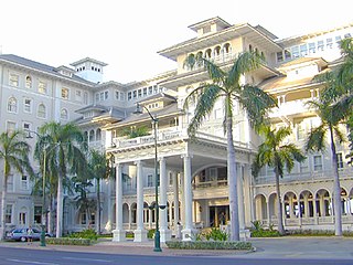
The Moana Hotel is a historic hotel building in Honolulu, Hawaii, located at 2365 Kalākaua Avenue in the Waikiki neighborhood. Built in the late 19th century as the first hotel in Waikiki, the Moana opened in 1901. It is listed on the National Register of Historic Places. The building is currently part of the resort complex known as Moana Surfrider, A Westin Resort & Spa and is managed by Westin Hotels & Resorts.

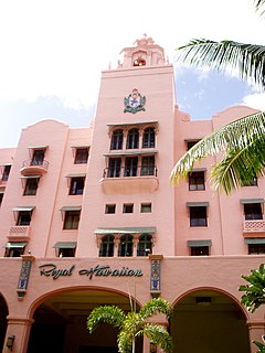
The Royal Hawaiian Hotel is a beachfront luxury hotel located in Waikiki in Honolulu, Hawaii, on the island of Oahu. It is part of The Luxury Collection brand of Marriott International. One of the first hotels established in Waikiki, the Royal Hawaiian is considered one of the most luxurious and famous hotels in Hawaiian tourism, and in its 95-year history has been host to numerous celebrities and world dignitaries. The bright pink hue of its concrete stucco façade with its Spanish/Moorish styled architecture and prominent location on the wide sandy beach have earned it the alliterative nickname of "The Pink Palace of the Pacific".

ʻĀinahau was the royal estate of Princess Victoria Kaʻiulani, heir to the throne of the Kingdom of Hawaiʻi.

The Wailuku River is a 28.0-mile-long (45.1 km) water course on the Island of Hawaiʻi in the Hawaiian Islands. It is the longest river in Hawai'i and the largest in the state by mean discharge. Its course lies mostly along the divide between the lava flows of Mauna Kea and those of Mauna Loa to the south. It arises at about the 10,800 feet (3,300 m) elevation along the eastern slope of Mauna Kea. It flows generally eastward, descending steeply from the mountain and entering the Pacific Ocean at Hilo.

Route 200, known locally as Saddle Road, traverses the width of the Island of Hawaiʻi, from downtown Hilo to its junction with Hawaii Route 190 near Waimea. The road was once considered one of the most dangerous paved roads in the state, with many one-lane bridges and areas of marginally maintained pavement. Most of the road has now been repaved, and major parts have new re-alignments to modern standards. The highway is mostly one-lane in each direction, but there are two lanes on the uphill portions. The highway reaches a maximum elevation of 6,632 feet (2,021 m) and is subject to fog and low visibility. Many rental car companies used to prohibit use of their cars on Saddle Road, but now allow use of the road. The highway experiences heavy use as it provides the shortest driving route from Hilo to Kailua-Kona and access to the slopes of Mauna Loa and the Mauna Kea Observatories.

Saint Joseph Catholic Church in Hilo is a parish of the Roman Catholic Church of Hawaii in the United States. Located at 43 Kapiolani Street, 19°43′20″N155°5′25″W, in Hilo on the Big Island of Hawaii, the church falls under the jurisdiction of the Diocese of Honolulu and its bishop. It is named after Saint Joseph, foster father of Jesus. This parish operates the St. Joseph Junior and Senior High School and an elementary school.
Waiākea is an ancient subdivision (ahupuaʻa) in the Hilo District of the Big Island of Hawaiʻi and an early settlement on Hilo Bay.

Hakalau is a small unincorporated community located along the Hamakua coast about 15 miles (24 km) north of Hilo on the Big Island of Hawaii in the U.S. state of Hawaii at 19°53′49″N155°7′35″W.
The Hawaiʻi Belt Road is a modern name for the Māmalahoa Highway and consists of Hawaiʻi state Routes 11, 19, and 190 that encircle the Island of Hawaiʻi. The southern section, between Hilo and Kailua-Kona is numbered as Route 11. The section between Hilo and Waimea is Route 19. Between Waimea and Kailua-Kona, the road is split in two: the original "mauka" route and a "makai" Route 19, completed in 1975, which serves as access to the Kona and Kohala Coast resorts. In the Hawaiian language, mauka means "towards the mountain" and makai means "towards the sea". These terms are commonly used in travel directions.

Banyan Drive is a tree-lined street at the shoreline of Hilo, Hawaii. It is known as the "Hilo Walk of Fame" for the banyan trees planted by celebrities. These trees have withstood several tsunamis that have devastated the town on the Big Island of Hawaii.

Liliʻuokalani Park and Gardens is a 24.14-acre (97,700 m2) park with Japanese gardens, located on Banyan Drive in Hilo on the island of Hawaiʻi.
The Turtle Bay Resort is a resort with cottages on the North Shore of Oahu island in Hawaii.

The Federal Building, U.S. Post Office and Courthouse in Hilo, Hawaii is a former courthouse of the United States District Court for the District of Hawaii. Completed in 1917 and expanded in the 1930s, the building was listed in the National Register of Historic Places in 1974.

Waikoloa Beach is an area located on the South Kohala coast on the island of Hawaii and is located in the census-designated place of Puako. It can be confused for Waikoloa Village, a CDP in the same "ahupuaʻa" and is also known as "Waikoloa".

Hilo Bay is a large bay located on the eastern coast of the island of Hawaiʻi.

Kīlauea Military Camp (KMC) is operated as a Morale, Welfare and Recreation (MWR) facility on Hawai‘i Island, also known as the Big Island, in Hawaiʻi. It is located inside Hawaiʻi Volcanoes National Park. This United States Department of Defense (DOD) facility is at an elevation of 4,000 feet, within walking distance from Kilauea Volcano, the world’s most active volcano.

Waiākea-Uka (IPA:/'waj.ə.kei.ə.'u.kə/) is an ancient subdivision (ahupuaʻa) in the Hilo District of the Big Island of Hawaiʻi, located mauka (mountain-side) of the Waiākea ahupua'a; its location is on the lower flanks of the volcano Mauna Loa. Because of this, one meaning of the name 'Waiākea-Uka' can be translated from 'Olelo Hawai'i as '(the) mountain-side (of) Waiākea'. Many ahupua'a have this -uka appellation, as the directions 'mountain-side' and 'sea-side' (makai) are the two best ways of orientating something in space on any of the islands.

The Grand Naniloa Hotel is a hotel in Hilo, Hawaii, on the eastern side of the Big Island. It is the largest hotel in the state of Hawaii's second largest city, and has the longest history as a hotel on Hawaii Island.
Coordinates: 19°43′43″N155°04′00″W / 19.7285577°N 155.0667647°W