Related Research Articles

Newfoundland and Labrador is the easternmost province of Canada, in the country's Atlantic region. It is composed of the island of Newfoundland and the continental region of Labrador to the northwest, with a combined area of 405,212 square kilometres (156,500 sq mi). In 2021, the province's population was estimated at 521,758. About 94% of the province's population lives on the island of Newfoundland, of whom more than half live on the Avalon Peninsula.

Labrador is a geographic and cultural region within the Canadian province of Newfoundland and Labrador. It is the primarily continental portion of the province and constitutes 71% of the province's area but is home to only 6% of the province's population. It is separated from the island of Newfoundland by the Strait of Belle Isle. It is the largest and northernmost geographical region in Atlantic Canada.

The Gulf of St. Lawrence is the outlet of the North American Great Lakes via the St. Lawrence River into the Atlantic Ocean. The gulf is a semi-enclosed sea, covering an area of about 226,000 square kilometres (87,000 sq mi) and containing about 34,500 cubic kilometres (8,300 cu mi) of water, which results in an average depth of 152 metres (499 ft).

The Bay of Islands is an extensive inlet located on the west coast of the island of Newfoundland, in Canada. The Way Office was established on July 1, 1883. The first Waymaster was Thomas Carter. The largest island in the bay is Woods Island. It is surrounded in most directions by the Long Range Mountains and it is directly north of the Lewis Hills.

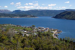
Stephenville is a town in Newfoundland and Labrador, Canada, on the west coast of the island of Newfoundland.

Hinchinbrook Island is an island in the Cassowary Coast Region, Queensland, Australia. It lies east of Cardwell and north of Lucinda, separated from the north-eastern coast of Queensland by the narrow Hinchinbrook Channel. Hinchinbrook Island is part of the Great Barrier Reef Marine Park and wholly protected within the Hinchinbrook Island National Park, except for a small and abandoned resort. It is the largest island on the Great Barrier Reef. It is also the largest island national park in Australia.
The Burin Peninsula is a peninsula located on the south coast of the island of Newfoundland in the province of Newfoundland and Labrador. Marystown is the largest population centre on the peninsula.
Woody Point is a town located in the heart of Gros Morne National Park, on the western coast of Newfoundland. Situated on Bonne Bay, the Town of Woody Point encompasses three areas: Curzon Village, Woody Point and Winterhouse Brook. It has a total population of 244 residents. Woody Point is a Registered Heritage District and has a waterfront with many heritage buildings and four Registered Newfoundland and Labrador Heritage Structures. The community is served by Route 431.

Newfoundland and Labrador is the easternmost province in Canada. The Strait of Belle Isle separates the province into two geographical divisions, Labrador and the island of Newfoundland. The province also includes over seven thousand small islands.

Brig Bay is a local service district and designated place in the Canadian province of Newfoundland and Labrador. It was first mapped by Captain James Cook in September 1764. The name "Brig" was adopted by the French who occupied the bay prior to English occupation. It provided a safe and well-sheltered harbour.

Newfoundland is a large island off the east coast of the North American mainland and the most populous part of the Canadian province of Newfoundland and Labrador. It has 29 percent of the province's land area. The island is separated from the Labrador Peninsula by the Strait of Belle Isle and from Cape Breton Island by the Cabot Strait. It blocks the mouth of the Saint Lawrence River, creating the Gulf of Saint Lawrence, the world's largest estuary. Newfoundland's nearest neighbour is the French overseas collectivity of Saint Pierre and Miquelon.

La Poile Bay is a natural bay in Newfoundland, Canada, in the southwestern area of the island, off the south coast. It subdivides into Northeast Arm and North Bay. The settlement of La Poile is located on the bay.
Médée Bay is a natural bay off the island of Newfoundland in the province of Newfoundland and Labrador, Canada. It faces the modern village and archeological site of L'Anse aux Meadows.
Goose Bay is a natural bay off the island of Newfoundland in the province of Newfoundland and Labrador, Canada.
Witless Bay is a natural bay off of the island of Newfoundland in the province of Newfoundland and Labrador, Canada. It is located on the eastern coast of the Avalon Peninsula, south of Bay Bulls and north of La Manche Provincial Park.
Bay Bulls is a natural bay off the island of Newfoundland in the province of Newfoundland and Labrador, Canada.
Sandwich Bay, is a natural bay on the coast of Labrador in the province of Newfoundland and Labrador, Canada. The principal permanent settlement is Cartwright, located at the south entrance to the inner part of the bay. Other settlements along the bay include Paradise River and North River. Both of these communities are located at the outlets of the rivers of the same name into the bay. The is a road following the entire eastern coastline of Sandwich Bay, Newfoundland and Labrador Route 516.
Pottles Bay is a natural bay on the coast of Labrador in the province of Newfoundland and Labrador, Canada. It is fed by the Northwest Brook basin and drains into the Labrador Sea.
The following outline is provided as an overview of and topical guide to Newfoundland and Labrador.
Pensons Arm is a local service district and designated place in the Canadian province of Newfoundland and Labrador. Pensons Arm, is a coastal village in Labrador, 20 km southeast of Charlottetown. It has a population of 43 in the 2021 census.
References
- ↑ United States Hydrographic Office; Davenport, Richard G. (1884). Newfoundland and Labrador: The coast and banks of Newfoundland and the coast of Labrador, from Grand Point to the Koksoak River, with the adjacent islands and banks (Public domain ed.). Govt. print. off. pp. 526–. Retrieved 20 November 2011.
| | This Labrador location article is a stub. You can help Wikipedia by expanding it. |
Hinchinbrook Bay, or Island as it is more famously known, is actually considered a tropical park and is called the Hinchinbrook Island National Park. [1]
- ↑ "Hinchinbrook Island National Park". 22 October 2009.