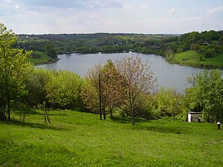
Smila

The Struve Geodetic Arc is a chain of survey triangulations stretching from Hammerfest in Norway to the Black Sea, through ten countries and over 2,820 kilometres (1,750 mi), which yielded the first accurate measurement of a meridian arc.
Greenwood is a neighborhood of Louisville, Kentucky located along Cane Run Road and Greenwood Road. It is sometimes referred to by its large industrial park and shipping facility, Riverport.

The Church of the Annunciation is located at 3547 Clifton Avenue at Resor Street in Cincinnati, Ohio, United States. The Church is located in the Clifton neighborhood. It is part of the Clifton Avenue Historic District. This historic parish was founded in February 1910 and the present building was completed in August 1930. This church was designed by Boston architect Edward T. P. Graham, who was active in both the Archdiocese of Boston and the Archdiocese of Cincinnati in the first half of the 20th century.
Etna is an unincorporated community in Custer County, Nebraska, United States. It lies at an elevation of 2,802 feet (854 m).

Census Division No. 9 is a census division located within the Central Plains Region of the province of Manitoba, Canada. Unlike in some other provinces, census divisions do not reflect the organization of local government in Manitoba. These areas exist solely for the purposes of statistical analysis and presentation; they have no government of their own.

Station Road is a cricket ground in Darley Dale, Derbyshire, England, which has hosted only one top-class match: the 1975 John Player League match between Derbyshire and Hampshire. The away side won by 70 runs thanks to fifties from Barry Richards and Gordon Greenidge, and Thomas Mottram and John Rice taking five and four wickets respectively.
Çarlı is a village and municipality in the Kurdamir Rayon of Azerbaijan.
N'Goa is a small town and commune in the Cercle of San in the Ségou Region of Mali. As of 1998 the commune had a population of 7,172.

Dainava (Varėna) is a village in Varėna district municipality, in Alytus County, in southeastern Lithuania. According to the 2001 census, the village has a population of 95 people.
The Russian Islamic University is Russia's first official Islamic university. It was founded in 1998 in Kazan, Tatarstan. The university consists of three departments and four sub-departments. In 2008 the university had around 70 faculty and more than 400 students. The university changed its status to Islamic institute in 2009.
Järve is a village in Lääneranna Parish, Pärnu County in southwestern Estonia.

Dodds Bridge is an unincorporated community in Turman Township, Sullivan County, in the U.S. state of Indiana.
Zovi Do is a village in the municipality of Nevesinje, Republika Srpska, Bosnia and Herzegovina.
Selište is a village in the municipality of Trstenik, Serbia. According to the 2002 census, the village has a population of 928 people.
Singhia Assembly constituency was an assembly constituency in Samastipur district in the Indian state of Bihar.
Pink Arrow is an unincorporated community in Navajo County, Arizona, United States. Pink Arrow is located at 35°46′37″N110°09′26″W.
Kahletown is an unincorporated community in Jefferson County, in the U.S. state of Pennsylvania.
Tulip is an unincorporated community in northwest Audrain and southwest Monroe counties, in the U.S. state of Missouri. The community is on Monroe county road 92. Long Branch flows past approximately one mile west and north of the site. Moberly is approximately 15 miles to the north-northwest in Randolph County and Centralia is eight miles south in northeast Boone County, Missouri.
Family Christian Academy (FCA) is a private Christian school in Channelview, unincorporated Harris County, Texas, in the Houston metropolitan area. It serves Pre-Kindergarten through Grade 12.
This page is based on this
Wikipedia article Text is available under the
CC BY-SA 4.0 license; additional terms may apply.
Images, videos and audio are available under their respective licenses.


