
Holland is a geographical region and former province on the western coast of the Netherlands. The name Holland is also frequently used informally to refer to the whole of the country of the Netherlands. This usage is commonly accepted in other countries and is also commonly employed by the Dutch themselves. However, some in the Netherlands, particularly those from regions outside Holland, find it undesirable or misrepresentative to use the term for the whole country.

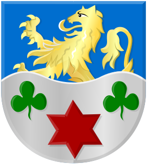
South Holland is a province of the Netherlands with a population of over 3.7 million as of October 2021 and a population density of about 1,373/km2 (3,560/sq mi), making it the country's most populous province and one of the world's most densely populated areas. Situated on the North Sea in the west of the Netherlands, South Holland covers an area of 3,307 km2 (1,277 sq mi), of which 607 km2 (234 sq mi) is water. It borders North Holland to the north, Utrecht and Gelderland to the east, and North Brabant and Zeeland to the south. The provincial capital is the Dutch seat of government The Hague, while its largest city is Rotterdam. The Rhine-Meuse-Scheldt delta drains through South Holland into the North Sea. Europe's busiest seaport, the Port of Rotterdam, is located in South Holland.

The Hague is a city and municipality on the western coast of the Netherlands on the North Sea. It is the administrative and royal capital of the Netherlands and its seat of government, as well as the capital of the province of South Holland. It hosts the International Court of Justice and International Criminal Court.
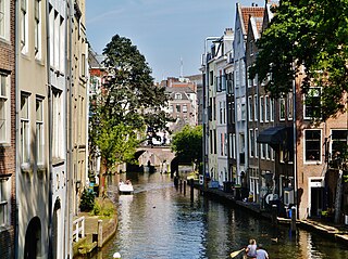
Utrecht is the fourth-largest city and a municipality of the Netherlands, capital and most populous city of the province of Utrecht. It is located in the eastern corner of the Randstad conurbation, in the very centre of mainland Netherlands; it has a population of 361,966 as of December 1, 2021.

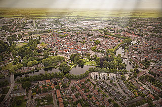
Gouda is a city and municipality in the west of the Netherlands, between Rotterdam and Utrecht, in the province of South Holland. Gouda has a population of 72,338 and is famous for its Gouda cheese, stroopwafels, many grachten, smoking pipes, and its 15th-century city hall. Its array of historic churches and other buildings makes it a very popular day trip destination.
Woerden is a city and a municipality in central Netherlands. Due to its central location between Amsterdam, Rotterdam, The Hague, and Utrecht, and the fact that it has rail and road connections to those cities, it is a popular town for commuters who work in those cities.

Boskoop is a town in the province of South Holland. It was a separate municipality until it merged into Alphen aan den Rijn in 2014. The town had a population of 15,050 in 2012 and covers an area of 7.29 km2 (2.81 sq mi) of which 1.39 km2 (0.54 sq mi) is water. It's the world's biggest joined floriculture area.

Zwijndrecht is both a village and a municipality located in the Flemish province of Antwerp, in Belgium. As well as Zwijndrecht proper, the municipality includes the village of Burcht. As of January 1, 2006, Zwijndrecht had a total population of 18,231.

The Oude Rijn is a branch of the Rhine delta in the Dutch provinces of Utrecht and South Holland, starting west of Utrecht, at Harmelen and runs by a mechanical pumping station into the North Sea at Katwijk. Its present-day length is 52 kilometres.

Gorredijk is the largest town in the municipality of Opsterland, in the Dutch province of Friesland. Gorredijk had a population of 7,360 in 2019.

Jodensavanne was a Jewish plantation community in Suriname, South America, and was for a time the centre of Jewish life in the colony. It was established in the 1600s by Sephardi Jews and became more developed and wealthy after a group of Jews fleeing persecution in Brazil settled there in the 1660s. It was located in what is now Para District, about 50 km (31 mi) south of the capital Paramaribo, on the Suriname River. Sugarcane plantations were established and Black African people were used as slave labour. At its height in around 1700 it was home to roughly 500 plantation owners and 9000 slaves. The colony faced regular attacks from Indigenous people, slave revolts, and even raids from the French navy. The community eventually relocated to the capital of Paramaribo. Clearing of grave sites and maintenance of the synagogue ruins has been attempted at various times from the 1940s to the 21st century.

Nieuwleusen is a town in the Dutch province of Overijssel with 9.215 inhabitants as of 1 January 2007. At the 2001 municipal reform, most of the former municipality of Nieuwleusen was incorporated into the municipality of Dalfsen. Part, including the Lichtmis area, was added to the municipality of Zwolle.
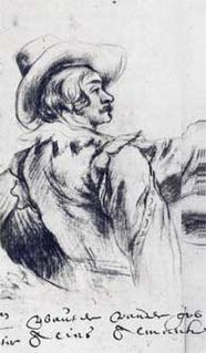
Wouter Pietersz. Crabeth II was a Dutch Golden Age painter.

The area around the town of Wageningen was settled as early as the 9th century. Located on the north bank of the Nederrijn river, between the Gelderse valley and the Veluwe, a wooded, hilly, glacial moraine, by the 12th century it was part of the Duchy of Guelders, in the Holy Roman Empire. Wageningen received its city charter from Count Otto II on June 12, 1263. Today, it is in the province of Gelderland, in east-central Netherlands.

Meterik is a village in the Dutch province of Limburg. It is located in the municipality of Horst aan de Maas, bordering rich farmland to the north and a moor called De Peel to the west. Meterik is located along a brook, the Kabroekse beek, which provides fertile grazing lands.
Ename is a Belgian village in the Flemish province of East Flanders. It stands on the right side of the river Scheldt and it is part of the municipality of Oudenaarde. The territory was inhabited during Prehistoric and Roman times, and became a trade settlement during the 10th century. From the 11th century it was part of the domain of the Benedictine abbey of Saint Salvator, until its 1795 dissolution in the aftermath of the French Revolution. The remains of the Saint Salvator abbey are today part of a major heritage project in Flanders, established by the Province of East-Flanders. The Provincial Archaeological Museum of Ename displays the major finds that have been excavated on the abbey site. Today the village of Ename hosts the Museumnacht in July and the Feeste t’ Ename with the traditional horse market that has been held for centuries during the celebrations of the patron hallow Saint Laurentius, on the 10th of August.
Schielands Hoge Zeedijk, formerly called Hoogendijk is a Dutch dike in the province of South Holland that stretches from the Schie at Schiedam to the Gouwe near Gouda. Constructed in the 13th century, the dike continues to protect an area inhabited by 3 million people from flooding by the North Sea.
Huizum is a residential area of the municipality of Leeuwarden in the province of Friesland, Netherlands. It has approximately 9,000 inhabitants. Huizum was formerly part of Leeuwarderadeel and incorporates a former village.
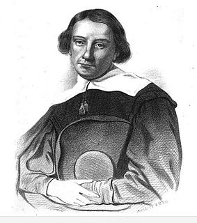
Passchier de Fijne was a Netherlands pastor and writer. He was one of the first pastors of the Remonstrant Brotherhood. Because of his forbidden preaching on the ice of the river Gouwe at Gouda he was also called "the kingfisher".
Herman Herbers was a Dutch pastor and theologian.