Related Research Articles

Crafton is a hamlet in the civil parish of Mentmore, in Buckinghamshire, England.

Handy Cross is a hamlet in the parish of Little Marlow, Buckinghamshire, England. It is located on Marlow Hill, on the old road between Marlow and High Wycombe. At the 2011 Census the population of the hamlet was included in the civil parish of Great Marlow. Today the hamlet consists of a farm, several households and a Harvester pub & restaurant.

Nash Lee is a hamlet in the parish of Wendover, in Buckinghamshire, England. It is located to the north of the village, about two miles west of Wendover.

Westlington is a hamlet near the village of Dinton in the civil parish of Dinton-with-Ford and Upton, Buckinghamshire, England.

Upton is a hamlet in the civil parish of Dinton-with-Ford and Upton, in Buckinghamshire, England. It is located to the north of the main village of Dinton, on the junction between the new road from Aylesbury to Thame, and the old road before it was rerouted.

Wormstone is a hamlet in the parish of Waddesdon, in Buckinghamshire, England. It is located just south-south east of the main village.

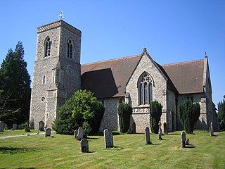
Waldridge is an ancient village in the civil parish of Dinton-with-Ford and Upton in Buckinghamshire, England. Although little of the original village survives today, the Waldridge Manor in the nearby village of Meadle shows the approximate location of the original settlement of Waldridge Village.

The Principal Triangulation of Britain was the first high-precision triangulation survey of the whole of Great Britain and Ireland, carried out between 1791 and 1853 under the auspices of the Board of Ordnance. The aim of the survey was to establish precise geographical coordinates of almost 300 significant landmarks which could be used as the fixed points of local topographic surveys from which maps could be drawn. In addition there was a purely scientific aim in providing precise data for geodetic calculations such as the determination of the length of meridian arcs and the figure of the Earth. Such a survey had been proposed by William Roy (1726–1790) on his completion of the Anglo-French Survey but it was only after his death that the Board of Ordnance initiated the trigonometric survey, motivated by military considerations in a time of a threatened French invasion. Most of the work was carried out under the direction of Isaac Dalby, William Mudge and Thomas Frederick Colby, but the final synthesis and report (1858) was the work of Alexander Ross Clarke. The survey stood the test of time for a century, until the Retriangulation of Great Britain between 1935 and 1962.

Hitchin and Harpenden was a constituency represented in the House of Commons of the UK Parliament from 1997 general election until 2024 general election. The seat was represented by the Conservative Party for the duration of its existence.
Lilley is a small village and civil parish situated between Hitchin and Luton in Hertfordshire, England. Lilley stands on high ground: nearby Telegraph Hill is just over 600 feet above sea level.

Ayot Green is a hamlet in Hertfordshire, England and is near the A1(M) Motorway, close to Welwyn Garden City. It is a typical traditional English village, centred on a village green. There are several other Ayots in the area, including Ayot St Lawrence and Ayot St Peter, and it also gives name to the rail trail called Ayot Greenway which stretches from Ayot Green to Wheathampstead.

Little Meadle is a hamlet in Buckinghamshire, England. It is part of the civil parish of Longwick-cum-Ilmer and is located between the hamlets of Owlswick and Meadle. It is approximately 5 miles (8.0 km) from Aylesbury and 20 miles (32 km) from Oxford. In addition to the Farm House it consists of a collection of houses built over the past 60 years, and it gained an official name with the Royal Mail in 2004, as well as being mapped with the Ordnance Survey 2006. The term Little Meadle is a relatively new one it has no historical meaning in itself, except that it is close to the village of Meadle and is a small hamlet that was previously known only by the name of the road in which it is situated Stockwell Lane.

The A105 road is an A road in London, England. It runs from Canonbury, in between Highbury and Dalston, to Enfield Town. The road is 8 miles (13 km) long. Part of the road forms Green Lanes, one of the longest streets in London, while the A105 also serves as the primary access route to the Shopping City shopping centre in Wood Green.

Hitchin is a parliamentary constituency in Hertfordshire and Bedfordshire which returned one Member of Parliament (MP) to the House of Commons of the Parliament of the United Kingdom from 1885 until it was abolished for the 1983 general election.
Winchbottom is a hamlet in the parish of Little Marlow, in Buckinghamshire, England.

Craigmarloch is a private residential area of the town of Cumbernauld in North Lanarkshire, Scotland. It was the last such area that the Cumbernauld Development Corporation (CDC) laid out and began to construct. The area is designed to be like a village, with features such as: a village green, a main street, focal points, gateways, water features and recreational and community facilities. The responsibility for the development of the area passed from the CDC to North Lanarkshire Council in 1996.

Darby Green is a village in the parish of Yateley, North East Hampshire, England. The electoral ward of Frogmore and Darby Green is separated from the rest of the parish by a small gap around Clarks Farm, until recently a composting farm in the mushroom producing industry. The ward has a boundary shared with Blackwater, which is one part of the Civil Parish of Hawley.

The Broxbourne Mill Stream which diverges from the River Lee Navigation just south of Dobbs Weir, is one of the few remaining 'old river' loops of the River Lea, with a relatively natural channel form and a diverse range of habitats. Broxbourne developed as a small settlement for milling at a river crossing point at Broxbourne Mill. Spital Brook empties into the Mill Stream by Nazeing New Road.

Oughtonhead Common is a 17.4 hectare Local Nature Reserve in the Westmill district of Hitchin, Hertfordshire. It is owned and managed by North Hertfordshire District Council. and home to the Oughtonhead Common nature reserve.

The River Oughton is a two mile long tributary of the River Hiz in Hitchin, Hertfordshire. It rises at Oughtonhead and flows north-east between Oughtonhead Common and Oughtonhead Nature Reserve. It forms the boundary of Hitchin parish.
References
- ↑ "Ordnance Survey Election Maps". www.ordnancesurvey.co.uk. Ordnance Survey. Retrieved 18 February 2016.
- ↑ Ordnance Survey: Landranger map sheet 166 Luton & Hertford (Hitchin & St Albans) (Map). Ordnance Survey. 2012. ISBN 9780319232095.
51°57′29″N0°17′20″W / 51.958°N 0.289°W
| | This Hertfordshire location article is a stub. You can help Wikipedia by expanding it. |