Pottersville is an unincorporated hamlet in Howell County, Missouri, United States. It is located approximately ten miles west of West Plains. Besides a few homes, only a post office and fire station are located there. The ZIP Code for Pottersville is 65790.
Hutton Valley is an unincorporated community in the township of the same name in northern Howell County, in the U.S. state of Missouri. The community is located approximately five miles east of Willow Springs on Missouri Route U, just south of U.S. Route 60.
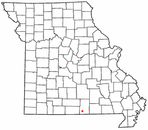
Arditta is an unincorporated community in southwest Howell County, in the Ozarks of southern Missouri. Arditta is located on U.S. Route 160 between Egypt Grove and Caulfield. It is approximately twelve miles southwest of West Plains.
Bly is an extinct town in southwest Howell County, in the Ozarks of southern Missouri. The location is on Bennetts Bayou, approximately 3.5 miles southeast of Caulfield.
Chapel is an unincorporated community in northeastern Howell County, in the U.S. state of Missouri. The community is located on county road 2680, east of Missouri Route W, and approximately four miles south-southeast of Mountain View. The Chapel Hill Church and historic school lie just west of Route W.
Chapin is an unincorporated community in Howell County, in the U.S. state of Missouri. The community was located along the St. Louis–San Francisco Railway on the north bank of Howell Creek, approximately four miles southeast of West Plains.
Crider is an unincorporated community in western Howell County, in the U.S. state of Missouri. Crider is approximately ten miles west of West Plains and about two miles northwest of Pottersville and is located on Missouri Route AD.
Cull is an unincorporated community in eastern Howell County, in the U.S. state of Missouri. The community is located on a county road south of U.S. Route 160 and is approximately nine miles east of West Plains, near the eastern border of the county. The community of Rover in Oregon County lies about two miles to the east.
Cureall is an unincorporated community in Howell County, in the U.S. state of Missouri.
Egypt Grove is an unincorporated community in southwest Howell County, in the U.S. state of Missouri. The community is located along US Route 160, east of Caulfield.
Frankville is an unincorporated community in southern Howell County, in the U.S. state of Missouri. The community is located at the intersection of U.S. Route 60 and county road 8660, approximately two miles southeast of West Plains.
Fruitville is an unincorporated community in southeast Howell County, in the U.S. state of Missouri.
Homeland is an unincorporated community in southwest Howell County, in the Ozarks of southern Missouri, United States. The community is located on U.S. Route 160, approximately four miles southwest of West Plains. Arrowhead Lakes on Spring Creek lie just to the southeast.
Horton is an unincorporated community in northwest Howell County, in the Ozarks of southern Missouri, United States. The community is located within the Mark Twain National Forest, west of Missouri Route AP and approximately one-half mile east of the Douglas - Howell county line. The Noblett Lake recreation area on Noblett Creek is just to the northwest in Douglas County.
Lebo is an unincorporated community in southern Howell County, in the U.S. state of Missouri. The community is located south of West Plains at the intersection of Missouri routes 142 and JJ, approximately one mile north of the Missouri - Arkansas state line.
Leota is an unincorporated community in southwestern Howell County, in the U.S. state of Missouri. The community is located on Missouri Route 142 and is approximately two miles north of the Missouri - Arkansas state line.
Sterling is an unincorporated community in northwest Howell County, in the U.S. state of Missouri. The community is located adjacent to the railroad just east of U.S. Route 63, approximately one mile south of the county line.
Trask is an unincorporated community in northern Howell County, in the U.S. state of Missouri. The community is located on Missouri Route V, approximately one mile south of U.S. Route 60 between Willow Springs and Mountain View.
Benton Township is an inactive township in Howell County, in the U.S. state of Missouri.
Mashek is an extinct town in Lincoln County, in the U.S. state of Missouri.