Hoddles Creek (tributary)

Last updated

Hoddles Creek is a creek near Melbourne in Victoria, Australia.

Melbourne City in Victoria, Australia

Melbourne is the capital and most populous city of the Australian state of Victoria, and the second most populous city in Australia and Oceania. Its name refers to an urban agglomeration of 2,080.5 km2 (803.3 sq mi), comprising a metropolitan area with 31 municipalities, and is also the common name for its city centre. The city occupies much of the coastline of Port Phillip bay and spreads into the hinterlands towards the Dandenong and Macedon ranges, Mornington Peninsula and Yarra Valley. It has a population of approximately 5 million, and its inhabitants are referred to as "Melburnians".

Australia Country in Oceania

Australia, officially the Commonwealth of Australia, is a sovereign country comprising the mainland of the Australian continent, the island of Tasmania, and numerous smaller islands. It is the largest country in Oceania and the world's sixth-largest country by total area. The neighbouring countries are Papua New Guinea, Indonesia, and East Timor to the north; the Solomon Islands and Vanuatu to the north-east; and New Zealand to the south-east. The population of 25 million is highly urbanised and heavily concentrated on the eastern seaboard. Australia's capital is Canberra, and its largest city is Sydney. The country's other major metropolitan areas are Melbourne, Brisbane, Perth, and Adelaide.

Contents

Geography

The Hoddles Creek is a tributary of the Yarra River. [1] It is located on the northwestern slopes of the Yarra Ranges. [2] Its source is at the southern side of Sale Hill. [2] It flows in a northwestern direction through the small towns of Hoddles Creek and Launching Place, until it reaches the Yarra River. [2] This includes farmland and native vegetation. [2]

Yarra River river in Victoria, Australia

The Yarra River or historically, the Yarra Yarra River, is a perennial river in east-central Victoria, Australia.

Hoddles Creek, Victoria Town in Victoria, Australia

Hoddles Creek is a bounded rural locality near Melbourne in Victoria, Australia. Its local government area is the Shire of Yarra Ranges. At the 2016 census, Hoddles Creek had a population of 627, compared to 609 at the 2011 census.

Launching Place, Victoria Town in Victoria, Australia

Launching Place is a town in Victoria, Australia, 54 km east of Melbourne's central business district. Its local government area is the Shire of Yarra Ranges. At the 2016 census, Launching Place had a population of 2,394.

Melbourne Water

By the Water Act 1989, it became part of the Upper Yarra Catchment for Melbourne Water, the water system of Melbourne. [3] In other words, some of its water is used for irrigation and drinking water in the city of Melbourne. Moreover, Melbourne Water monitors the flow of the stream at Launching Place, Victoria. [2]

Melbourne Water is a Victorian government owned statutory authority that controls much of the water system in Melbourne, Victoria, Australia, including the reservoirs, and the sewerage and drainage system that services the city.

Fishing

The creek may also be used recreationally to angle Brown trout. [1] [2] In a study conducted in 1997, it was home to six species of fish. [2] Since the advent of a fishway at Dights Falls, it has attracted more native fish species, like the Spotted galaxias and the Australian grayling. [2]

Brown trout Species of fish

The brown trout is a European species of salmonid fish that has been widely introduced into suitable environments globally. It includes both purely freshwater populations, referred to as the riverine ecotype, Salmo trutta morpha fario, and a lacustrine ecotype, S. trutta morpha lacustris, also called the lake trout, as well as anadromous forms known as the sea trout, S. trutta morpha trutta. The latter migrates to the oceans for much of its life and returns to fresh water only to spawn. Sea trout in Ireland and Britain have many regional names: sewin in Wales, finnock in Scotland, peal in the West Country, mort in North West England, and white trout in Ireland.

Dights Falls

Dights Falls is a rapids and weir on the Yarra River Melbourne, Victoria, just downstream of the junction with the Merri Creek. At this point the river narrows and is constricted between 800,000-year-old volcanic, basaltic lava flow and a much older steep, silurian, sedimentary spur. The north side also contains abundant graptolite fossils in sedimentary sandstone.

Spotted galaxias species of fish

Spotted galaxias is a largish, primarily-freshwater galaxias species found in southern Australia. Spotted galaxias are perhaps the most beautiful of the Australian galaxias species. They are a somewhat tubular, deep-bodied fish, with a dusky brownish-red colouration overlain with dark, haloed spots, dramatic black edges to dorsal, anal and pelvic fins, and a dark diagonal stripe through the eye.

Related Research Articles

Yarra Valley region surrounding the Yarra River in Victoria, Australia

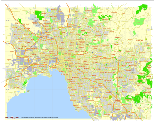
The Yarra Valley is the name given to the region surrounding the Yarra River in Victoria, Australia. The river originates approximately 90 kilometres east of the Melbourne central business district and flows towards it and out into Port Phillip Bay. The name Yarra Valley is used in reference to the upper regions surrounding the Yarra River and generally does not encompass the lower regions including the city and suburban areas, where the topography flattens out, or the upper reaches which are in inaccessible bushland. Included in the Yarra Valley is the sub-region of Upper Yarra which encompasses the towns of the former Shire of Upper Yarra in the catchment area upstream of and including Woori Yallock. The Yarra Valley is a popular day-trip and tourist area, featuring a range of natural features and agricultural produce, as well as the Lilydale to Warburton Rail Trail.

Yarra Ranges Shire Local government area in Victoria, Australia

The Shire of Yarra Ranges is a local government area in Victoria, Australia, located in the outer eastern and northeastern suburbs of Melbourne extending into the Yarra Valley and Dandenong Ranges. It has an area of 2,469.9 square kilometres (953.6 sq mi), and at the 2016 Australian census, it had a population of 149,537.

Maribyrnong River River in Victoria, Australia

The Maribyrnong River is a perennial river of the Port Phillip catchment, located in the north–western suburbs of Melbourne, in the Australian state of Victoria.

Warburton, Victoria Town in Victoria, Australia

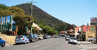
Warburton is a country town in Victoria, Australia, 72 kilometres east of Melbourne's central business district. Its local government area is the Shire of Yarra Ranges. At the 2016 census, Warburton had a population of 2,012 people.

Christmas Hills is a town in Victoria, Australia, 35 km north-east of Melbourne's Central Business District in the local government area of the Shire of Nillumbik. At the 2016 Census, Christmas Hills had a population of 355.

Merri Creek river in Victoria, Australia

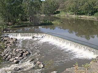
The Merri Creek is a waterway in southern parts of Victoria, Australia, which flows through the northern suburbs of Melbourne. It begins near Wallan north of Melbourne and flows south for 70 km until it joins the Yarra River at Dights Falls. The area where the creek meets the river was traditionally the location for large gatherings of the Wurundjeri people and is suspected to have been the location for one of the earliest land treaties in Australia between Indigenous Australians and European settlers.

Division of Casey Australian federal electoral division

The Division of Casey is an Australian electoral division in the state of Victoria. The division was created in 1969 and is named for Richard Casey, who was Governor-General of Australia 1965–69.

Moonee Ponds Creek river in Victoria, Australia

The Moonee Ponds Creek is a creek and major tributary of the Yarra River running through urban Melbourne, Victoria, Australia from northern to inner suburbs. In 2004 a reporter for the Age newspaper described it as "arguably the most abused tributary of the Yarra River, and part of the true underside of Melbourne".

Mullum Mullum Creek river in Victoria, Australia

Mullum Mullum Creek is a creek in the outer eastern suburbs of Melbourne, Victoria, Australia. It is the main watercourse of the Mullum Mullum Valley, a tributary of the Yarra River and Yarra Valley. For tens of thousands of years it was used as a food and tool source sustainably by the Wurundjeri people, Indigenous Australians of the Kulin nation, who spoke variations of the Woiwurrung language group.

Darebin Creek river in Australia

Darebin Creek is a creek that runs through the northern suburbs of Melbourne, Victoria, Australia. It is the main watercourse of the Darebin Valley and a major tributary of the Yarra River. For tens of thousands of years it was used as a food and tool source sustainably by the Wurundjeri people, Indigenous Australians of the Kulin nation alliance, who spoke variations of the Woiwurrung language group.

Koonung Creek river in Victoria, Australia

Koonung Creek is a small tributary of the Yarra River in Melbourne's east. The creek originates in Nunawading near Springvale Road, and flows to join the Yarra at the border between Ivanhoe East, Bulleen and Balwyn North. The place the two waterways meet forms the borders between these suburbs. Bushy Creek is a tributary to the creek, joining near Elgar Park in Mont Albert North. A shared use path follows the course of the creek, known as the Koonung Creek Trail.

Shire of Upper Yarra Local government area in Victoria, Australia

The Shire of Upper Yarra was a local government area centred on the upper reaches of the Yarra Valley, about 60 kilometres (37 mi) east of Melbourne, the state capital of Victoria, Australia, extending eastwards into Victoria's interior. The shire covered an area of 1,732 square kilometres (668.7 sq mi), and existed from 1888 until 1994.

Warrandyte State Park

Warrandyte State Park is a state park, located in Warrandyte, east of Melbourne, Victoria on the banks of the Yarra River and surroundings. The park comprises 586 hectares of remnant bushland in various locations throughout Warrandyte and Wonga Park around Pound Bend, Fourth Hill, Black Flat, Yarra Brae and various other locations in the area. It hosts many significant geographical, environmental, archaeological and historical sites, such as the site of the first gold discovery in Victoria in 1851 and preserves the sites of former gold mines and tunnels. It is a popular destination for school and community groups and is frequented by local bush walkers and hikers.

Andersons Creek river

Andersons Creek is a creek in Warrandyte and Park Orchards, east of Melbourne, Victoria, Australia. It is a tributary of the Yarra River. For tens of thousands of years it was used as a food and tool source sustainably by the Wurundjeri people, Indigenous Australians of the Kulin nation, who spoke variations of the Woiwurrung language group.

OShannassy Reservoir lake in Australia

The O'Shannassy Reservoir is an Australian man-made water supply dammed reservoir. The 3.1-gigalitre water store across the O'Shannassy River is located near the locality of McMahons Creek, approximately 80 kilometres (50 mi) east of Melbourne, Victoria. The dam that creates the impoundment is called the O'Shannassy Dam.

OShannassy River river in Australia

The O'Shannassy River is a perennial river of the Port Phillip catchment, located in the north-eastern Greater Metropolitan Melbourne region of the Australian state of Victoria.

Little Yarra River river in Victoria, Australia

The Little Yarra River is a perennial river of the Port Phillip catchment, located in the Greater Metropolitan Melbourne region of the Australian state of Victoria.

Watts River river

The Watts River is a perennial river of the Port Phillip and Western Port catchment, located near Healesville, in the Central Victoria region of the Australian state of Victoria.

References

Coordinates: 37°46′16″S145°34′12″E / 37.7711°S 145.5701°E / -37.7711; 145.5701

Geographic coordinate system Coordinate system

A geographic coordinate system is a coordinate system that enables every location on Earth to be specified by a set of numbers, letters or symbols. The coordinates are often chosen such that one of the numbers represents a vertical position and two or three of the numbers represent a horizontal position; alternatively, a geographic position may be expressed in a combined three-dimensional Cartesian vector. A common choice of coordinates is latitude, longitude and elevation. To specify a location on a plane requires a map projection.