
Clay County is a county located in the U.S. state of Texas. As of the 2010 census, its population was 10,752. The county seat is Henrietta. The county was founded in 1857 and later organized in 1860. It is named in honor of Henry Clay, famous American statesman, Kentucky Senator and United States Secretary of State.

Wichita County is a county located in the U.S. state of Texas. As of the 2010 census, its population was 131,500. The county seat is Wichita Falls. The county was created in 1858 and organized in 1882. Wichita County is part of the Wichita Falls, Texas, TX Metropolitan Statistical Area.

Archer County is a county located in the U.S. state of Texas. As of the 2010 census, its population was 9,054. Its county seat is Archer City.

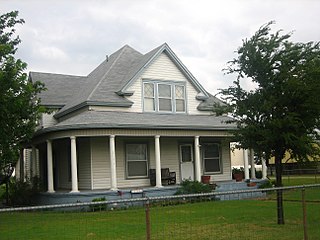
Archer City is a city in and the county seat of Archer County, Texas, United States. The city lies at the junction of State Highway 79 and State Highway 25. It is located 25 miles (40 km) south of Wichita Falls, and is part of the Wichita Falls metropolitan statistical area. Its population was 1,834 at the 2010 census.

Holliday is a city in Archer County, Texas, United States. It is part of the Wichita Falls, Texas Metropolitan Statistical Area. The population was 1,758 at the 2010 census. The town is named for nearby Holliday Creek, named in turn for John Holliday, a member of a Republic of Texas military expedition.

Lakeside City is a town in Archer County, Texas, United States. It is part of the Wichita Falls, Texas Metropolitan Statistical Area. The population was 997 at the 2010 census.
Henrietta is a city in and the county seat of Clay County, Texas, United States. It is part of the Wichita Falls metropolitan statistical area. The population was 3,141 at the 2010 census, a decline of 123 from the 2000 tabulation of 3,264.

Jacksboro is a city in Jack County, Texas, in the United States. Its population was 4,511 at the 2010 census. U.S. Highways 281 and 380 intersect at Jacksboro, which is the county seat of Jack County.

Wichita Falls is a city in and the county seat of Wichita County, Texas, United States. It is the principal city of the Wichita Falls Metropolitan Statistical Area, which encompasses all of Archer, Clay, and Wichita counties. According to the 2010 census, it had a population of 104,553, making it the 38th-most populous city in Texas. In addition, its central business district is 5 miles (8 km) from Sheppard Air Force Base, which is home to the Air Force's largest technical training wing and the Euro-NATO Joint Jet Pilot Training program, the world's only multinationally staffed and managed flying training program chartered to produce combat pilots for both USAF and NATO.
Scotland is a city in Archer County in the U.S. state of Texas. It is part of the Wichita Falls, Texas Metropolitan Statistical Area. The population was 501 at the 2010 census. The town is named for its founder, Henry J. Scott.

The Snoqualmie River is a 45-mile (72 km) long river in King County and Snohomish County in the U.S. state of Washington. The river's three main tributaries are the North, Middle, and South Forks, which drain the west side of the Cascade Mountains near the town of North Bend and join near the town of Snoqualmie just above the Snoqualmie Falls. After the falls the river flows north through rich farmland and the towns of Fall City, Carnation, and Duvall before meeting the Skykomish River to form the Snohomish River near Monroe. The Snohomish River empties into Puget Sound at Everett. Other tributaries of the Snoqualmie River include the Taylor River and the Pratt River, both of which enter the Middle Fork, the Tolt River, which joins at Carnation, and the Raging River at Fall City.

The Trinity River is a 710 mile long river in Texas, and is the longest river with a watershed entirely within the U.S. state of Texas. It rises in extreme northern Texas, a few miles south of the Red River. The headwaters are separated by the high bluffs on the southern side of the Red River.
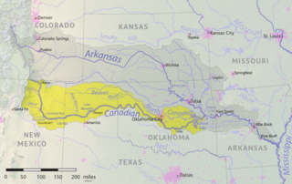
The Beaver River is an intermittent river, 280 miles (450 km) long, in western Oklahoma and northern Texas in the United States. It is a tributary of the North Canadian River, draining an area of 11,690 square miles (30,300 km2) in a watershed that extends to northeastern New Mexico and includes most of the Oklahoma Panhandle.
Anarene is a ghost town in Archer County, Texas, United States. Its name was used for the town portrayed in the film adaptation of Larry McMurtry's novel, The Last Picture Show.

Huff is a ghost town in northeastern Archer County, Texas, United States. It is part of the Wichita Falls, Texas Metropolitan Statistical Area.

The Wichita River, part of the Red River watershed, lies in north-central Texas. Rising in northeastern Knox County at the confluence of its North and South Forks, the river flows 90 miles (140 km) northeast across Baylor, Archer, Wichita, and Clay counties before joining the Red River just west of Byers Bend in northern Clay County.

Temescal Creek is an approximately 29-mile-long (47 km) watercourse in Riverside County, in the U.S. state of California. Flowing primarily in a northwestern direction, it connects Lake Elsinore with the Santa Ana River. It drains the eastern slopes of the Santa Ana Mountains on its left and on its right the western slopes of the Temescal Mountains along its length. With a drainage basin of about 1,000 square miles (2,600 km2), it is the largest tributary of the Santa Ana River, hydrologically connecting the 720-square-mile (1,900 km2) San Jacinto River and Lake Elsinore watersheds to the rest of the Santa Ana watershed. However, flowing through an arid rain shadow zone of the Santa Ana Mountains, and with diversion of ground water for human use, the creek today is ephemeral for most of its length, except for runoff from housing developments and agricultural return flows.
The exposed strata at the surface in and around Wichita Falls are the products of one ancient period of deposition with a modest amount of recent and modern alteration. In all cases, the strata are products of terrigenous (non-marine) environments dominated by fluvial depositional and erosional systems.
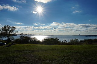
Lake Wichita was a large man-made lake of 2,200-acre (890 ha) acres located some three miles southwest of Wichita Falls, Texas. Its creation was primarily the work of the business entrepreneur Joseph A. Kemp, who with his brother-in-law Frank Kell, is considered one of the principal founders of Wichita Falls in the early 20th century. In 1995, the dam and spillway were rebuilt lowering conservation elevation to 976', decreasing surface acreage to 1224 acres at full pool, and leaving an average depth of four feet.

Kickapoo Lake is a reservoir in the U.S. state of Mississippi. Lake Kickapoo is an artificial lake twelve miles northwest of Archer City in west central Archer County. The waters of the North Fork of the Little Wichita River were impounded in 1945 to form the reservoir, which has a capacity of 106,000 acre-feet and covers 6,200 acres. The lake serves as a municipal water supply for Wichita Falls, thirty-two miles to the northeast. It was named for the Kickapoo Indians and for Kickapoo Creek, which empties into the reservoir. Lake Kickapoo has a drainage area of 275 square miles. The 3,000 acres of shoreline are owned by Wichita Falls. Since construction of the lake, various recreational spots have been developed, including picnic areas on Long and Council islands, which lie in the southern portion of the lake.