Hollihaka

Last updated
Hollihaka
District of Oulu
Montage Hollihaka Oulu.jpg
Coordinates: 65°00′22″N025°27′15″E / 65.00611°N 25.45417°E / 65.00611; 25.45417 Coordinates: 65°00′22″N025°27′15″E / 65.00611°N 25.45417°E / 65.00611; 25.45417
Country Finland
City Oulu
Areas of Oulu City Centre
Population (2013) [1]
  Total 2,447
Postal code 90120

Hollihaka is a district of the city centre area of Oulu, Finland. It is bounded by the estuary of the Oulujoki river to the west, the Vanhatulli district to the north, the Leveri district to the east and the Nuottasaari district to the south. [2] Together with the two latter districts, Hollihaka forms a neighbourhood called Heinäpää.

Oulu City in North Ostrobothnia, Finland

Oulu is a city and municipality of 203,750 inhabitants in the region of North Ostrobothnia, Finland. It is the most populous city in Northern Finland and the fifth most populous city in the country. There are no larger cities in the world, apart from Murmansk Russia, that are more northerly than Oulu. It is also considered one of Europe's "living labs", where residents experiment with new technology at a community-wide scale.

Finland Republic in Northern Europe

Finland, officially the Republic of Finland is a country in Northern Europe bordering the Baltic Sea, Gulf of Bothnia, and Gulf of Finland, between Norway to the north, Sweden to the northwest, and Russia to the east. Finland is a Nordic country and is situated in the geographical region of Fennoscandia. The capital and largest city is Helsinki. Other major cities are Espoo, Vantaa, Tampere, Oulu and Turku.

Oulujoki river of Finland

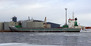
Oulujoki, Swedish: Ule älv (in modern Finnish literally "Oulu River", originally in old Northern Ostrobothnian dialect literally "Flood River", is a river in Oulu province, Finland. Its origin is Oulujärvi and its watershed area covers a significant part of Kainuu region. It flows into the Bothnian Bay at Oulu. Port of Oulu is located at the mouth of the river.

Hollihaka is mainly residential area. There are a few noteworthy parks in the district: a large waterside park Hollihaka Park, a small city park Heinätorinpuisto Park and the park bordering the Puistokatu street Kyösti Kallio Park. The Holy Trinity Cathedral of the Oulu Diocese of the Orthodox Church of Finland is located in Hollihaka.

Heinätorinpuisto Park park in Oulu, Finland

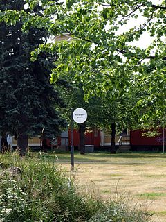
Heinätorinpuisto Park is a public park in the Hollihaka district of Oulu, Finland.

Finnish Orthodox Church

The Finnish Orthodox Church, or Orthodox Church of Finland, is an autonomous Eastern Orthodox archdiocese of the Ecumenical Patriarchate of Constantinople. The Church has a legal position as a national church in the country, along with the Evangelical Lutheran Church of Finland.

Related Research Articles

Oulu University Hospital Hospital in Oulu, FI

Oulu University Hospital is a university hospital in Oulu, Finland. It is the northernmost of the five university hospitals in Finland.

Tuira, Oulu District of Oulu in Finland

Tuira is a neighbourhood of the city of Oulu, Finland. It is located north of city centre across the Oulujoki River. After the first bridges over Oulujoki connecting Tuira with Oulu were built in 1869, population growth of Tuira accelerated and Tuira was annexed by city of Oulu from the neighbouring rural municipality in 1886. Until the 1970s Tuira was a neighbourhood of wooden townhouses, but the new zoning plan of 1969 changed it to a suburb of residential tower blocks.

Pikisaari, Oulu District of Oulu in Finland

Pikisaari is a neighbourhood of the city of Oulu, Finland. The neighbourhood consists of Pikisaari and Korkeasaari islands connected due to the post-glacial rebound. Pikisaari is located near the city centre in the estuary of Oulujoki River in between market square and Hietasaari island.

Myllytulli District of Oulu in Finland

Myllytulli is a neighbourhood of the city centre area of Oulu, Finland.

Intiö District of Oulu in Finland

Intiö is a neighbourhood of the city centre area of Oulu, Finland. It is located on the southern bank of the Oulu River in between Myllytulli and Värttö neighbourhoods.

Oulu Museum of Art Art museum in Myllytulli, Oulu

The Oulu Museum of Art (OMA) is an art museum in the Myllytulli neighbourhood in Oulu. It is located on the edge of the Hupisaaret Islands park.

Raksila District of Oulu in Finland

Raksila is a neighbourhood of the city centre area of Oulu, Finland. It is bounded by the Oulu railway station to the west, the Oulu Cemetery in the Intiö neighbourhood to the north, the Finnish national road 4 to the east and the Finnish national road 22 to the south.

Linnanmaa District of Oulu in Finland

Linnanmaa is a neighbourhood of the Kaijonharju area of Oulu, Finland. The neighbourhood is located about five kilometers north of the city centre.

Toppilansaari District of Oulu in Finland

Toppilansaari is a neighbourhood in the Tuira area in the city of Oulu, Finland. It is located on the south side of the Toppilansalmi strait. Toppilansaari was separated from the Hietasaari district while it was rezoned to residential development in the early 2000s. The westernmost part of the neighbourhood was the location for the Finnish Housing Fair in 2005. The Möljä Bridge over the Toppilansalmi strait connects Toppilansaari with the Toppila neighbourhood. The bridge was completed in 2012.

Hietasaari, Oulu District of Oulu in Finland

Hietasaari is a neighbourhood in the Tuira area in the city of Oulu, Finland. The neighbourhood consists of Mustasaari and Hietasaari islands, separated by the Mustasalmi strait, together with some smaller islands. Hietasaari is zoned as recreation area with only few people living in the neighbourhood permanently.

Pokkinen District of Oulu in Finland

Pokkinen is a district of the city centre area of Oulu, Finland. Together with districts of Vaara and Vanhatulli, Pokkinen forms the central business district of Oulu. It is bounded by the estuary of the Oulujoki river to the west, the Koskikeskus and Myllytulli districts to the north, the Vaara district to the east and the Vanhatulli district to the south.

Vanhatulli District of Oulu in Finland

Vanhatulli is a district of the city centre area of Oulu, Finland. Together with the districts of Pokkinen and Vaara, Vanhatulli forms the central business district of Oulu. It is bounded by the estuary of the Oulujoki river to the west, the Pokkinen and Vaara districts to the north, the Leveri and Hollihaka districts to the south and the railway to the east.

Välivainio District of Oulu in Finland

Välivainio is a neighbourhood in the Puolivälinkangas area in the city of Oulu, Finland. It is located about 2 km north of the city centre. It is bordered by National road 4 in the north and east, National road 20 in the south and National road 8156 in the west.

Vihreäsaari District of Oulu in Finland

Vihreäsaari is an uninhabited island and a neighbourhood in the Tuira area in the city of Oulu, Finland. It is separated from the Hietasaari island by the Johteensalmi strait.

Vaara District of Oulu in Finland

Vaara is a district of the city centre area of Oulu, Finland. Together with the districts of Pokkinen and Vanhatulli, Vaara forms the central business district of Oulu. It is bounded by the districts of Raksila to the east, Pokkinen to the west, Myllytulli to the north and Vanhatulli to the south.

Toppila District of Oulu in Finland

Toppila is a district of Oulu, Finland. It is bounded by the Toppilansalmi strait in the south and west, railway in the east and the Taskila district in the north. The Möljä Bridge over the Toppilansalmi strait connects Toppila with the Toppilansaari district.

Kontinkangas District of Oulu in Finland

Kontinkangas is a district of Oulu, Finland. It is located to the east of the National road 4 and to the north of the National road 22 about two kilometers from the city centre. Its neighbouring districts are Kaukovainio, Raksila, Peltola and Oulunsuu.

Karjasilta District of Oulu in Finland

Karjasilta is a district in the Höyhtyä area in the city of Oulu, Finland. The district close to the city centre is bordered by the Raksila district to the north, Finnish national road 4 to the east, the Vanhatulli and Limingantulli districts to the west and the Nokela and Höyhtyä districts to the south.

Holy Trinity Cathedral, Oulu Church in Oulu, Finland

Holy Trinity Cathedral, Oulu, is an Eastern Orthodox cathedral in Oulu, Finland. The church is located in the Hollihaka district about one kilometre south of the city centre.

References

  1. "Oulun kaupungin ikäluokkatilasto kaupunginosittain 1.1.2013" (pdf). City of Oulu. 2013. Retrieved June 23, 2013.
  2. Oulun suuralue- ja kaupunginosajako 1.1.2013 alkaen [Subdivisions of the City of Oulu on Jan 1, 2013](pdf) (Map). City of Oulu. 2013. Retrieved 2013-08-07.