Related Research Articles
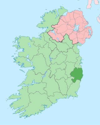
County Wicklow is a county in Ireland. The last of the traditional 32 counties, having been formed as late as 1606, it is part of the Eastern and Midland Region and the province of Leinster. It is bordered by the Irish Sea to the east and the counties of Wexford to the south, Carlow to the southwest, Kildare to the west, and South Dublin and Dún Laoghaire–Rathdown to the north.

Glendalough is a glacial valley in County Wicklow, Ireland, renowned for an Early Medieval monastic settlement founded in the 6th century by St Kevin. From 1825 to 1957, the head of the Glendalough Valley was the site of a galena lead mine. Glendalough is also a recreational area for picnics, for walking along networks of maintained trails of varying difficulty, and also for rock climbing.

The Wicklow Mountains form the largest continuous upland area in Ireland. They occupy the whole centre of County Wicklow and stretch outside its borders into the counties of Dublin, Wexford and Carlow. Where the mountains extend into County Dublin, they are known locally as the Dublin Mountains. The highest peak is Lugnaquilla at 925 metres.

The Wicklow Way is a 131-kilometre (81-mile) long-distance trail that crosses the Wicklow Mountains in Ireland. It runs from Marlay Park in the southern suburbs of Dublin through County Wicklow and ends in the village of Clonegal in County Carlow. It is designated as a National Waymarked Trail by the Irish Sports Council and is waymarked by posts with a yellow "walking man" symbol and a directional arrow. Typically completed in 5–7 days, it is one of the busiest of Ireland's National Waymarked Trails, with up to 24,000 people a year walking the most popular sections. The Way is also used regularly by a number of mountain running competitions.

Kevin is an Irish saint, known as the founder and first abbot of Glendalough in County Wicklow, Ireland. His feast day is 3 June.
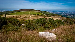
Kilmashogue or Kilmashoge is a mountain in Dún Laoghaire–Rathdown county in Ireland. It is 408 metres high and forms part of the group of hills in the Dublin Mountains which comprises Two Rock, Three Rock, Kilmashogue and Tibradden Mountains. The forest plantation on its northern slope, which is composed mainly of Sitka spruce, Scots pine and beech, is a habitat for Sika deer, hares, rabbits and foxes. A number of prehistoric monuments can be found on the slopes of the mountain.

Historically, a turf maze is a labyrinth made by cutting a convoluted path into a level area of short grass, turf or lawn. Some had names such as Mizmaze, Troy Town, The Walls of Troy, Julian's Bower, or Shepherd's Race. This is the type of maze referred to by William Shakespeare in A Midsummer Night's Dream when Titania says:

Glenmalure is a 20-kilometre long U-shaped glacial valley in the Wicklow Mountains in Ireland. Glenmalure is an important base for climbing in the Wicklow mountains, and particularly accessing the massif of Lugnaquilla, and contains one of the earliest An Óige youth hostels in Ireland. Glenmalure was also an important historical area and the site of the Battle of Glenmalure in 1580, as well as various events in the Irish Rebellion of 1798.

Dunlavin is a village in County Wicklow, Ireland, situated about 50 kilometres (30 mi) south-west of Dublin. It is centred on the junction of the R412 and R756 regional roads. It was founded around the end of the 17th century and became a prominent town in the area for a time. The village is in a civil parish of the same name.
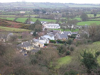
Hollywood is a village in west County Wicklow, Ireland. It is 15 km (9 mi) south of Naas on the Wicklow Gap road near its junction with the N81 road. It is known for its pre-1950s themed fair which takes place in August of every year. A population of less than 100 people registered in the 2002 Census, though the community draws from a larger area which consists of about 500 people. The village is in a civil parish of the same name.

The R756 road is a regional road in Ireland running west–east from Dunlavin to Laragh. Its entire 32 km (20 mi) length is within County Wicklow crossing east–west through the Wicklow Gap.

Camaderry at 699 metres (2,293 ft), is the 90th-highest peak in Ireland on the Arderin scale, and the 112th-highest peak on the Vandeleur-Lynam scale. Camaderry is situated in the southern sector of the Wicklow Mountains range, and forms a broad horseshoe around the valley of Glendalough with the hydroelectric station at Turlough Hill 681 metres (2,234 ft), and the mountains of Conavalla 734 metres (2,408 ft), and Lugduff 652 metres (2,139 ft). Camaderry has a subsidiary summit, Camaderry South East Top 677 metres (2,221 ft), and both lie across the deep Wicklow Gap from Tonelagee 817 metres (2,680 ft), which sits on the "central spine" of the Wicklow range.

Tibradden Mountain is a mountain in County Dublin in the Republic of Ireland. Other former names for the mountain include "Garrycastle" and "Kilmainham Begg". It is 467 metres high and is the 561st-highest mountain in Ireland. It forms part of the group of hills in the Dublin Mountains which comprises Two Rock, Three Rock, Kilmashogue and Tibradden Mountains. The views from the summit encompass Dublin to the north, Two Rock to the east and the Wicklow Mountains to the south and west.

A bullaun is the term used for the depression in a stone which is often water filled. Natural rounded boulders or pebbles may sit in the bullaun. The size of the bullaun is highly variable and these hemispherical cups hollowed out of a rock may come as singles or multiples with the same rock.
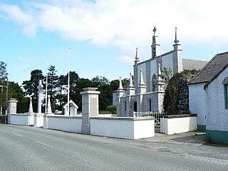
Valleymount is a small village in western County Wicklow, Ireland. The name 'Valleymount' does not appear before 1839. Previously, the village was known as 'the Cross of Ballymore' or simply 'the Cross', with 'cross' referring to land belonging to the church.

Carrickgollogan is a hill in Dún Laoghaire–Rathdown in Ireland, towards the southern border of the traditional County Dublin. It is 276 metres high, on the eastern edge of the Dublin Mountains, rising above the districts of Rathmichael and Shankill. Its summit is noted for the panoramic views it offers of south Dublin and north Wicklow.
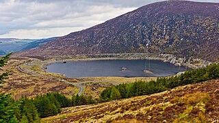
The Turlough Hill Power Station is a pumped storage power station in Ireland, owned and operated by the Electricity Supply Board (ESB).

The Piper's Stones or the Athgreany stone circle is a Bronze Age stone circle at Athgreany, County Wicklow. It sits on a low hillock overlooking the N81, 2 km south of Hollywood.

Glendalough Upper Lake is a glacial lake near Glendalough, County Wicklow, Ireland.
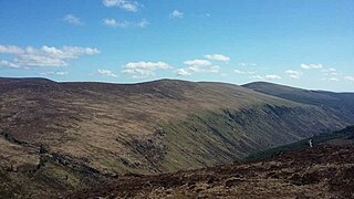
Lugduff at 652 metres (2,139 ft), is the 154th–highest peak in Ireland on the Arderin scale, and the 186th–highest peak on the Vandeleur-Lynam scale. Lugduff is situated in the southern sector of the Wicklow Mountains range, and forms a broad horseshoe around the Upper Lake of the Glendalough valley with the mountains of Mullacor 661 metres (2,169 ft), Conavalla 734 metres (2,408 ft), the hydroelectric station at Turlough Hill 681 metres (2,234 ft), and Camaderry 699 metres (2,293 ft).
References
- 1 2 "The Hollywood Stone". Megalithic Monuments of Ireland. Retrieved 4 October 2021.
- ↑ "Hollywood Stone (WI023-009063)". Wicklow Rock Art Project. Retrieved 4 October 2021.
- ↑ Saward, Jeff. "The Labyrinth in Ireland" (PDF). Labyrinthos. p. 2. Retrieved 7 November 2021.
- ↑ "Welcome return of the Hollywood Stone". Independent.ie. 22 December 2005. Retrieved 19 February 2022.