Holmes Run Trail

Last updated
Holmes Run Trail
Length5 miles (8.0 km)
Location Alexandria, Virginia and Fairfax County, Virginia
Trailheads Cameron Run Regional Park, Lake Barcroft, Roundtree Park
Usecycling, pedestrians
Cycling details
Surface asphalt and stonedust
Holmes Run Trail Map
HolmesRunTrail.jpg
Map of the southern section of the Holmes Run Trail

The Holmes Run Trail is a partially paved trail that travels through parks northwest along Holmes Run from Cameron Run in Alexandria, Virginia to Annandale Road (Virginia State Route 649) in Fairfax County, Virginia. The trail travels near the sides of the stream with multiple bridges, some of which are only about a foot higher than the water. The trail consists of two sections that are separated by Lake Barcroft near Columbia Pike (Virginia State Route 244) in Fairfax County.

Contents

The Alexandria portion of the trail is 2.6 miles (4.2 km) in length and travels northwest in Alexandria from Eisenhower Avenue at Cameron Run, next to Cameron Run Regional Park, to the Alexandria/Fairfax County boundary near the end of North Chambliss Street. The Fairfax County portion of the trail travels northwest between that boundary and Columbia Pike and is 1.2 miles (1.9 km) in length. A bridge over the Run in Alexandria that is located a short distance southeast of the boundary and Fairfax County's Glen Hills Park connects these two portions of the trail, which together comprise the trail's entire 3.8-mile-long (6.1 km) southern section. The northern section of the trail is 1.2 miles (1.9 km) in length and located entirely in Fairfax County. It has an asphalt surface in some places and a stonedust surface in others. [1]

History

The Holmes Run Trail was first envisioned as a trail along the Holmes Run stream valley in the 1970s as part of the Cameron Run Valley flood control project that built Cameron Run Regional Park. [2] The first 1.5 miles of the trail were built, from Cameron Run to the west end of Dora Kelly Nature Park as part of the Cameron Run project in the early 1980s. [3] Fairfax County began work in 2006 to extend the trail 1.5 miles in Fairfax County from Glen Hills Park to Columbia Pike. That work was completed in 2007, but the two sections didn't connect as they were separated by Holmes Run. [4] In 2012, Alexandria built a trail underpass below Eisenhower Avenue to connect Holmes Run to the Eisenhower Avenue Trail. [5] In 2013 Alexandria built a low water crossing from Glen Hills Park to Dora Kelly Nature Park in the area of Chambliss Street, connecting the two southern sections of the trail. [6] In November 2018, a trail bridge across Holmes Run was built by Alexandria to replace a low water crossing at N. Ripley Street. [7]

The trail section west of Lake Barcroft in Fairfax County was built prior to 2001. [8]

Trail route

Map all coordinatesin "Holmes Run Trail" using: OpenStreetMap  
Download coordinates as: KML  ·  GPX

The paved 3.8-mile-long (6.1 km) southern section of the Holmes Run Trail begins near Cameron Run Regional Park and the Great Waves Waterpark in southwestern Alexandria. [9] [10] [11] The trail connects near its beginning to the west end of the Eisenhower Avenue Trail, which travels east between Eisenhower Avenue and the north side of Cameron Run to the Hoffman Town Center and the Eisenhower Avenue station on Washington Metro's Blue Line. [9] [10] [12]

An underpass beneath Eisenhower Avenue connects the Eisenhower Avenue and Holmes Run Trails. [9] [12] The Holmes Run Trail begins by traveling northwest from Eisenhower Avenue along the northeast side of Cameron Run, passing under the Blue Line and three railroad bridges that are separated by sections of Cameron Run Regional Park. [9] [13] [14] The trail then enters the easternmost portion of Ben Brenman Park, where it passes the origin of Cameron Run at the confluence of Holmes Run and Backlick Run. [9] [10]

The trail then travels northwest on the east side of Holmes Run within Ben Brenman Park, where it connects to a paved trail that crosses the Run. [9] [15] That trail travels west near the north side of Backlick Run through Ben Brenman Park and Cameron Station Linear Park to reach Armistead Boothe Park, which is adjacent to the Samuel W. Tucker Elementary School. [9] [10]

After leaving its intersection with the Backlick Run trail, the Holmes Run Trail continues to travel northwest in Alexandria on the east side of the Run and passes under Duke Street. [9] [16] The trail then travels through Holmes Run Park, passing the Charles Beatley Bridge, which crosses the Run to connect the trail with North Pickett Street and Holmes Run Parkway. [9] [17]

The trail continues northwest through Brookvalley Park, where it crosses the Run to the stream's west side. [9] [18] The trail then travels next to the Run under North Van Dorn Street and the Henry G. Shirley Memorial Highway (Interstate 395). [9] [19] The trail then crosses North Beauregard Street and returns to the east side of the Run. [9] [20] [21]

The trail then continues northwest through several wooded sections on the east side of the Run in Dora Kelley Nature Park until it reaches North Chambliss Street, where a bridge carries the trail over the Run to its west side. [9] [22] Shortly thereafter, the trail enters Fairfax County and travels through Glen Hills Park on the Run's west side. [9] [10] [23]

After leaving Glen Hills Park, the southern section of the trail continues northwest on the west side of the Run, passing to the east of the Parklawn Pool. [23] [24] [25] The trail then crosses the Run five times in Holmes Run Stream Valley Park and Lillian Carey Park before it reaches its end on the east side of the Run. There the trail connects to the Columbia Pike Trail. [10] [23] [26] The trail section meets at its terminus a trail that travels along the southeast side of Columbia Pike. [10] [23] [27]

Separated by Lake Barcroft from the longer southern section of the trail, the trail's 1.2-mile-long (1.9 km) northern section begins at the southeast side of a cul-de-sac at the north end of Sprucedale Drive, west of Sleepy Hollow Road (Virginia State Route 613) and south of Holmes Run. [10] [28] The trail initially travels east and then turns to travel north, crossing Holmes Run on a bridge to reach the Run's north side. [29] The trail then travels northwest on the north side of the Run through Holmes Run Stream Valley Park. [10] [23] [30] The trail terminates at the south end of Hockett Street, which travels north and connects the trail to the nearby Annandale Road (Virginia State Route 649). [10] [23] [31] While portions of the northern section are paved, that section has a stone dust surface along most of its length. [10]

Flooding

Users of the trail need to know the weather conditions before entering the trail. Holmes Run is part of the Cameron Run/Holmes Run Watershed, [32] and is used to help channel flood waters toward Cameron Run and the Potomac River. Because the trail travels near the level of the water, during and after rainstorms various parts may be submerged, especially on the section of trail that goes underneath Interstate 395. [9]

Related Research Articles

Virginia State Route 236 state highway in Virginia, United States

State Route 236 is a primary state highway in the U.S. state of Virginia. The state highway runs 15.63 miles (25.15 km) from U.S. Route 29 and US 50 in Fairfax east to SR 400 in Alexandria. SR 236 is a major suburban arterial highway that connects the independent cities of Fairfax and Alexandria via Annandale in Fairfax County. The state highway is known as Main Street in City of Fairfax, Little River Turnpike in Fairfax County, where the highway meets Interstate 495 (I-495), and Duke Street in Alexandria, where the road has junctions with I-395 and US 1.

Washington & Old Dominion Railroad Regional Park

The Washington & Old Dominion Railroad Regional Park is a linear regional park in Northern Virginia. The park's primary feature is the Washington & Old Dominion Railroad Trail, an asphalt-surfaced paved rail trail that runs through densely populated urban and suburban communities as well as through rural areas. Most of the trail travels on top of the rail bed of the former Washington and Old Dominion Railroad, which closed in 1968.

Mount Vernon Trail

The Mount Vernon Trail (MVT) is a 17 miles (27 km) long shared use path that travels along the George Washington Memorial Parkway in Northern Virginia between Rosslyn and George Washington's home at Mount Vernon. The trail connects the easternmost portions of Arlington County, the City of Alexandria, and Fairfax County, and travels mostly on dedicated trail with a small portion on city streets. As part of U.S. Bike Route 1, the MVT opened in April 1972 as a gravel path and was subsequently expanded and paved.

Four Mile Run stream in Virginia

Four Mile Run is a 9.4-mile-long (15.1 km) stream in Northern Virginia that starts near Interstate 66, at Gordon Avenue in Fairfax County and proceeds southeast through Falls Church to Arlington County in the U.S. state of Virginia. Most of the stretch is parkland and is paralleled by two paved non-motorized transport and recreational trails, the Washington & Old Dominion Railroad Trail and the Four Mile Run Trail.

Custis Trail

The Custis Trail is a hilly 4.5 miles (7.2 km)-long shared use path in Arlington County, Virginia. The asphalt-paved trail travels along Interstate 66 (I-66) between Rosslyn and the Washington & Old Dominion Railroad Trail at Bon Air Park.

Pimmit Run river in the United States of America

Pimmit Run is a 7.8-mile-long (12.6 km) stream in northern Virginia that runs from Fairfax County to the Potomac River at Chain Bridge in the Arlingwood neighborhood of Arlington.

Northern Virginia trolleys

The earliest electric railway, or streetcar line, in Northern Virginia opened in 1892. At their peak, when merged into a single interurban system, the successors of this and several other lines ran between downtown Washington, D.C., Rosslyn and Arlington Junction – in present-day Crystal City – and out to Mount Vernon, Fairfax City and Nauck.

Schuylkill River Trail Philadelphia mixed-use trail

The Schuylkill River Trail is a multi-use trail along the banks of the Schuylkill River in southeastern Pennsylvania. Partially complete as of 2018, the trail is ultimately planned to run about 140 miles (230 km) from the river's headwaters in Schuylkill County to Fort Mifflin in Philadelphia.

Difficult Run stream in Virginia, United States of America

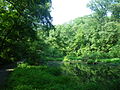
Difficult Run is a 15.9-mile-long (25.6 km) tributary stream of the Potomac River in Northern Virginia in the United States. The area has had many historical uses dating back to the early 1800s. Today, the area is used recreationally by visitors interested in the watershed's variety of options including hiking, biking, fishing, boating, climbing, and bird watching. The wildlife at Difficult Run is vast as 163 different species can be seen depending on the season. There are 41 different soil types found on the trail and alongside the stream. The stream is part of the greater 57.7- square-mile Drainage basin, or watershed, located in the north-central portion of Fairfax County and drains directly to the Potomac River.

Oxon Creek creek in Maryland and Washington, D.C.

Oxon Creek is a stream on the Potomac River which feeds a cove that straddles the border between Washington, D.C. and Prince George's County, Maryland just north of Interstate 495 at Woodrow Wilson Bridge. Oxon Creek heads at the confluence of Oxon Run and Barnaby Run, sometimes referred to as Winkle Doodle Run. It starts just inside the boundary of D.C. and then runs 1.5 miles (2.4 km) to the south and west into Maryland to empty into the Potomac at Goose Island across from the city of Alexandria, Virginia. Before reaching the Potomac, the creek widens to form Oxon Cove which is partially in Maryland and partially in Washington, D.C.. The creek is almost entirely within Oxon Cove National Park, except for the first few feet in D.C. and a portion of the cove on the southside of the Blue Plains Advanced Wastewater Treatment Plant.

Bluemont Junction Trail

The Bluemont Junction Trail is a 1.2-mile (1.9 km) asphalt-paved rail trail in Arlington County, Virginia, that the Arlington County government constructed along a former branch of the defunct Washington and Old Dominion Railroad. The shared use path travels southwest from Ballston through Bluemont Junction Park to Bluemont Junction. The trail connects Ballston to the Washington & Old Dominion Railroad Trail and the Four Mile Run Trail in and near Bluemont Park.

Cameron Run stream in Virginia

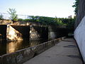
Cameron Run is a 3.0-mile-long (4.8 km) tributary stream of the Potomac River, located in the U.S. state of Virginia. A third-order stream, it is formed by the confluence of Backlick Run and Holmes Run. It flows eastward from Alexandria and forms the border between Fairfax County and Alexandria before opening into Hunting Creek and then into the Potomac River. The lower course near Eisenhower Avenue is largely channelized and flows just north of the Capital Beltway until it crosses under it near Telegraph Road The lower 1 mile (1.6 km) or so is tidal and was navigable in colonial times. Cameron Run Regional Park, a water park, lies along a portion of the stream. Cameron Run is part of the Cameron Run Watershed, which encompasses a total of 44 square miles (110 km2) in Northern Virginia. The Watershed is made up of eight subwatersheds: Tripps Run, Upper Holmes Run, Lower Holmes Run, Turkeycock Run, Backlick Run, Indian Run, Pike Branch, and Cameron Run and its tributaries.

Occoquan River tributary of the Potomac River in Virginia, United States

The Occoquan River is a tributary of the Potomac River in Northern Virginia, where it serves as part of the boundary between Fairfax and Prince William counties. The river is a scenic area, and several local high schools and colleges use the river for the sport of rowing.

Four Mile Run Trail

The Four Mile Run Trail is a 7-mile long, paved shared use path in Arlington County, Virginia. It runs along Four Mile Run from Benjamin Banneker Park in Falls Church to the Mount Vernon Trail near Ronald Reagan Washington National Airport, where Four Mile Run empties into the Potomac River. The trail runs roughly parallel to parts of the Washington & Old Dominion Railroad Trail as it follows Four Mile Run, sometimes on the other side of the stream.

The Donut Hole Trail (DHT) is a long-distance backpacking trail paralleling the West Branch of the Susquehanna River through Sproul State Forest. It is one of the most remote and challenging of the state's backpacking trails and is for seasoned hikers only, with numerous steep ascents and unbridged stream crossings. Bridges were recently constructed or replaced over Cooks Run, Drury Run, Seven Mile Run, and Paddy Run. Extensive relocations have been made in the Bull Run, Seven Mile, and Merrimam Hollow areas, eliminating many stream crossings. The biggest remaining challenge of the orange-blazed DHT is a deep-water ford of the very wide Kettle Creek that should not be attempted during high water. A yellow-blazed side trail provides a lengthy detour around this crossing.

Gwynns Falls Trail

Gywnns Falls Trail is a 15-mile (24 km) series of hiking and bicycling trails inside Baltimore, Maryland, named for the Gwynns Falls, whose course it follows, and the surrounding Gwynns Falls Leakin Park it passes through. The trail uses unique alignments, sidepaths on existing streets, and on-street sections. The trail consists of one 10.75-mile (17.30 km) mainline, plus a number of branches, including the Middle Branch Trail, the Hutton Trail, and the Dickeyville Trail. All of these trails carry signage designating them as the Gwynns Falls Trail; their individual names are designated via pavement markers designating their route. The entirety of the Middle Branch Trail, as well as the section of the mainline trail east of the Middle Branch Trail's northern terminus, are part of the East Coast Greenway.

The Cameron Run Watershed (CRW) is a highly urbanized, 44 square-mile watershed located in Northern Virginia. "The region is completely urbanized with nearly 95 percent of the watershed developed with mixed residential and commercial use". Seventy-five percent of the watershed lies in Fairfax County, and the rest lies in Arlington County and the cities of Falls Church and Alexandria. In addition to several streams, there are two lakes—Lake Barcroft and Fairview Lake —and four ponds. There are eight sub-watersheds within the CRW. The western part of the CRW lies within the Piedmont; the southeastern part in the Coastal Plain.

Alexandria, Virginia, an independent city in the Commonwealth of Virginia, is located along the western bank of the Potomac River. The city of approximately 151,000 is about six miles south of downtown Washington, D.C..

Holmes Run stream in Virginia

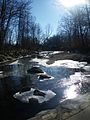
Holmes Run is a stream in the Cameron Run Watershed in Northern Virginia. It runs through Fairfax County and the City of Alexandria. It is a first-order tributary of the Potomac River.

References

  1. "Bike Trails and Biking" . Retrieved 6 November 2018.
  2. Hodge, Paul (30 June 1977). "Councilwoman, residents urge speed-up in construction of Cameron Run Park". The Washington Post.
  3. Hodge, Paul (25 May 1983). "Surf's Up! Wave Pool to Open in Alexandria Park". The Washington Post.
  4. Kunkle, Fredrick (23 November 2006). "Making A Walk on The Wild Side Easier". The Washington Post. Retrieved 6 November 2018.
  5. Cranor, David. "Beauregard Small Area Plan includes trails, bike lanes, parking and bikeshare". TheWashCycle. Retrieved 6 November 2018.
  6. "Expanding Trail Access: Holmes Run Getting Second Bridge". patch.com. 7 May 2013. Retrieved 6 November 2018.
  7. "City Of Alexandria To Celebrate New Holmes Run Trail Pedestrian And Bicycle Bridge". Alexandria Times. 2 November 2018. Retrieved 6 November 2018.
  8. Fischer, Lori (13 September 2001). "Jurisdictions Seek to Link Bike Paths in N. Virginia". The Washington Post.
  9. 1 2 3 4 5 6 7 8 9 10 11 12 13 14 15 "Alexandria Bike Map" (PDF). Alexandria Bikeways: GO Alex: Alexandria's Resource for Transportation Alternatives. Government of Alexandria, Virginia. Retrieved 25 February 2017.
  10. Coordinates of beginning of Holmes Run Trail: 38°48′17″N77°06′20″W / 38.804632°N 77.105666°W
  11. 1 2 Coordinates of underpass connecting Eisenhower Avenue and Holmes Run Trails: 38°48′16″N77°06′20″W / 38.804463°N 77.105523°W
  12. Coordinates of Metro Blue Line bridge crossing over Holmes Run Trail: 38°48′20″N77°06′25″W / 38.805425°N 77.107021°W
  13. Coordinates of railroad bridges crossing over Holmes Run Trail:
    (1) 38°48′21″N77°06′27″W / 38.805742°N 77.107492°W
    (2) 38°48′23″N77°06′33″W / 38.806490°N 77.109110°W
    (3) 38°48′24″N77°06′33″W / 38.806628°N 77.109287°W
  14. Coordinates of intersection of Holmes Run Trail and Backlick Run Trail: 38°48′33″N77°06′42″W / 38.809098°N 77.111774°W
  15. Coordinates of Duke Street Bridge over Holmes Run Trail: 38°48′42″N77°06′48″W / 38.811738°N 77.113250°W
  16. Coordinates of intersection of Holmes Run Trail and trail to Charles Beatley Bridge: 38°48′55″N77°07′08″W / 38.815319°N 77.118833°W
  17. Coordinates of Holmes Run Trail crossing Holmes Run south of North Van Dorn Street: 38°49′08″N77°07′37″W / 38.818852°N 77.126991°W
  18. Coordinates of Interstate 395 bridge over Holmes Run Trail: 38°49′15″N77°07′42″W / 38.820913°N 77.128409°W
  19. Coordinates of crossing of Holmes Run Trail and North Beauregard Street: 38°49′30″N77°07′56″W / 38.824970°N 77.132206°W
  20. Coordinates of crossing of Holmes Run Trail and Holmes Run north of North Beauregard Street: 38°49′30″N77°07′56″W / 38.824970°N 77.132206°W
  21. Coordinates of Holmes Run Trail bridge over Holmes Run east of North Chambliss Street: 38°49′52″N77°08′05″W / 38.830985°N 77.134821°W
  22. 1 2 3 4 5 6 "Fairfax County Bicycle Map". Fairfax County Bicycle Program. Government of Fairfax County, Virginia. Retrieved 24 February 2017.
  23. "Parklawn Pool". Alexandria, Virginia: Parklawn Recreation Association. Archived from the original on 2 December 2016. Retrieved 25 February 2017.
  24. Coordinates of Holmes Run Trail east of Parklawn Pool: 38°50′00″N77°08′09″W / 38.833259°N 77.135710°W
  25. Coordinates of Holmes Run Trail bridges over Holmes Run in Holmes Run Stream Valley Park:
    (1) 38°50′17″N77°08′17″W / 38.838040°N 77.138063°W
    (2) 38°50′20″N77°08′19″W / 38.838833°N 77.138510°W
    (3) 38°50′25″N77°08′25″W / 38.840141°N 77.140349°W
    (4) 38°50′26″N77°08′30″W / 38.840527°N 77.141765°W
    (5) 38°50′27″N77°08′38″W / 38.840962°N 77.143895°W
  26. Coordinates of intersection of Holmes Run Trail and Columbia Pike trail: 38°50′33″N77°08′41″W / 38.842430°N 77.144816°W
  27. Coordinates of entrance to Holmes Run Trail at Sprucedale Drive: 38°50′44″N77°10′48″W / 38.845630°N 77.180122°W
  28. Coordinates of Holmes Run Trail bridge over Holmes Run north of Sprucedale Drive: 38°50′48″N77°10′44″W / 38.846701°N 77.178899°W
  29. Coordinates of Holmes Run Trail north of Holmes Run in Holmes Run Stream Valley Park:
    (1) 38°50′50″N77°10′52″W / 38.847193°N 77.181122°W
    (2) 38°50′52″N77°11′08″W / 38.847751°N 77.185560°W
    (3) 38°50′56″N77°11′23″W / 38.848851°N 77.189858°W
    (4) 38°51′03″N77°11′38″W / 38.850892°N 77.193938°W
  30. Coordinates of entrance to Holmes Run Trail at Hockett Street: 38°51′10″N77°11′46″W / 38.852719°N 77.196192°W
  31. "Cameron Run/Holmes Run Watershed, VA Fact Sheet" (PDF). U.S. Army Corps of Engineers. Archived from the original (PDF) on 19 July 2011. Retrieved 25 March 2011.

Coordinates: 38°49′04″N77°07′26″W / 38.817846°N 77.123928°W / 38.817846; -77.123928