Holy Family Professional Schools Foundation

Last updated
SAFA
Holy Family
Professional Schools Foundation
SAFAAndalusia.png
Established 1940;78 years ago (1940)
Founder Rafael Villoslada Peula, SJ
Purpose Free education for the poor
Region served
Andalusia, Spain
Director
Juan Pablo Rodriguez, SJ
Chairman
Javier Benjumia [1]
Affiliations Jesuit, Catholic
Website SAFA
SAFA School in Alcala la Real, Jaen, Spain SAFA.jpg
SAFA School in Alcalá la Real, Jaén, Spain

SAFA is the acronym (SAgrada FAmilia) for the Holy Family Professional Schools Foundation, a non-profit, private, cultural institution founded in 1940 by the Jesuit Rafael Villoslada Peula. The institution currently has 27 educational centers scattered throughout the eight provinces of Andalusia and serves some 20,000 students.

Andalusia Autonomous community of Spain

Andalusia is an autonomous community in southern Spain. It is the most populous, and the second largest autonomous community in the country. The Andalusian autonomous community is officially recognised as a "historical nationality". The territory is divided into eight provinces: Almería, Cádiz, Córdoba, Granada, Huelva, Jaén, Málaga and Seville. Its capital is the city of Seville.

Contents

Origin of SAFA

Fundación Escuelas Profesionales de la Sagrada Familia was founded in 1940, months after the end of the Spanish Civil War. In that socioeconomic context, a young Jesuit Father Rafael Villoslada Peula proposed providing vocational training to children who otherwise had no opportunity to receive a basic education.

Spanish Civil War War between the Republicans and the Nationalists in Spain from 1936 to 1939

The Spanish Civil War took place from 1936 to 1939. Republicans loyal to the left-leaning Second Spanish Republic, in alliance with the Anarchists and Communists, fought against the Nationalists, an alliance of Falangists, Monarchists, and Catholics, led by General Francisco Franco. Due to the international political climate at the time, the war had many facets, and different views saw it as class struggle, a war of religion, a struggle between dictatorship and republican democracy, between revolution and counterrevolution, between fascism and communism. The Nationalists won the war in early 1939 and ruled Spain until Franco's death in November 1975.

The founding charter defines SAFA as an institution whose teaching work, always free, aims to promote and create the future workers of the Province of Huelva, among the impoverished classes of the Andalusian towns and fields, It offers Christian and social education, as well as the human and social promotion of its beneficiaries, with special emphasis on professional education. The work as defined in the charter continues into the 21st century, through cooperation between the Foundation and the Ministry of Education and Science of the Council of Andalusia. [2] [3] [4]

Province of Huelva Province of Spain

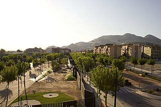
Huelva is a province of southern Spain, in the western part of the autonomous community of Andalusia. It is bordered by Portugal, the provinces of Badajoz, Seville, and Cádiz, and the Atlantic Ocean. Its capital is Huelva.

The SAFA Foundation offers primary, secondary, and technical training, including adult education, throughout Andalusia, in twenty-seven centers: Alcalá de los Gazules, Alcalá la Real, Almería Andújar, Atarfe, Baena, Bujalance, Cádiz, Chiclana, Écija, El Puerto S. María, Huelva, Jerez, Las Lomas, Linares, Málaga (ICET), Montellano, Osuna, Pedro Abad, Sevilla (B. Paloma), Sevilla (N.S. Reyes), Sevilla (P. Vereda), Úbeda, Valverde del Camino, Villacarrillo, Villanueva, Centro Naturaleza Constantina, and Centro Universitario Úbeda. [5]

Alcalá de los Gazules Municipality in Andalusia, Spain

Alcalá de los Gazules is a city located in the province of Cádiz, Spain. According to the 2006 census, the town has a population of 5,633 inhabitants. Alcalá de los Gazules is situated in the Sierra de Cádiz.

Alcalá la Real city in Jaén, Spain

Alcalá la Real is a city in the province of Jaén, Spain. According to the 2006 census (INE), the city has a population of 22,129 inhabitants.

Atarfe Municipality in Andalusia, Spain

Atarfe is a Spanish city, that belongs to the province of Granada, in Andalusia. It is located in the north central part of the Vega of Granada. It borders the municipalities of Moclín, Colomera, Albolote, Maracena, Granada, Santa Fe, and Pinos Puente. By this village run the Rivers Cubillas and Colomera. Its districts include Caparacena, Sierra Elvira, Hurpe and Cubillas.

Centers

Student data SAFA 2008-2009
CityCenter Student body
Alcala de los GazulesSAFA Alcalá de los Gazules429
Alcalá la RealSAFA Alcalá la Real1093
AlmeriaSAFA Almería721
AndújarSAFA Andújar1589
AtarfeSAFA Atarfe391
BaenaSAFA Baena1975
BujalanceSAFA Bujalance245
CádizSAFA Father Villoslada359
Chiclana de la FronteraSAFA Chiclana de la Frontera377
ConstantineConstantine Nature CenterFour. Five
ÉcijaSAFA Écija1422
Santa Maria PortSAFA San Luis2118
HuelvaSAFA FUNCADIA1350
Jerez de la FronteraSAFA Jerez436
The hillsSAFA Las Lomas204
LinaresSAFA Linares784
MalagaSAFA Málaga (ICET)827
MontellanoSAFA Montellano328
OsunaSAFA Osuna360
Pedro AbadSAFA Pedro Abad301
SevilleCentral Address150
SevilleSAFA Blanca Paloma575
SevilleSAFA Our Lady of the Kings746
SevilleSAFA Patronato Vereda1056
ÚbedaSAFA Úbeda2064
Valverde del CaminoSAFA Valverde del Camino355
VillacarrilloSAFA Villacarrillo456
Villanueva del ArzobispoSAFA Villanueva del Arzobispo409

References

  1. Rich Associates law firm. Retrieved 20 November 2017.
  2. Atenciano, Manuel Valbuena. "Historia". www.safa.edu (in Spanish). Retrieved 2017-11-20.
  3. "No One Left Behind | Pilots". no1leftbehind.eu. Retrieved 2017-11-20.
  4. Madrid), Congreso Sobre La Educacion Social En EspaÑa (1989 (1989). Actas del Congreso sobre la Educación Social en España: 20-22 de septiembre de 1989, [Madrid] (in Spanish). Ministerio de Educación. ISBN   9788436917345.
  5. "Nuestros Centros". www.safa.edu (in Spanish). Retrieved 2017-11-20.

Coordinates: 37°23′44.26″N5°59′42.15″W / 37.3956278°N 5.9950417°W / 37.3956278; -5.9950417

Geographic coordinate system Coordinate system

A geographic coordinate system is a coordinate system that enables every location on Earth to be specified by a set of numbers, letters or symbols. The coordinates are often chosen such that one of the numbers represents a vertical position and two or three of the numbers represent a horizontal position; alternatively, a geographic position may be expressed in a combined three-dimensional Cartesian vector. A common choice of coordinates is latitude, longitude and elevation. To specify a location on a plane requires a map projection.