Honey Creek (Platte River)

Last updated

Honey Creek is a stream in Tayler County, Iowa and Nodaway County, Missouri. [1] It is a tributary of Platte River.

Stream A body of surface water flowing down a channel

A stream is a body of water with surface water flowing within the bed and banks of a channel. The stream encompasses surface and groundwater fluxes that respond to geological, geomorphological, hydrological and biotic controls.
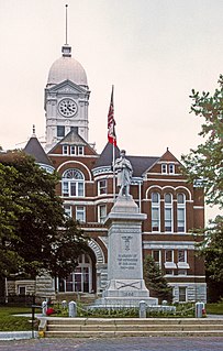
Taylor County, Iowa County in the United States

Taylor County is a county located in the U.S. state of Iowa. As of the 2010 census, the population was 6,317, making it the fourth-least populous county in Iowa. The county seat is Bedford. The county was formed in 1847 and named after General and President Zachary Taylor.
Iowa State of the United States of America

Iowa is a state in the Midwestern United States, bordered by the Mississippi River to the east and the Missouri River and Big Sioux River to the west. It is bordered by six states; Wisconsin to the northeast, Illinois to the east, Missouri to the south, Nebraska to the west, South Dakota to the northwest and Minnesota to the north.

The stream headwaters are at 40°48′31″N94°29′24″W / 40.80861°N 94.49000°W / 40.80861; -94.49000 and the confluence with the Platte is at 40°21′19″N94°41′16″W / 40.35528°N 94.68778°W / 40.35528; -94.68778 Coordinates: 40°21′19″N94°41′16″W / 40.35528°N 94.68778°W / 40.35528; -94.68778 . [1]

Confluence Meeting of two or more bodies of flowing water

In geography, a confluence occurs where two or more flowing bodies of water join together to form a single channel. A confluence can occur in several configurations: at the point where a tributary joins a larger river ; or where two streams meet to become the source of a river of a new name ; or where two separated channels of a river rejoin at the downstream end.

Geographic coordinate system Coordinate system

A geographic coordinate system is a coordinate system that enables every location on Earth to be specified by a set of numbers, letters or symbols. The coordinates are often chosen such that one of the numbers represents a vertical position and two or three of the numbers represent a horizontal position; alternatively, a geographic position may be expressed in a combined three-dimensional Cartesian vector. A common choice of coordinates is latitude, longitude and elevation. To specify a location on a plane requires a map projection.

Honey Creek was so named on account of honeybees near its course. [2]

See also

Related Research Articles

Honey Creek may refer to some places in the United States:

One Hundred and Two River river in the United States of America

The One Hundred and Two River is a tributary of the Platte River of Missouri that is approximately 80 miles (130 km) long, in northwestern Missouri in the United States, with its source tributaries rising in southwestern Iowa.

Tarkio River river in the United States of America

The Tarkio River is a non-navigable river that stretches for approximately 140 miles (225 km) from Cass County, Iowa to its mouth on the Missouri River in Holt County, Missouri.

Arapahoe Creek is a stream in Andrew and Nodaway counties of northwest Missouri. It is a tributary to the Nodaway River.

Moniteau Creek is a stream in Randolph, Howard and Boone counties in the U.S. state of Missouri. The headwaters of the stream are southwest of Moberly in Randolph County. The stream flows south passing into Howard County in the Rudolph Bennett Conservation Area. The stream flows south-southwest along the eastern part of the county passing under Missouri Route 124 and becomes the boundary between Howard and Boone counties before passing under U. S. Route 40 and entering the Missouri River just south of Rocheport.

Wildcat Creek is a stream in Gentry and Nodaway Counties in northwestern Missouri. It is a tributary of the Grand River.

Townsen Creek is a stream in Iron County in the U.S. state of Missouri.

Deer Creek is a stream in northwestern Benton County, Arkansas and southwestern McDonald County, Missouri. It is a tributary of Butler Creek.

Brushy Creek is a stream in Nodaway County, Missouri and Taylor County, Iowa in the United States. It is a tributary of Platte River.

Burr Oak Creek is a stream in Nodaway County in the U.S. state of Missouri. It is a tributary of Nodaway River.

Elkhorn Creek is a stream in Nodaway County in the U.S. state of Missouri. It is a tributary of the Nodaway River.

Florida Creek is a stream in Nodaway County in the U.S. state of Missouri. It is a tributary of the Nodaway River.

Hickory Creek is a stream in Nodaway County in the U.S. state of Missouri. It is a tributary of the Nodaway River.

Huff Creek is a stream in Nodaway County in the U.S. state of Missouri. It is a tributary of Nodaway River.

Jones Branch is a stream in Nodaway County in the U.S. state of Missouri. It is a tributary of One Hundred and Two River.

Mill Creek is a stream in the U.S. states of Iowa and Missouri. It is a tributary of Nodaway River.

Mozingo Creek is a stream in Nodaway County in the U.S. state of Missouri.

Muddy Creek is a stream in Nodaway County in the U.S. state of Missouri. It is a tributary of Nodaway River.

Sink Creek is a stream in Nodaway County in the U.S. state of Missouri. It is a tributary of Nodaway River.

White Cloud Creek is a stream in Andrew and Nodaway Counties in the U.S. state of Missouri. It is a tributary of One Hundred and Two River.

References

  1. 1 2 U.S. Geological Survey Geographic Names Information System: Honey Creek (Platte River)
  2. "Nodaway County Place Names, 1928–1945". The State Historical Society of Missouri. Archived from the original on June 24, 2016. Retrieved November 24, 2016.