
Bladel is a municipality and town in the province of North Brabant, Southern Netherlands. In 2019, it had a population of 20,175.

Ravenstein is a city and a former municipality in the south of the Netherlands, in the province of North Brabant. The former municipality covered an area of 42.68 km². In 2003 it was incorporated into the city of Oss.

Maasland is a town in the western Netherlands, in the province of South Holland. It lies in the municipality (gemeente) of Midden-Delfland and covers an area of 24.42 km2.

Geervliet is a town in the Dutch province of South Holland. It is a part of the municipality of Nissewaard, and lies about 6 km northwest of Spijkenisse on the Brielse Meer. It received city rights in 1381.
Vlijmen is a town in the Dutch province of North Brabant. It is located in the municipality of Heusden, about 6 km west of 's-Hertogenbosch.

Hei- en Boeicop is a small village in the Dutch province of Utrecht. Part of the municipality of Vijfheerenlanden, it lies about 9 km south of IJsselstein. The statistical area "Hei- en Boeicop", which includes the surrounding countryside, has a population of around 940.
Zoelen is a village in the Dutch province of Gelderland. It is a part of the municipality of Buren, and lies about 3 km north of Tiel.
Ackersdijk en Vrouwenregt is a former municipality in the Dutch province of South Holland, located about halfway between Delft and Schiedam. It existed from 1817 to 1855, when it was joined to the municipality of Vrijenban. The area is now part of the municipalities of Midden-Delfland, Delft, and Pijnacker-Nootdorp.
Sint Kruis is a village in the Dutch province of Zeeland. It is located about 4 km east of Aardenburg, in the municipality of Sluis.

Zeddam is a village in the Dutch province of Gelderland. It is located in the municipality of Montferland, about 7 km south of Doetinchem.

Roggel is a village in the Dutch province of Limburg. It is located in the municipality of Leudal.
Bladel en Netersel is a former municipality in the Dutch province of North Brabant. It covered the villages of Bladel and Netersel.

Engelen is a village in the Dutch province of North Brabant. It is part of the municipality of 's-Hertogenbosch.

Westerhoven is a village in the Dutch province of North Brabant. It is located in the municipality of Bergeijk, about 15 km southwest of Eindhoven.
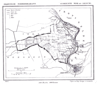
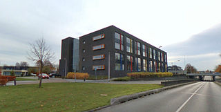
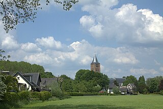
Wijk en Aalburg is a village in the Dutch province of North Brabant. It is located in the municipality of Altena, about 15 km northwest of 's-Hertogenbosch.

Hoogeloon is a Dutch village in the commune of Bladel, in North Brabant. Hoogeloon is situated 4 km north of Hapert and is around 20 km west of Eindhoven.
Heikant is a hamlet in the municipality of Bladel, in the Dutch province of North Brabant. It is located about 3 km east of Hoogeloon.

Remco Paul George Bosma is a Dutch politician. He has been Mayor of Bladel since 16 January 2019. Previously Bosma was a member of the House of Representatives for the People's Party for Freedom and Democracy between 1 March 2016 and 23 March 2017. He served in the States of Flevoland between 15 March 2007 and 1 March 2016.
