
Palmerston North is a city in the North Island of New Zealand and the seat of the Manawatū-Whanganui region. Located in the eastern Manawatu Plains, the city is near the north bank of the Manawatu River, 35 km (22 mi) from the river's mouth, and 12 km (7 mi) from the end of the Manawatu Gorge, about 140 km (87 mi) north of the capital, Wellington. Palmerston North is the country's eighth-largest urban area, with an urban population of 81,500.

Masterton, a large town in the Greater Wellington Region of New Zealand, operates as the seat of the Masterton District. It is the largest town in the Wairarapa, a region separated from Wellington by the Rimutaka ranges. It stands on the Waipoua stream between the Ruamahunga and Waingawa Rivers - 100 kilometres north-east of Wellington and 39.4 kilometres south of Eketahuna.
Woodville, previously known as The Junction is a small town in the southern North Island of New Zealand, 75 km north of Masterton and 25 km east of Palmerston North. The 2013 census showed that 1401 people reside in Woodville.
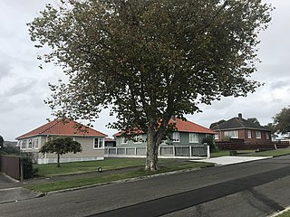
Roslyn is a suburb in the city of Palmerston North, Manawatū-Whanganui, New Zealand.
Kelvin Grove is a suburb of Palmerston North on New Zealand's North Island. It is bounded on the north by the North Island Main Trunk railway, Manawatu District and Milson, on the west by Palmerston North–Gisborne Line and Roslyn, the south by the Manawatu River, and the east by James Line and Whakarongo.
Papaioea is a suburb of Palmerston North on New Zealand's North Island.
Cloverlea is a suburb of Palmerston North, New Zealand. It is also an area about Cloverlea Road, Palmerston North and a homestead on No 1 Line, Palmerston North. The suburb is located north east of Highbury, north west of Palmerston North Hospital Area and north of Takaro.

Rangitāne is a Māori iwi (tribe). Their rohe (territory) is in the Manawatū, Horowhenua, Wairarapa and Marlborough areas of New Zealand.

Te Manawa is a museum, art gallery and science centre in Palmerston North, New Zealand. It is operated by the Te Manawa Museums Trust, a charitable trust incorporated on 20 August 1999. From that date, the Trust assumed responsibility for art works and heritage assets transferred to its care but held on behalf of others. From 1 July 2000 the Trust commenced leasing the premises and managing the institution under agreements entered into with the Palmerston North City Council.
Louisa Matilda Snelson was a New Zealand civic leader. She and her husband George Snelson were considered the "father and mother of Palmerston North".

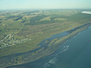
Rongotea is a small rural village in the Manawatū District of the Manawatū-Whanganui region. Located on the western Manawatū Plains, approximately 19 km (12 mi) northwest of the region's main city, Palmerston North.

Awapuni railway station was a station in Kairanga County, on the Foxton Branch and, from 1908, the North Island Main Trunk in New Zealand, now in the Palmerston North suburb of Awapuni. It was beside the Mangaone Stream, near its confluence with the Kawau Stream, about 400 m (440 yd) west of Maxwells Line on the north side of Pioneer Highway. Nothing remains of the former station, except a wide verge, partly occupied by a cycleway, built in 2015.

Bunnythorpe railway station was a station on the North Island Main Trunk in New Zealand, serving the village of Bunnythorpe.
Koitiata is a settlement located in the southwestern part of Rangitikei District of the Manawatū-Whanganui region of New Zealand's North Island. At the time of the 2018 census, Koitiata had a population of 128. Marton is located 24 km to the east and Whanganui is located 29 km to the northwest. Nearby Koitiata is Lake Koitiata.
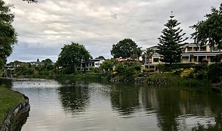
Hokowhitu Lagoon, also sometimes called Centennial Lagoon, is a natural oxbow lake in the city of Palmerston North, New Zealand. Hokowhitu was created from a meander of the Manawatu River. Many features surround the lagoon including a walkway, Caccia Birch House, and a former campus of a Massey University — the facilities of which are now used by the New Zealand Defence Force, Te Wānanga o Aotearoa and the Abbey Theatre Company. The lagoon also gives its name to the surrounding suburb, Hokowhitu.
Newbury is a rural community in Palmerston North City and Manawatu District, in the Manawatū-Whanganui region in New Zealand's central North Island.
Rangiotu is a farming community in the Manawatu District and Manawatū-Whanganui region in New Zealand's central North Island.
Ballance is a farming community in Tararua District and Manawatū-Whanganui region of New Zealand's North Island. The main settlement is located on the west back of the Mangahao River, south and west of Woodville and 11 km north-west of Pahiatua.

The Whakarongo Railway Station was a passenger rail station on the Palmerston North to Gisborne line, in the suburb of Whakarongo in the north of Palmerston North. The station was situated between the Terrace End Station and Ashhurst Station.

Karere Railway Station was a passenger and freight station, located south of Palmerston North, which served the Foxton Branch Line in New Zealand. It served the branch line from 1873 until the line's closure in 1959.

