
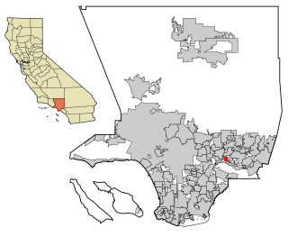
Los Angeles County, officially the County of Los Angeles, and sometimes abbreviated as L.A. County, is the most populous county in the United States and in the U.S. state of California, with 9,861,224 residents estimated as of 2022. It is the most populous non–state-level government entity in the United States. Its population is greater than that of 40 individual U.S. states. At 4,083 square miles (10,570 km2) and with 88 incorporated cities and many unincorporated areas, it is home to more than one-quarter of California residents and is one of the most ethnically diverse counties in the United States. Its county seat, Los Angeles, is also California's most populous city and the second most populous city in the United States, with about 3.9 million residents.

Glendale is a city in the San Fernando Valley and Verdugo Mountains regions of Los Angeles County, California. As of the 2020 U.S. Census the population was 196,543, up from 191,719 as of the 2010 census, making it the fourth-largest city in Los Angeles County and the 24th-largest city in California. It is located about 10 miles (16 km) north of downtown Los Angeles.

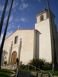
San Gabriel is a city located in the San Gabriel Valley of Los Angeles County, California. At the 2010 census, the population was 39,718.

Hacienda Heights is an unincorporated suburban community in Los Angeles County, California, United States. As of the 2010 census, the community had a total population of 54,038, up from 53,122 at the 2000 census. For statistical purposes, the Census Bureau has defined Hacienda Heights as a census designated place (CDP). It is the second largest CDP in Los Angeles County by area and the county's fourth largest CDP by population.
La Crescenta-Montrose is an unincorporated area in Los Angeles County, California, United States. The community is bordered by Glendale to the south and west, La Cañada Flintridge to the east, and Angeles National Forest to the north. According to the United States Census Bureau, the La Crescenta-Montrose Census-Designated Place (CDP) measures about 3.4 square miles (8.8 km2), and the population was 19,997 at the 2020 census, up from 19,653 in 2010 and 18,532 in 2000.

The San Gabriel Valley is one of the principal valleys of Southern California, lying generally to the east of the city of Los Angeles. Surrounding features include:

Lincoln Heights is one of the oldest neighborhoods in Los Angeles, California, United States. It was originally called "East Los Angeles" from 1873 to 1917. It is a densely populated, mostly Latino and Asian neighborhood. It includes many historic landmarks and was known as "the Bedroom of the Pueblo".
The Los Angeles Westside is an urban region in western Los Angeles County, California. It has no official definition, but sources like LA Weekly and the Mapping L.A. survey of the Los Angeles Times place the region on the western side of the Los Angeles Basin south of the Santa Monica Mountains.

State Route 2 (SR 2) is a state highway in the U.S. state of California. It connects the Los Angeles Basin with the San Gabriel Mountains and the Victor Valley in the Mojave Desert. The highway's southwestern end is at the intersection of Centinela Avenue at the Santa Monica-Los Angeles border and its northeastern end is at SR 138 east of Wrightwood. The SR 2 is divided into four segments, and it briefly runs concurrently with U.S. Route 101 (US 101) and Interstate 210 (I-210). The southwestern section of SR 2 runs along a segment of the east–west Santa Monica Boulevard, an old routing of US 66, to US 101 in East Hollywood; the second section runs along segments of both the north–south Alvarado Street and Glendale Boulevard in Echo Park; the third section to I-210 in Glendale is known as the north–south Glendale Freeway; and the northeastern portion from I-210 in La Cañada Flintridge to SR 138 is designated as the Angeles Crest Highway.

Chinese communities form a substantial portion of the population of the San Gabriel Valley, just east of Los Angeles, California. The region has achieved international prominence as a hub of overseas Chinese, or hua qiao. Although Chinese immigrants were a noteworthy presence in the establishment of Southern California from the 19th century, significant Chinese migration to suburban San Gabriel Valley coincided with a trend of white out-migration from the 1970s onward. This opened an opportunity for well-educated and affluent Asian Americans to begin settling in the west San Gabriel Valley, primarily to Monterey Park.
Bassett is an unincorporated community in the San Gabriel Valley, in Los Angeles County, California, United States, located within the Census-designated places boundaries of Avocado Heights and West Puente Valley. Located in the San Gabriel Valley, the ZIP Code is 91746 and the community is inside area code 626.

San Fernando Road is a major street in the City of Los Angeles and Los Angeles County. Within the Burbank city limits it is signed as San Fernando Boulevard, and north of Newhall Pass it is signed as The Old Road. It was previously designated as Business Loop 5 in the 1970s.
Valley Boulevard is a street in Southern California, running east from Los Angeles to Pomona, where it becomes Holt Boulevard, and a continuation from Fontana to Colton. It generally parallels Interstate 10 (I-10) and State Route 60 (CA 60), and is the original alignment of U.S. Route 60 (US 60). The present north end of I-710 is at Valley Boulevard in Los Angeles, just west of Alhambra.
The San Rafael Hills are a mountain range in Los Angeles County, California. They are one of the lower Transverse Ranges, and are parallel to and below the San Gabriel Mountains, adjacent to the San Gabriel Valley overlooking the Los Angeles Basin.

Los Angeles City Council District 14 is one of the 15 districts of the Los Angeles City Council. The district, which has a large Latin American population, includes the neighborhoods of Boyle Heights, Downtown Los Angeles and parts of Northeast Los Angeles. Councilman Kevin de León has represented the district since 2020. He replaced José Huizar after winning outright in the special election held during the 2020 California primaries; he was officially appointed on October 15, 2020. Huizar had vacated the seat earlier in the year due to bribery and corruption allegations.

John Strother Griffin (1816–1898) was a surgeon attached to the General Stephen W. Kearney expedition from New Mexico to California, a landowner and founder of East Los Angeles and a member of the Common Council of the city of Los Angeles, where he was one of the first university-trained physicians to settle.
The Foothill League is a high school athletic conference in the Santa Clarita Valley area of Los Angeles County, California that is affiliated with the CIF Southern Section. All current members are part of the William S. Hart Union High School District.