| Hornungskuppe | |
|---|---|
The Hornungskuppe and Monte Kali | |
| Highest point | |
| Elevation | 439 m above sea level (NHN) (1,440.3 ft) |
| Coordinates | 50°54′18″N9°58′43″E / 50.90500°N 9.97850°E Coordinates: 50°54′18″N9°58′43″E / 50.90500°N 9.97850°E |
| Geography | |
| Parent range | Seulingswald |
| Geology | |
| Type of rock | Bunter Sandstone |
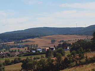
The Hornungskuppe (called the Hornsberg in the Middle Ages) is a wooded hill, 439 m above sea level (NHN) , in the Thuringian Zipfel on the border of Hesse and Thuringia in Germany. It is part of the natural region of the Seulingswald.
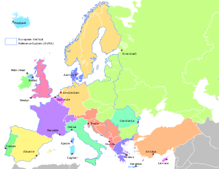
Normalhöhennull or NHN is a vertical datum used in Germany.
Hesse or Hessia, officially the State of Hesse, is a federal state (Land) of the Federal Republic of Germany, with just over six million inhabitants. The state capital is Wiesbaden; the largest city is Frankfurt am Main.
Thuringia, officially the Free State of Thuringia, is a state of Germany.
The Hornsberg was mentioned in documents dating to the 12th century in connexion with the eponymous noble family. It belongs to the parish of Widdershausen in the borough of Heringen in the Hessian county of Hersfeld-Rotenburg and the parish of Dankmarshausen in Thuringian Wartburgkreis. [1] The border between the two German states runs over the hill.

Hersfeld-Rotenburg is a Kreis (district) in the east of Hesse, Germany. Neighboring districts are Werra-Meißner, Wartburgkreis, Fulda, Vogelsbergkreis, Schwalm-Eder.
Dankmarshausen is a village and a former municipality in the Wartburgkreis district of Thuringia, Germany. Since 1 January 2019, it is part of the town Werra-Suhl-Tal.
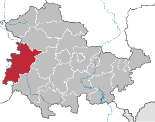
Wartburgkreis is a Kreis (district) in the south of Thuringia, Germany. Neighboring districts are the districts Unstrut-Hainich-Kreis, Gotha, Schmalkalden-Meiningen, and the districts Fulda, Hersfeld-Rotenburg and Werra-Meißner-Kreis in Hesse. The district-free city Eisenach is nearly completely surrounded by the district.
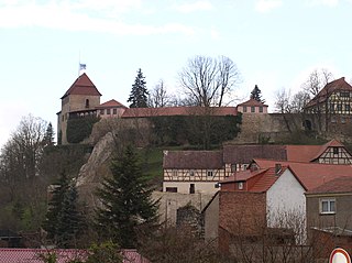
The Hornungskuppe is (still) used for forestry. The fenced in terrain on which the spoil tip of Monte Kali stands begins on its western slopes. Barely 500 metres to the northeast on a spur of the Hornungskuppe stands Hornsberg Castle. [2]
Monte Kali and Kalimanjaro are local colloquial names for the spoil heap or spoil tip that towers over the town of Heringen, Hesse, Germany. It is one of a number of sites where the K+S chemical company dumps sodium chloride, a byproduct of potash mining and processing, a major industry in the area.
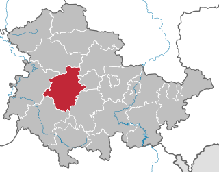
Gotha is a Kreis (district) in western central Thuringia, Germany. Neighboring districts are Unstrut-Hainich-Kreis, Sömmerda, the Kreis-free city Erfurt, Ilm-Kreis, Schmalkalden-Meiningen and the Wartburgkreis.
Schmalkalden-Meiningen is a Landkreis in the southwest of Thuringia, Germany. Its neighboring districts are the districts Wartburgkreis, Gotha, Ilm-Kreis, the district-free city Suhl, the district Hildburghausen, the Bavarian district Rhön-Grabfeld, and the district Fulda in Hesse.
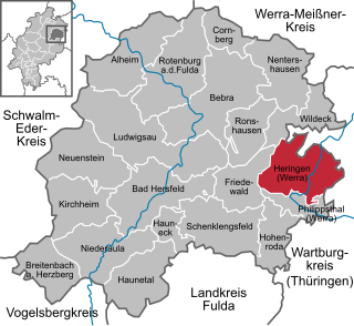
Heringen (Werra) is a small town in Hersfeld-Rotenburg district in eastern Hesse, Germany lying right at the boundary with Thuringia.
Schleiz is a town in the district of Saale-Orla-Kreis in Thuringia, Germany. The former municipality Crispendorf was merged into Schleiz in January 2019.
Creuzburg is a town on the Werra river in the Wartburgkreis in Thuringia, Germany.
Bad Liebenstein is a municipality and spa town in Wartburgkreis district of Thuringia, Germany.
Philippsthal (Werra) is a market community in Hersfeld-Rotenburg district in eastern Hesse, Germany, right at the boundary with Thuringia.
Frauensee is a village and a former municipality in the Wartburgkreis district of Thuringia, Germany. Since July 2018, it is part of the town Bad Salzungen.

Gerstungen is a municipality in the Wartburgkreis district of Thuringia, Germany. In July 2018 the former municipalities of Marksuhl and Wolfsburg-Unkeroda were merged into Gerstungen.
Herleshausen is a community in the Werra-Meißner-Kreis in Hesse, Germany.
Weißenborn is a community in the Werra-Meißner-Kreis in Hesse, Germany.
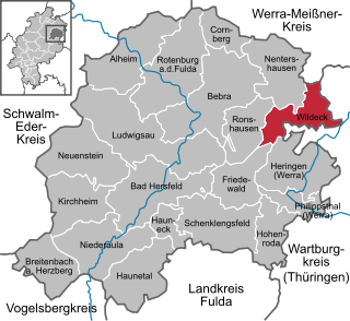
Wildeck is a community in Hersfeld-Rotenburg district in northeastern Hesse, Germany lying right at the boundary with Thuringia, 54 km southeast of Kassel.
Berka/Werra is a former Verwaltungsgemeinschaft in the district Wartburgkreis in Thuringia, Germany. The seat of the Verwaltungsgemeinschaft was in Berka/Werra. It ws disbanded in January 2019, when its municipalities were merged into the new town Werra-Suhl-Tal.
The Hopfenberg is a wooded hill near Winterstein in the borough of Waltershausen, in the county of Gotha in the German state of Thuringia.
The Schneeberg is a mountain, 692.4 metres high, that marks the southernmost boundary point of the borough of Suhl in the German state of Thuringia.
Lerchenberg is a geographical Name:
The Seulingswald is a hill range in the German Central Uplands which reaches heights of up to 480.3 m above sea level (NHN). It is part of the Fulda-Werra Uplands in the East Hesse Highlands within the Hessian county of Hersfeld-Rotenburg; small ridges extend into the Thuringian county of Wartburgkreis. It is a sandstone range and one of the largest contiguous woodland areas in Hesse.

Werra-Suhl-Tal is a town and a municipality in the district Wartburgkreis, in Thuringia, Germany. It was created with effect from 1 January 2019 by the merger of the former municipalities of Berka/Werra, Dankmarshausen, Dippach und Großensee. The name refers to the rivers Werra, Suhl (Weihe) and Suhl (Werra).