Dressage is a highly skilled form of riding performed in exhibition and competition, as well as an "art" sometimes pursued solely for the sake of mastery. As an equestrian sport defined by the International Equestrian Federation, dressage is "the highest expression of horse training" where "horse and rider are expected to perform from memory a series of predetermined movements."

Monmouth County is a county located in Central New Jersey, in the United States within the New York metropolitan area, and the northernmost county along the Jersey Shore. As of the 2017 Census estimate, the county's population was 626,351, making it the state's fifth-most populous county, representing a decrease of 0.6% from the 2010 Census, when the population was enumerated at 630,380, in turn an increase of 15,079 from 615,301 at the 2000 Census. As of 2010, the county fell to the fifth-most populous county in the state, having been surpassed by Hudson County. Its county seat is Freehold Borough. The most populous place was Middletown Township, with 66,522 residents at the time of the 2010 Census, while Howell Township covered 61.21 square miles (158.5 km2), the largest total area of any municipality.
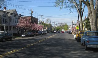
Allentown is a borough in Monmouth County, New Jersey, United States. As of the 2010 United States Census, the borough's population was 1,828, reflecting a decline of 54 (-2.9%) from the 1,882 counted in the 2000 Census, which had in turn increased by 54 (+3.0%) from the 1,828 counted in the 1990 Census.

Colts Neck Township is a township in Monmouth County, New Jersey, United States. As of the 2010 United States Census, the population was 10,142, reflecting a decline of 2,189 (-17.8%) from the 12,331 counted in the 2000 Census, which had in turn increased by 3,772 (+44.1%) from the 8,559 counted in the 1990 Census.

Farmingdale is a borough in Monmouth County, New Jersey, United States. As of the 2010 United States Census, the borough's population was 1,329, reflecting a decline of 258 (-16.3%) from the 1,587 counted in the 2000 Census, which had in turn increased by 125 (+8.5%) from the 1,462 counted in the 1990 Census.
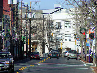
Freehold is a borough in Monmouth County, New Jersey, United States. It is the county seat of Monmouth County. As of the 2010 United States Census, the borough's population was 12,052, reflecting an increase of 1,076 (+9.8%) from the 10,976 counted in the 2000 Census, which had in turn increased by 234 (+2.2%) from the 10,742 counted in the 1990 Census.

Freehold Township is a township in Monmouth County, New Jersey, United States. As of the 2010 United States Census, the township's population was 36,184, reflecting an increase of 4,647 (+14.7%) from the 31,537 counted in the 2000 Census, which had in turn increased by 6,827 (+27.6%) from the 24,710 counted in the 1990 Census.
Manalapan Township is a township in Monmouth County, New Jersey, United States. As of the 2010 United States Census, the township's population was 38,872, representing an increase of 5,449 (+16.3%) from the 33,423 counted in the 2000 Census, which had in turn increased by 6,707 (+25.1%) from the 26,716 counted in the 1990 Census.

Millstone Township is a township in Monmouth County, New Jersey, United States. It is located in the New York Metropolitan Area. As of the 2010 United States Census, the township's population was 10,566, reflecting an increase of 1,596 (+17.8%) from the 8,970 counted in the 2000 Census, which had in turn increased by 3,901 (+77.0%) from the 5,069 counted in the 1990 Census.

Centenary University is a private liberal arts college in Hackettstown, New Jersey. Founded in 1867 by the Newark Conference of the United Methodist Church, Centenary has evolved from a coeducational preparatory school to a girls' preparatory school (1910), to a Junior college for women (1940), to a four-year women's college (1976), to a coeducational baccalaureate-degree-granting institution (1988) and finally to a master-degree-granting institution (1995). In 1999, Centenary founded the Center for Adult and Professional Studies (CAPS) program. In 2011, the program was renamed the School of Professional Studies (SPS). Centenary's main campus is located in Hackettstown.

Monmouth Park Racetrack is an American race track for thoroughbred horse racing in Oceanport, New Jersey, United States. It is owned by the New Jersey Sports and Exposition Authority and is operated under a five-year lease as a partnership with Darby Development, LLC.
Kentucky Horse Park is a working horse farm and an educational theme park opened in 1978 in Lexington, Kentucky. It is located off Kentucky State Highway 1973 and Interstate 75, at Exit 120, in northern Fayette County in the United States. The equestrian facility is a 1,224-acre (4.95 km2) park dedicated to "man's relationship with the horse." Open to the public, the park has a twice daily Horses of the World Show, showcasing both common and rare horses from around the globe. The horses are ridden in authentic costume. Each year the park is host to a number of special events and horse shows.
The Upper Freehold Regional School District is a regional public school district in Monmouth County, New Jersey, United States, which provides educational services to students in pre-kindergarten through twelfth grade. The district serves students from Allentown Borough and Upper Freehold Township, as well as those from Millstone Township, which sends students to the high school as part of a sending/receiving relationship.

Monmouth Battlefield State Park is a 1,818-acre (7.36 km2) New Jersey state park located on the border of Manalapan and Freehold Township, in Monmouth County, New Jersey, United States. This park preserves the historical battlefield on which the American Revolutionary War's Battle of Monmouth was waged.

Imlaystown is small historic unincorporated community located within Upper Freehold Township in Monmouth County, New Jersey, United States. It is located in ZIP code 08526. The community is accessible from Exit 11 of Interstate 195.

Lord Stirling Park is a 925/950 acre park operated by the Somerset County Park Commission and located in Basking Ridge, New Jersey, and separated from the Great Swamp National Wildlife Refuge by the Passaic River. The park displays a diverse ecosystem in floodplains of the upper Passaic River and its contributors and contains swamps, fields, forests, brooks, marshes, and meadows.

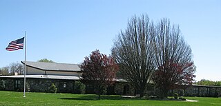
The Monmouth County Horse Show has been running since 1895 and is now located in Freehold, New Jersey.

Holmdel Park is located in Holmdel Township, New Jersey and is part of the Monmouth County Park System. The initial park land was established in 1962, with an additional 227 acres (92 ha) section added in 2001. Holmdel Park is also the home of the Holmdel Arboretum; aka David C. Shaw Arboretum and the Longstreet Farm, a living history farm set in the 1890s. The park is a popular destination for local elementary school trips and cross-country runners.

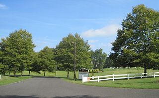
Coxs Corner, also known as Cox's Corner or Wrightsville, is an unincorporated community located within Upper Freehold Township, in Monmouth County, New Jersey, United States. Named for congressman and brigadier general James Cox (1753–1810), who had lived here at the family home of "Box Grove", it is at the juncture of County Route 524 and County Route 43. The Upper Freehold Historic Farmland Byway passes through the area.