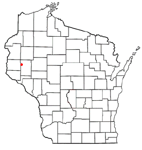
Tiffany is a town in Dunn County, Wisconsin, United States. The population was 633 at the 2000 census. The villages of Boyceville and Downing are located within the town.

Soyuz TM-22 was the 23rd manned spacecraft mission to visit the Soviet Space Station Mir.

Comoé is one of the 45 provinces of Burkina Faso, located in its Cascades Region. The capital of Comoé is Banfora. The population of Comoé was 400,534 in 2006.

Korahe is one of nine Zones of the Somali Region of Ethiopia. Korahe is bordered on the southwest by the Gode, on the northwest by Fiq, on the north by Degehabur, on the east by Werder, and on the southeast by Somalia. The largest city in Korahe is Kebri Dahar.
Awbere, , is one of the woredas in the Somali Region of Ethiopia. Part of the Jijiga Zone, Awbere is bordered on the southwest by Jijiga, on the west by the Shinile Zone, on the east by Somalia, and on the southeast by Kebri Beyah. Towns in Awbere include Aw Barre, Aw Bube, Derwernache, Lefe Isa, Gogti, Jaare, Herageel and Sheder.
The Harar Wildlife Sanctuary is a protected area in Ethiopia. It is located in the Misraq (East) Hararghe Zone of the Oromia Region, south of Babille, with a central latitude and longitude of 8°45′N42°38′E.

Enciso is a town and municipality in the García Rovira Province, part of Santander Department in northeastern Colombia.
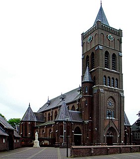
Schaijk is a town in the Dutch province of North Brabant. It is located in the municipality of Landerd, about 8 kilometres (5.0 mi) southeast of Oss.

Wólka Siemieńska is a village in the administrative district of Gmina Siemień, within Parczew County, Lublin Voivodeship, in eastern Poland. It lies approximately 2 kilometres (1 mi) west of Siemień, 9 km (6 mi) west of Parczew, and 45 km (28 mi) north of the regional capital Lublin.
Perdiguera is a municipality located in the province of Zaragoza, Aragon, Spain. According to the 2009 census (INE), the municipality has a population of 662 inhabitants.
Villalba de la Lampreana is a municipality located in the province of Zamora, Castile and León, Spain. According to the 2004 census (INE), the municipality has a population of 297 inhabitants.
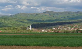
Tărlungeni is a commune in Brașov County, Romania. It is composed of four villages: Cărpiniș (Kerpenest), Purcăreni (Pürkerec), Tărlungeni and Zizin (Zajzon).

Ambatotsipihina is a town and commune in Madagascar. It belongs to the district of Antanifotsy, which is a part of Vakinankaratra Region. The population of the commune was estimated to be approximately 21,000 in 2001 commune census.
Tułkowice is a village in the administrative district of Gmina Wilczyce, within Sandomierz County, Świętokrzyskie Voivodeship, in south-central Poland. It lies approximately 2 kilometres (1 mi) west of Wilczyce, 12 km (7 mi) north-west of Sandomierz, and 74 km (46 mi) east of the regional capital Kielce.
Baraha is a Village Development Committee in Dailekh District in the Bheri Zone of western-central Nepal. At the time of the 1991 Nepal census it had a population of 3085 people residing in 552 individual households.
Rynowo-Kolonia is a settlement in the administrative district of Gmina Łobez, within Łobez County, West Pomeranian Voivodeship, in north-western Poland. It lies approximately 9 kilometres (6 mi) east of Łobez and 81 km (50 mi) east of the regional capital Szczecin.
Kozloduytsi is a village in the municipality of Dobrichka, in Dobrich Province, in northeastern Bulgaria.
Dolno Cherkovishte is a village in Stambolovo Municipality, in Haskovo Province, in southern Bulgaria.

Adrani is a village in the municipality of Kraljevo, western-central Serbia. According to the 2002 census, the village has a population of 2198 people.
Mehovine is a village in the municipality of Vladimirci, Serbia. According to the 2002 census, the village has a population of 615 people.


