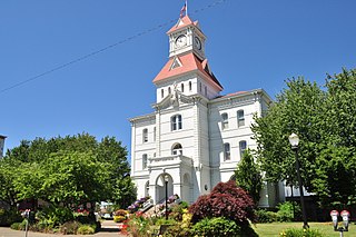
Benton County is one of the 36 counties in the U.S. state of Oregon. As of the 2020 census, the population was 95,184. Its county seat is Corvallis. The county was named after Thomas Hart Benton, a U.S. Senator who advocated American control over the Oregon Country. Benton County is designated as the Corvallis, OR Metropolitan Statistical Area, which is included in the Portland–Vancouver–Salem, OR–WA Combined Statistical Area. It is in the Willamette Valley.

Marys River is a 40-mile (64 km) tributary of the Willamette River in the U.S. state of Oregon. From its source at the confluence of its east and west forks near Summit, it flows generally southeast from the Central Oregon Coast Range to Corvallis.
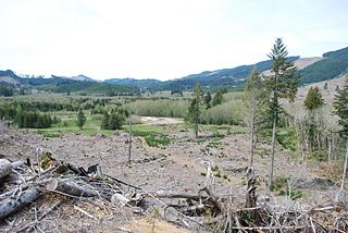
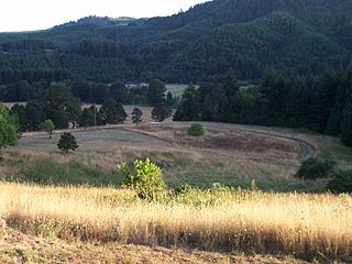
Valsetz was an unincorporated community and timber company town in Polk County, Oregon, United States, west of Falls City in the Central Oregon Coast Range. It no longer exists.
Fort Hoskins was one of three "forts" built by the U.S. Army to monitor the Coastal Indian Reservation in Oregon Territory in the mid- 19th century. The Fort Hoskins Site is listed on the National Register of Historic Places. Fort Hoskins was garrisoned by a number of companies of soldiers throughout its short existence, and future Union Civil War generals Christopher Columbus Augur and Phil Sheridan were stationed there.

Kings Valley is an unincorporated community and census-designated place in Benton County, Oregon, United States. It is located on the Luckiamute River and Oregon Route 223, the Kings Valley Highway. As of the 2010 census it had a population of 65.

John Minto IV was an American pioneer born in Wylam, England. He was a prominent sheep farmer in the U.S. state of Oregon and a four-time Republican representative in the state legislature. Minto also volunteered for the militia during the Cayuse War and years later helped locate Minto and Santiam passes through the Cascade Mountains east of Salem, Oregon.
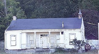
John Phillips House is a historic 1853 vernacular Greek Revival house in the Spring Valley area of Polk County, Oregon, United States. It was built for pioneer John Phillips, who came to Oregon via the Oregon Trail in 1845. He finished his journey to Oregon on the Meek Cutoff as part of Stephen Meek's "lost wagon train".

Irving was an unincorporated community in Lane County, Oregon, United States, and now partly within the Eugene city limits.

The Coburg Hills are a range of foothills of the western Cascade Range of Lane and Linn counties in the U.S. state of Oregon. They are located northeast of Eugene and east of Coburg, between the Mohawk Valley and Willamette Valley.

Talbot is an unincorporated community in Marion County, Oregon, United States. It was named after Guy W. Talbot, the first vice-president and general manager of the Oregon Electric Railway Company. The station was first known as Roby, after a pioneer family in the vicinity but the name was changed to Talbot when it became confused with "Ruby" in Multnomah County.

Horton is an unincorporated community in Lane County, Oregon, United States. It is about three miles northeast of Blachly, in the Lake Creek valley of the Central Oregon Coast Range.
Harlan is an unincorporated community in Lincoln County, Oregon, United States, about 30 miles west of Corvallis. It is located in a valley of the Central Oregon Coast Range in the Siuslaw National Forest. The community's economy was once based on logging and sawmills. Cattle ranching is another mainstay of the local economy.
Tiernan is an unincorporated community in Lane County, Oregon, United States. It is about five miles west of Mapleton on Oregon Route 126 near the Siuslaw River and within the Siuslaw National Forest.

The Valley and Siletz Railroad (VS) is a 40.6-mile (65.3 km) defunct railroad located in Polk and Benton counties in the U.S. state of Oregon.
Crowley is an unincorporated community in Polk County, Oregon, United States. It is located east of Oregon Route 99W, about four miles north of Rickreall.
Suver is an unincorporated community in Polk County, Oregon, United States. It is located about 10 miles north of Corvallis and about 8 miles south of Monmouth, 1 mile east of Oregon Route 99W.
Paris is an unincorporated community in Lane County, in the U.S. state of Oregon. It is a rural locale in the Central Oregon Coast Range north of the Siuslaw River and south of the Alsea River along one of its tributaries, Five Rivers. Paris is located at 44°15′09″N123°46′14″W.
Alpha is an unincorporated community in Lane County, in the U.S. state of Oregon.

Syenite is an unincorporated community in southern St. Francois County, in the U.S. state of Missouri. The community lies on Missouri Route DD, west of U.S. Route 67. Knob Lick lies approximately 1.5 miles to the east and the St. Francis River valley is to the north and west. Knob Lick Mountain lies about one mile to the south-southeast.
The Samaritan Health Services (SHS) is a non-profit, integrated delivery healthcare system consisting of five hospitals in Oregon and is headquartered in Corvallis, Oregon.

