Houston River (Louisiana)

Last updated
Houston River
Houston River (Louisiana)
USA Louisiana relief location map.svg
Red pog.svg
Location
Country United States
State Louisiana
Parish Calcasieu
Physical characteristics
SourceConfluence of bayous/forests/Bear Head Creek
  locationNear Starks in Calcasieu Parish, Louisiana, United States
  coordinates 30°20′01″N93°37′47″W / 30.3337°N 93.6298°W / 30.3337; -93.6298
Mouth West Fork Calcasieu River
  location
Near Westlake in Calcasieu, Calcasieu Parish, Louisiana, United States
  coordinates
30°17′41″N93°16′28″W / 30.2948°N 93.2745°W / 30.2948; -93.2745

Houston River begins at the crossing of LA 12, northeast of Starks, at the mouth of Bear Head creek in Calcasieu Parish, Louisiana, and terminates at the confluence with the West Fork Calcasieu River on the southwest border of Sam Houston Jones State Park.

Contents

Alternate names

Houston River is also referred to as Houston Creek and sometimes erroneously as West Fork Calcasieu River. [1] The river is considered a stream by the GNIS [2]

Drainage basin

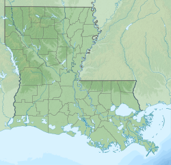
Houston River is part of the Calcasieu-Mermentau Basin and a sub-basin of the West Fork Calcasieu (HUC 08080205). [3]

Controversy

The Louisiana Department of Environmental Quality (LDEQ) issued a fish consumption advisory 11/20/00 and revised 5/29/03 then 7/1/04, for the Calcasieu River Drainage Basin, because of elevated Mercury levels. The fish includes largemouth bass, freshwater drum, and bowfin (choupique, grinnel) [4] The 2016 Louisiana Water Quality Integrated Report [5] was issued by the LDEQ February 10, 2017, indicating that potential health risk exists. The report listed that certain areas such as "Primary Contact Recreation (PCR; swimming) and "Secondary Contact Recreation" (SCR; boating) received a "Fully supporting designated use (F), but "Fish and wildlife propagation" (FWP; fishing) received a "Not supporting designated use" (N). The suspected cause of impairment included chloride, Mercury in fish tissue, oxygen; dissolved, sulfates, and total dissolved solids. fecal coliform [6] was also found in Bear Head creek up to Houston River as an impairment concerning swimming. [7] The Environmental Protection Agency added Houston River to Louisiana’s 2014 Clean Water Act Section 303(d) list (Subsegment 030806) because of waterbody impairment combinations (WICs) of chloride, sulfates, and total dissolved solids.

Related Research Articles

<span class="mw-page-title-main">Water quality</span> Assessment against standards for use

Water quality refers to the chemical, physical, and biological characteristics of water based on the standards of its usage. It is most frequently used by reference to a set of standards against which compliance, generally achieved through treatment of the water, can be assessed. The most common standards used to monitor and assess water quality convey the health of ecosystems, safety of human contact, extent of water pollution and condition of drinking water. Water quality has a significant impact on water supply and oftentimes determines supply options.

<span class="mw-page-title-main">Gunnison River</span> Tributary of the Colorado River in Colorado, United States

The Gunnison River is located in western Colorado, United States and is one of the largest tributaries of the Colorado River.

<span class="mw-page-title-main">Big South Fork of the Cumberland River</span> River in the United States

The Big South Fork of the Cumberland River is a 76-mile-long (122 km) river in the U.S. states of Tennessee and Kentucky. It is a major drainage feature of the Cumberland Plateau, a major tributary of the Cumberland River system, and the major feature of the Big South Fork National River and Recreation Area.

<span class="mw-page-title-main">Monocacy River</span> River in Maryland, United States

The Monocacy River is a free-flowing left tributary to the Potomac River, which empties into the Atlantic Ocean via the Chesapeake Bay. The river is 58.5 miles (94.1 km) long, with a drainage area of about 970 square miles (2,500 km2). It is the largest Maryland tributary to the Potomac.

A fecal coliform is a facultatively anaerobic, rod-shaped, gram-negative, non-sporulating bacterium. Coliform bacteria generally originate in the intestines of warm-blooded animals. Fecal coliforms are capable of growth in the presence of bile salts or similar surface agents, are oxidase negative, and produce acid and gas from lactose within 48 hours at 44 ± 0.5°C. The term thermotolerant coliform is more correct and is gaining acceptance over "fecal coliform".

<span class="mw-page-title-main">Cache Creek (Sacramento River tributary)</span> Stream from Lake to Yolo Counties, CA

Cache Creek is an 87-mile-long (140 km) stream in Lake, Colusa and Yolo counties, California.

<span class="mw-page-title-main">Mad River (California)</span> River in California, United States

The Mad River is a river in upper Northern California. It flows for 113 miles (182 km) in a roughly northwest direction through Trinity County and then Humboldt County, draining a 497-square-mile (1,290 km2) watershed into the Pacific Ocean north of the town of Arcata near [California Redwood Coast-Humboldt County Airport] in McKinleyville. The river's headwaters are in the Coast Range near South Kelsey Ridge.

<span class="mw-page-title-main">Harveys Creek</span> Tributary of the Susquehanna River in Luzerne County, Pennsylvania

Harveys Creek is a tributary of the Susquehanna River in Luzerne County, Pennsylvania, in the United States. It is approximately 14.5 miles (23.3 km) long and flows through Harveys Lake, Lake Township, Lehman Township, Jackson Township, and Plymouth Township. The creek's watershed has an area of 46.3 square miles (120 km2). The creek has four named tributaries, which are known as Bear Hollow Creek, Paint Spring Run, Pikes Creek, and East Fork Harveys Creek. The watershed is designated as a High-Quality Coldwater Fishery and a Migratory Fishery above Pikes Creek and as a Coldwater Fishery and a Migratory Fishery below it. The creek's source is Harveys Lake, the largest natural lake in Pennsylvania.

<span class="mw-page-title-main">Hurricane Creek (Black Warrior River tributary)</span> Creek in western Alabama

Hurricane Creek is a tributary of the Black Warrior River located in Southwestern Tuscaloosa County in western Alabama. It is over 30 miles long and its watershed covers approximately 120 square miles. It is used by communities around it, including the city of Tuscaloosa, for recreation and offers a wide variety of aquatic life and quality aesthetics. Three areas of this stream are on the federal 303(d) list of impaired streams, meaning they are protected by the Clean Water Act from further degradation. Current threats to water quality include active coal mining, abandoned mine lands, siltation, and some areas with high fecal coliform bacteria levels.

<span class="mw-page-title-main">Johnson Creek (Willamette River tributary)</span> Creek in Oregon, USA

Johnson Creek is a 25-mile (40 km) tributary of the Willamette River in the Portland metropolitan area of the U.S. state of Oregon. Part of the drainage basin of the Columbia River, its catchment consists of 54 square miles (140 km2) of mostly urban land occupied by about 180,000 people as of 2012. Passing through the cities of Gresham, Portland, and Milwaukie, the creek flows generally west from the foothills of the Cascade Range through sediments deposited by glacial floods on a substrate of basalt. Though polluted, it is free-flowing along its main stem and provides habitat for salmon and other migrating fish.

<span class="mw-page-title-main">Fanno Creek</span> River in Oregon, United States

Fanno Creek is a 15-mile (24 km) tributary of the Tualatin River in the U.S. state of Oregon. Part of the drainage basin of the Columbia River, its watershed covers about 32 square miles (83 km2) in Multnomah, Washington, and Clackamas counties, including about 7 square miles (18 km2) within the Portland city limits.

<span class="mw-page-title-main">South Fork Eel River</span> River in north-central California

The South Fork Eel River is the largest tributary of the Eel River in north-central California in the United States. The river flows 105 miles (169 km) north from Laytonville to Dyerville/Founders' Grove where it joins the Eel River. The South Fork drains a long and narrow portion of the Coast Range of California in parts of Mendocino and Humboldt counties. U.S. Route 101 follows the river for much of its length.

<span class="mw-page-title-main">Little Butte Creek</span> River in Oregon, USA

Little Butte Creek is a 17-mile-long (27 km) tributary of the Rogue River in the U.S. state of Oregon. Its drainage basin consists of approximately 354 square miles (917 km2) of Jackson County and another 19 square miles (49 km2) of Klamath County. Its two forks, the North Fork and the South Fork, both begin high in the Cascade Range near Mount McLoughlin and Brown Mountain. They both flow generally west until they meet near Lake Creek. The main stem continues west, flowing through the communities of Brownsboro, Eagle Point, and White City, before finally emptying into the Rogue River about 3 miles (5 km) southwest of Eagle Point.

<span class="mw-page-title-main">Big Butte Creek</span> River in Oregon, United States of America

Big Butte Creek is a 12-mile-long (19 km) tributary of the Rogue River in the U.S. state of Oregon. It drains approximately 245 square miles (635 km2) of Jackson County. Its two forks, the North Fork and the South Fork, both begin high in the Cascade Range near Mount McLoughlin. Flowing predominantly west, they meet near the city of Butte Falls. The main stem flows generally northwest until it empties into the Rogue Falls was incorporated in 1911, and remains the only incorporated town within the watershed's boundaries.

<span class="mw-page-title-main">Water pollution in India</span> Water pollution in India is mainly due to untreated wastewater discharge into rivers

Water pollution is a major environmental issue in India. The largest source of water pollution in India is untreated sewage. Other sources of pollution include agricultural runoff and unregulated small-scale industry. Most rivers, lakes and surface water in India are polluted due to industries, untreated sewage and solid wastes. Although the average annual precipitation in India is about 4000 billion cubic metres, only about 1122 billion cubic metres of water resources are available for utilization due to lack of infrastructure. Much of this water is unsafe, because pollution degrades water quality. Water pollution severely limits the amount of water available to Indian consumers, its industry and its agriculture.

<span class="mw-page-title-main">Burnt Bridge Creek</span> River in Washington , United States

Burnt Bridge Creek is a 13-mile (21 km) stream flowing for most of its length within the city of Vancouver in the U.S. state of Washington. It begins as drainage from field ditches near the unincorporated community of Orchards, east of the city. The creek flows generally west to Vancouver Lake. The lake drains to Lake River, which empties into the Columbia River about 11 miles (18 km) downstream of the city.

<span class="mw-page-title-main">McAleer Creek</span> River in Washington, United States

McAleer Creek is an urban creek approximately six miles long, flowing from Lake Ballinger in southern Snohomish County to Lake Washington. It drains an approximately 8.9-square-mile (23 km2) watershed. It is a salmon-bearing stream that also provides habitat to cutthroat trout, as well as watering a series of riparian areas, mostly in Lake Forest Park.

Herring River is a river in Wellfleet, Massachusetts that includes a tidal estuary. As of 2014, there are plans and funding in place to restore the river, after the construction of a dike across the river in 1909 as a mosquito control project severely hampered the health of the estuary.

<span class="mw-page-title-main">Furnace Run (Shamokin Creek tributary)</span> River

Furnace Run is a tributary of Shamokin Creek in Northumberland County, Pennsylvania, in the United States. It is approximately 1.0 mile (1.6 km) long and flows through Coal Township and Shamokin. The watershed of the stream has an area of 1.61 square miles (4.2 km2). It is impaired by sedimentation and siltation from urban runoff and storm sewers, but is not impacted by mine drainage. Reaches of the stream have been entirely enclosed. Furnace Run is named after a furnace that was built in the area in 1825. The stream is designated as a Coldwater Fishery and a Migratory Fishery.

References