Related Research Articles

Coutts is a village in southern Alberta, Canada that is a port of entry into the U.S. state of Montana. It is one of the busiest ports of entry on the Canada–United States border in western Canada. It connects Highway 4 to Interstate 15, an important trade route between Alberta, American states along I-15, and Mexico.
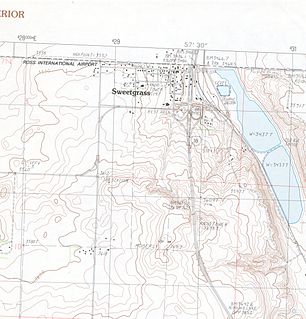
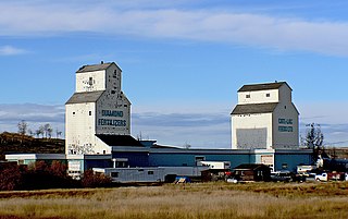
Sweet Grass is a census-designated place and unincorporated community in Toole County, Montana, United States, on the Canada–US border. It is the northern terminus of Interstate 15, an important route connecting western Canada, the western United States, and Mexico. The population was 65 according to the 2020 census.

Aldersyde is a hamlet in Alberta, Canada within the Foothills County. Located between Highway 2 and Highway 2A south of Highway 7, the hamlet is approximately 8 kilometres (5.0 mi) southeast of Okotoks, 10 kilometres (6.2 mi) north of High River and 25 kilometres (16 mi) south of Calgary. A Canadian Pacific Railway line runs through the hamlet.
Duchess is a village in southern Alberta, Canada that is surrounded by the County of Newell. It is north of Brooks and the Trans-Canada Highway.
There are several lakes named Mud Lake within the Canadian province of Alberta.

The County of Paintearth No. 18 is a municipal district in east central Alberta, Canada. Located in Census Division No. 7, its municipal office is located southeast of the Town of Castor near the intersection of Highway 12 and Highway 36.
De Winton is a hamlet in southern Alberta, Canada within the Foothills County. It is located just south of the City of Calgary and west of Highway 2A.

Etzikom is a hamlet in Alberta, Canada within the County of Forty Mile No. 8. It is approximately 20 kilometres (12 mi) east of Foremost on Highway 61.
Suffield is a hamlet in southern Alberta, Canada within Cypress County. It is located on the Trans-Canada Highway approximately 32 km (20 mi) northwest of Medicine Hat, and just south of CFB Suffield.

The Rocky Mountain Foothills are an upland area flanking the eastern side of the Rocky Mountains, extending south from the Liard River into Alberta. Bordering the Interior Plains system, they are part of the Rocky Mountain System or Eastern System of the Western Cordillera of North America.
Aden is a locality in the County of Forty Mile No. 8, Alberta. It serves as a port of entry into the U.S. state of Montana for the nearby Canada – United States border crossing. The port of entry is located where Alberta Highway 880 continues as Secondary Highway 409 within Liberty County, Montana.
Fork Lake is an unincorporated community in northern Alberta, Canada. It is located in Lac La Biche County, 6 kilometres (3.7 mi) south of Highway 55 and 93 kilometres (58 mi) west of Cold Lake.
Durlingville is an unincorporated area in central Alberta, Canada within the Municipal District of Bonnyville No. 87. It is located between Alberta Highway 28 and Alberta Highway 659.
Agatha is an unincorporated area in southeastern Alberta, Canada.
Cecil is a locality in Cypress County, Alberta, Canada.
Illingworth is a locality in Alberta, Canada.
Behan is a locality in Alberta, Canada.
Bantry is a locality in Alberta, Canada.
Haddock is a locality in Yellowhead County Alberta, Canada.
Castor Creek is a stream in Alberta, Canada. It is a tributary of the Battle River.
References
- ↑ "Howie". Geographical Names Data Base . Natural Resources Canada.
- ↑ Place-names of Alberta. Ottawa: Geographic Board of Canada. 1928. p. 66.
Coordinates: 50°54′00″N111°16′06″W / 50.90012°N 111.268432°W
| | This Southern Alberta location article is a stub. You can help Wikipedia by expanding it. |