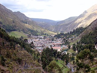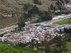
Lauricocha Province is one of 11 provinces of the Huánuco Region in Peru. The capital of the province is Jesús.

The Tarma Province is a Peruvian province, making up one of the nine provinces that conform the Junín Region. To the north it borders with the Junín Province, the east with the Chanchamayo Province, the south with the Jauja Province and the west with the Yauli Province.

The Daniel Alcides Carrión Province is the smallest of three provinces that make up the Pasco Region in Peru. It was named after the medical student Daniel Alcides Carrión. The capital of this province is Yanahuanca.

Cajacay District is one of fifteen districts of the Bolognesi Province in Peru.

Huallanca or Wallanka is a district of the Bolognesi Province in the Ancash Region of Peru.

The Dos de Mayo Province is one of eleven provinces of the Huánuco Region in Peru. The capital of this province is the city of La Unión.

Huayllay District is one of thirteen districts of the province Pasco in Peru.
Ninacaca is one of thirteen districts of the Pasco Province in Peru.
Paucartambo District is one of thirteen districts of the province Pasco in Peru.

Ticlacayán District is one of thirteen districts of the Pasco Province in the Pasco Region of Peru. Its seat is Ticlacayán.
Ulcumayo is one of four districts of the Junín Province in Peru.
Huancaya District is one of thirty-three districts of the province Yauyos in Peru.
Santiago de Chocorvos District is one of the sixteen districts of the Huaytará province in Peru.

Yanacocha is a 5,138-metre-high (16,857 ft) mountain and a nearby lake of that name in the Huaguruncho mountain range in the Andes of Peru. The mountain and the lake are located in the Pasco Region, Pasco Province, Huachón District, south of Huaguruncho.

Waqurunchu is a mountain north of the Waqurunchu mountain range in the Andes of Peru, about 4,800 m (15,700 ft) high. It is located in the Huánuco Region, Pachitea Province, Panao District, and in the Pasco Region, Pasco Province, Ticlacayan District.

Putaqa is a mountain north of the Waqurunchu mountain range in the Andes of Peru, about 4,600 m (15,100 ft) high. It is located in the Huánuco Region, Pachitea Province, Panao District. Putaqa lies northwest of a mountain named Ñawsaqucha and northeast of Waqurunchu.


