Related Research Articles
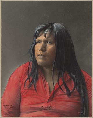
The Cocopah are Native Americans who live in Baja California, Mexico, and Arizona, United States.

San Luis is a city in Yuma County, Arizona, United States. The population was 35,257 at the 2020 census. It is part of the Yuma Metropolitan Statistical Area. San Luis, located in the southwest corner of the state directly adjacent to Mexico's Federal Highway 2 at San Luis Rio Colorado, was the second fastest-growing city or town in Arizona from 1990 to 2000. According to 2022 Census Bureau estimates, the population of the city is 35,770.

Fort Yuma was a fort in California located in Imperial County, across the Colorado River from Yuma, Arizona. It was Established in 1848. It served as a stop on the Butterfield Overland Mail route from 1858 until 1861. The fort was retired from active military service on May 16, 1883, and transferred to the Department of the Interior. The Fort Yuma Indian School and the Saint Thomas Yuma Indian Mission now occupy the site. It is one of the "associated sites" listed as Yuma Crossing and Associated Sites on the National Register of Historic Places in the Yuma Crossing National Heritage Area. In addition, it is registered as California Historical Landmark #806.
District of Arizona was a subordinate district of the Department of New Mexico territory created on August 30, 1862 and transferred to the Department of the Pacific in March 1865.

Port Isabel was a seaport established on Port Isabel Slough in 1865 during the American Civil War in Sonora, Mexico in the mouth of the Colorado River on the Gulf of California. It was founded to support the increased river traffic caused by the gold rush that began in 1862 on the Colorado River and the Yuma Quartermaster Depot newly established in 1864 to support the Army posts in the Arizona Military District. The slough was discovered in 1865 by the Captain W. H. Pierson of the schooner Isabel, that first used the slough to transfer its cargo to steamboats safe from the tidal bore of the Colorado River. Shortly afterward Port Isabel was established 3 miles up the slough and replaced Robinson's Landing as the place where cargo was unloaded in the river from seagoing craft on to flat bottomed steamboats of the Colorado River and carried up to Fort Yuma and points further north on the river.

The Yuma War was the name given to a series of United States military operations conducted in southern California and what is today southwestern Arizona from 1850 to 1853. The Quechan were the primary opponent of the United States Army, though engagements were fought between the Americans and other native groups in the region.
The Butterfield Overland Mail in California was created by the United States Congress on March 3, 1857, and operated until June 30, 1861. Subsequently, other stage lines operated along the Butterfield Overland Mail in route in Alta California until the Southern Pacific Railroad arrived in Yuma, Arizona in 1877.
Alamo Mucho Station, the misspelled name of Alamo Mocho Station was one of the original Butterfield Overland Mail stations located south of the Mexican border, in Baja California. Its location is 0.5 miles south-southeast of the Mexicali International Airport Terminal building.
The Butterfield Overland Mail was a transport and mail delivery system that employed stagecoaches that travelled on a specific route between St. Louis, Missouri and San Francisco, California and which passed through the New Mexico Territory. It was created by the United States Congress on March 3, 1857, and operated until March 30, 1861. The route that was operated extended from where the ferry across the Colorado River to Fort Yuma Station, California was located, through New Mexico Territory via Tucson to the Rio Grande and Mesilla, New Mexico then south to Franklin, Texas, midpoint on the route. The New Mexico Territory mail route was divided into two divisions each under a superintendent. Tucson was the headquarters of the 3rd Division of the Butterfield Overland Mail Company. Franklin Station in the town of Franklin,, was the headquarters of the 4th Division.
The Butterfield Overland Mail route in Baja California was created as a result of an act by the United States Congress on March 3, 1857, and operated until June 30, 1861 as part of the Second Division of the route. Subsequently other stage lines operated along the route until the Southern Pacific Railroad arrived in Yuma, Arizona.
Steamboats on the Colorado River operated from the river mouth at the Colorado River Delta on the Gulf of California in Mexico, up to the Virgin River on the Lower Colorado River Valley in the Southwestern United States from 1852 until 1909, when the construction of the Laguna Dam was completed. The shallow draft paddle steamers were found to be the most economical way to ship goods between the Pacific Ocean ports and settlements and mines along the lower river, putting in at landings in Sonora state, Baja California Territory, California state, Arizona Territory, New Mexico Territory, and Nevada state. They remained the primary means of transportation of freight until the advent of the more economical railroads began cutting away at their business from 1878 when the first line entered Arizona Territory.
Pedrick's was a steamboat landing owned by John Pedrick that supplied wood to steamboats on the lower Colorado River in Sonora, Mexico, from the mid 1850s to the late 1870s. After the 1854 Gadsden Purchase, Pedrick's was within New Mexico Territory and Arizona Territory after 1863. Pedrick's landing was located 24 miles above Ogden's Landing and 31 miles below Fort Yuma. Pedrick's lay along the east bank of the river just above what is now the Sonora – Arizona border in modern Yuma County, Arizona.
Colorado City is a ghost town in what is now Yuma County, Arizona. It was located on the south bank of the Colorado River at Jaeger's Ferry, 1 mile down river from Fort Yuma.
Jaeger's Ferry was a major river ferry at the Yuma Crossing of the Colorado River in the 1850s until 1862, 1 mile below Fort Yuma.
Jaeger City, or Jaegerville, was a former settlement in what is now Imperial County, California, at Jaeger's Ferry on the Colorado River a mile downstream from Fort Yuma. It was named for L. J. F. Jaeger who ran the ferry there from 1851.
Bradshaw's Ferry was a ferry at the crossing point on the Colorado River, of the Bradshaw Trail at Olive City and later at Mineral City and Ehrenburg, between what was then San Diego County, California, and Arizona County, New Mexico Territory. The ferry connected the Bradshaw Trail to the road to the gold placers of La Paz, the first big strike of the Colorado River Gold Rush. From 1863, the La Paz - Wikenburg Road connected the Bradshaw Trail to the new mining boom town settlements in the interior of Arizona Territory.
J. L. Smith, also known as Hualapai Smith,, a Forty-Niner, and an Arizona pioneer, a ferry and steamboat landing operator on the Colorado River, Hualapai Smith's in Sonora after 1865 into the 1870s.
George A. Johnson & Company was a partnership between three men who pioneered navigation on the Colorado River. Benjamin M. Hartshorne, George Alonzo Johnson and Alfred H. Wilcox. The George A. Johnson & Company was formed in the fall of 1852, and was reorganized as the Colorado Steam Navigation Company in 1869.

Hualapai Valley is a valley in Mohave County, Arizona.
Cooke's Wagon Road or Cooke's Road was the first wagon road between the Rio Grande and the Colorado River to San Diego, through the Mexican provinces of Nuevo México, Chihuahua, Sonora and Alta California, established by Philip St. George Cooke and the Mormon Battalion, from October 19, 1846 to January 29, 1847 during the Mexican–American War. It became the first of the wagon routes between New Mexico and California that with subsequent modifications before and during the California Gold Rush eventually became known as the Southern Trail or Southern Emigrant Trail.
References
- 1 2 The Arizona Sentinel; Saturday, December 7, 1872, page 3
- 1 2 3 4 The War of the Rebellion, Series I, Vol. L, Part I, Correspondence, U.S. Government Printing Office, Washington, 1897
- ↑ The Arizona Sentinel, Saturday, January 22, 1887, p.3
- ↑ U.S. Geological Survey Geographic Names Information System: Hualapai Valley
- ↑ "Rosario Peña P., Marcarán sitios históricos de San Luis y el valle, Historiadores y cronistas harán un recorrido por varios lugares, SAN LUIS DIGITAL, 13/06/2014". Archived from the original on 2016-03-04. Retrieved 2015-06-23.
- ↑ The War of the Rebellion, Series I, Vol. L, Part I, Correspondence, U.S. Government Printing Office, Washington, 1897, p.41
- ↑ Official Map Of The Territory Of Arizona, With All The Recent Explorations. Compiled by Richard Gird C.E. Commissioner. Approved By John N. Goodwin, Governor. In Accordance With An Act Of The Legislature, Approved Oct. 23d. 1864. We hereby certify that this is the Official Map of the Territory of Arizona, and approve the same. Prescott October 12th 1865. (with signed seal dated 1863). Published By A. Gensoul, Pacific Map Depot. No. 511 Montgomery St. San Francisco. Lith. Britton & Co. San Francisco. Accessed from www.davidrumsey.com, December 1, 2014. Shows location of Port Isabel, Sonora and other landings, settlements and the mining districts along the Colorado River and the interior of the territory in 1865.
- ↑ Arizona Sentinel (Yuma), 30 Aug. 1873, p.3