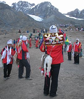
Cinajara or Sinaqara is a mountain in the Vilcanota mountain range in the Andes of Peru, about 5,471 metres (17,949 ft) high. It is situated in the Cusco Region, Quispicanchi Province, in the districts Ccarhuayo and Ocongate. Cinajara lies southwest of the Jolljepunco. The annual religious Quyllur Rit'i festival takes place at the foot of the mountains Cinajara and Jolljepunco.

Wamanripa is a mountainous complex in the Wansu mountain range in the Andes of Peru, about 5,300 metres (17,388 ft) high. It is situated in the Cusco Region, Chumbivilcas Province, Santo Tomás District. Wamanripa lies southeast of the mountain Chankuwaña and east of the mountains Waytani and Uturunku.
Wamanripa is a mountain in the Cordillera Central in the Andes of Peru, about 5,000 metres (16,404 ft) high. It is situated in the Lima Region, Huarochirí Province, on the border of the districts of Huarochirí and San Damian. It lies west of a lake named Chumpiqucha (Chumpicocha).
Ch'aqu is a mountain in the Andes of Peru, about 5,000 metres (16,404 ft) high. It is located in the Cusco Region, Quispicanchi Province, Cusipata District. It lies northeast of Hatun Ch'aqu and Yanaqaqa and northwest of Yuraq Q'asa. Ch'aqu is situated on the left bank of the river Pukamayu which flows to the west as a right affluent of the Willkanuta River. The confluence is near Cusipata.
Hatun Ch'aqu is a mountain in the Andes of Peru, about 5,000 metres (16,404 ft) high. It is located in the Cusco Region, Canchis Province, Pitumarca District, and in the Quispicanchi Province, Cusipata District. It lies south-west of the mountain Ch'aqu, west of the mountain Yanaqaqa, north-west of the mountain Tiklla Q'asa and north of the mountain Tuqtu. Its ridge stretches to the north-west.
Waña is a mountain in the Wansu mountain range in the Andes of Peru, about 5,400 metres (17,717 ft) high. It is situated in the Cusco Region, Chumbivilcas Province, Santo Tomás District. Waña lies northwest of Wamanripa, northeast of Chankuwaña, east of Wayunka and southeast of Ikma.
Wamanripa is a 5,110-metre-high (16,765 ft) mountain in the Paryaqaqa mountain range in the Andes of Peru. It is situated in the Lima Region, Huarochirí Province, San Mateo District. Wamanripa lies northwest of Phaqcha and Uqsha Wallqa and northeast of Waqaypaka.
Wamanripayuq is a 4,960-metre-high (16,273 ft) mountain in the Andes of Peru. It is located in the Huánuco Region, Ambo Province, San Rafael District, and in the Pachitea Province, Panao District.

Huarmaripayoc is a mountain in the Urubamba mountain range in the Andes of Peru, about 5,000 m (16,404 ft) high. It is located in the Cusco Region, Urubamba Province, Ollantaytambo District. It lies southwest of Patacancha and northwest of Salcayoc.

Huamanripayco is a mountain in the Vilcanota mountain range in the Andes of Peru, about 5,200 m (17,100 ft) high. It is located in the Cusco Region, Canchis Province, Pitumarca District. Huamanripayco lies on the northeastern shore of Sibinacocha.
Wamanripayuq may refer to:
Pisquioc is a mountain in the Vilcanota mountain range in the Andes of Peru, about 5,000 m (16,000 ft) high. It is located in the Cusco Region, Quispicanchi Province, Marcapata District, south of Aquichua.
Huamanripayoc is a mountain in the Chila mountain range in the Andes of Peru, about 5,000 m (16,000 ft) high. It is located in the Arequipa Region, Castilla Province, Chachas District. Huamanripayoc lies at the Cacamayo, northwest of Ticlla and northeast of Huayllayoc.
Wamanripa is a mountain in the Andes of Peru, about 5,000 metres (16,404 ft) high. It is located in the Lima Region, Huaura Province, Santa Leonor District.
Wamanripayuq is a mountain in the Chunta mountain range in the Andes of Peru, about 5,000 m (16,000 ft) high. It lies in the Huancavelica Region, Castrovirreyna Province, on the border of the districts of Castrovirreyna and Santa Ana.
Wamanripayuq is a mountain in the Andes of Peru which reaches an altitude of approximately 5,000 metres (16,404 ft). It is located in the Lima Region, Huarochirí Province, Carampoma District. Wamanripayuq lies east of Awqa Pallqa.
Wamanripa is a mountain in the Andes of Peru which reaches an altitude of approximately 4,600 metres (15,092 ft). It is located in the Lima Region, Huarochirí Province, Carampoma District. Wamanripa lies southeast of Wamanripayuq.
Wamanripa is a mountain in the Cordillera Central in the Andes of Peru which reaches an altitude of approximately 5,000 metres (16,404 ft). It is located in the Junín Region, Yauli Province, Yauli District. Wamanripa lies east of Yanta Pallana and south of a lake named Pumaqucha.
Jatun Huamanripa is a 4,601-metre-high (15,095 ft) mountain in the Vilcabamba mountain range in the Andes of Peru. It is located in the Cusco Region, La Convención Province, Vilcabamba District. Jatun Huamanripa lies southwest of a mountain named Nañuhuaico, northwest of Panta and northeast of Azulcocha. It is between the Chaupehuaico in the west, also known as Muñacocha brook, and the westernmost of two neighbouring rivers named Jatun Huyaco in the east, also known as Collacocha brook.
Wamanripa is mountain in the Cordillera Central in the Andes of Peru which reaches a height of approximately 4,600 metres (15,092 ft). It is located in the Lima Region, Yauyos Province, Huancaya District.


