Related Research Articles
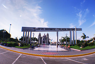
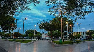
Chimbote ; Quechua: Chimputi) is the largest city in the Ancash Region of Peru, and the capital of both Santa Province and Chimbote District.
Ancash is a department and region in western Peru. It is bordered by the departments of La Libertad on the north, Huánuco and Pasco on the east, Lima on the south, and the Pacific Ocean on the west. Its capital is the city of Huaraz, and its largest city and port is Chimbote. The name of the region originates from the Quechua word anqash, from anqas ('blue') or from anka ('eagle').
Huacho is a city in Peru, capital of the Huaura Province and capital of the Lima Region. Also is the most populated city of the Lima Region and Norte Chico. It is located 223 feet above sea level and 148 km north of the city of Lima. The city is located on the Pan-American Highway and it is close to the Lachay National Reserve, so it has extensive vegetation and wildlife.

La Libertad is a region in northwestern Peru. Formerly it was known as the Department of La Libertad. It is bordered by the Lambayeque, Cajamarca and Amazonas regions on the north, the San Martín Region on the east, the Ancash and Huánuco regions on the south and the Pacific Ocean on the west. Its capital is Trujillo, which is the nation's third biggest city. The region's main port is Salaverry, one of Peru's largest ports. The name of the region is Spanish for "freedom" or "liberty"; it was named in honor of the Intendencia of Trujillo's proclaiming independence from Spain in 1820 and fighting for that. It is the ninth smallest department in Peru, but it is also its second-most populous department after Piura and its second-most densely populated department after Lambayeque.
The Department of Lima is a department and region located in the central coast of Peru; the seat of the regional government is Huacho.

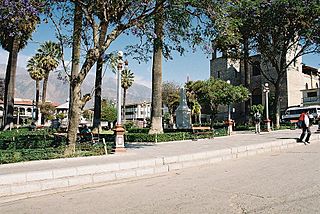
Huaraz, founded as San Sebastián de Huaraz, is a city in Peru. It is the capital of the Ancash Region and the seat of government of Huaraz Province. The urban area's population is distributed over the districts of Huaraz and Independencia. The city is located in the middle of the Callejon de Huaylas valley and on the right side of the Santa river. The city has an elevation of approximately 3050 meter s above sea level. The built-up area covers 8 km2 and has a population of 120,000 inhabitants, making it the second largest city in the central Peruvian Andes after the city of Huancayo. It is the 22nd largest city in Peru. Huaraz is the seat of the province's Roman Catholic Bishop and the site of the cathedral.

The 1970 Ancash earthquake occurred on 31 May off the coast of Peru in the Pacific Ocean at 15:23:29 local time. Combined with a resultant landslide, it is the most catastrophic natural disaster in the history of Peru. Due to the large amounts of snow and ice included in the landslide that caused an estimated 66,000-70,000 casualties, it is also considered to be the world's deadliest avalanche.
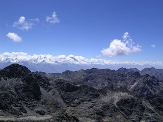
The Santa Valley is an inter-andean valley in the Ancash Region in the north-central highlands of Peru. Due to its location between two mountain ranges, it is known as Callejón de Huaylas, the Alley of Huaylas, whereas "Huaylas" refers to the territorial division's name during the Viceroyalty of Peru.
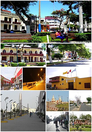
Casma is a city in the coastal desert of Peru, located 330 kilometers (210 mi) northwest of Lima. It is the capital of Casma Province and the third most populous city in the Ancash Region with an estimated population of 29,343 (2015). It is located in the lower Casma Valley, covering an area of 1,205 km2.

Asunción Province is one of the 20 provinces of the Ancash Region in Peru, one of the smallest provinces of the region. It is located in the heart of the central highlands of the region, on the eastern slopes of the Cordillera Blanca, in the eastern area of the Ancash Region at a distance of 121 km from the city of Huaraz, the capital of the region, and 521 km from the city of Lima, the capital of Peru. Chacas, the capital of the province, is located about 3,350 m high in the midst of extremely rugged terrain.

The Huarmey Province is one of 20 provinces located in the Ancash Region of Peru. It takes around 4 hours to arrive to Huarmey from Lima by bus and its main economic activities include agriculture, fishing, tourism, and mineral shipping.
Pallasca District is one of 11 districts of the Pallasca Province in the Ancash region in Peru.

The Santa Province is one of twenty provinces of the Ancash Region in Peru.
The Caraz District is one of 10 districts of the Huaylas Province in the Ancash Region of Peru. The capital of the district is Caraz. Its elevation is 2,285 m. In Caraz, the paved road comes from Pativilca.

The Casma River, which upstream is called Río Grande, is a river that crosses northern Casma province in the Ancash Region of Peru. It originates in the Black Mountain Range and drains into the Pacific Ocean. Major tributaries include the Sechín River (right).
The Sechín River is a seasonal river about 55 km (34 mi) long in the Ancash department of Peru that remains dry for long seasons, increasing its volume at times of rain in the mountains at its source. It is of irregular regime, due to this is known as Loco River. It rises at an altitude of 4,385 m (14,386 ft) in the Cordillera Negra and it ends by flowing into the Casma River about 10 km (6.2 mi) inland from the Pacific Ocean. The Casma-Sechin basin runs down the western slopes of the Andes mountain range - one of the world’s driest deserts. The city of Casma, population 30,000, is located near the junction of the two rivers. The Pan-American Highway crosses the Sechin River at Casma.
Recuay is a town in the Ancash Region, Peru. It is located at the border of the Santa River, 3422 msnm, and it the capital of the Recuay Province. it was created by law 11326 on April 14, 1950.
Culebras District is one of five districts of the province Huarmey in Peru.
Huarmey District is one of five districts of the province Huarmey in Peru.

El Castillo de Huarmey is a pyramid-like structure on the coast of Peru, in the Ancash Region north of Lima, the most studied section of the archeological complex is the Wari mausoleum which was discovered in an undisturbed condition. The 2013 discovery at El Castillo de Huarmey of a royal Wari tomb containing 60 individuals and three burials of elite women suggests the need to reassess the Wari presence on the coast of Peru. The 45-hectare (110-acre) area around the tomb has been the target of looters for decades. The team named the site, which provided evidence of the Wari Empire. El Castillo de Huarmey was excavated in secret over the course of several months in 2013 to prevent looting.
References
- ↑ e.g. personal home page of a co-investigating scientist, also BienVenida, Edition 40 Archived 2007-09-28 at the Wayback Machine .
- ↑ "Normales Climaticás Estándares y Medias 1991-2020". National Meteorology and Hydrology Service of Peru. Archived from the original on 21 August 2023. Retrieved 6 November 2023.
10°04′7″S78°9′37″W / 10.06861°S 78.16028°W
| | This Ancash Region geography article is a stub. You can help Wikipedia by expanding it. |