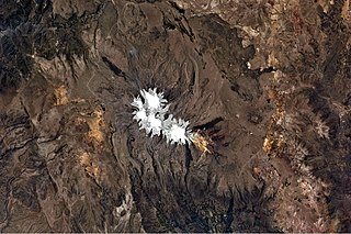
Arequipa is a department in southwestern Peru. It is bordered by the departments of Ica, Ayacucho, Apurímac and Cusco in the north, the Department of Puno in the east, the Department of Moquegua in the south, and the Pacific Ocean in the west. Its capital, also called Arequipa, is Peru's second-largest city.

Puca Mauras is a volcano in the Andes of Peru, about 4,262 metres (13,983 ft) high. It is situated at the "Valley of the Volcanoes" in the Arequipa Region, Castilla Province, on the border of the districts of Andagua and Chilcaymarca. Puca Mauras lies in the western extensions of the Chila mountain range, northeast of the Ticsho and Yanamauras volcanoes.

Yanawara is a mountain in the Andes of Peru, about 5,267.2 metres (17,281 ft) high. It is located in the Arequipa Region, Castilla Province, on the border of the districts Andagua, Ayo and Machaguay. Yanawara lies south-west of P'aqu Urqu and north of Qullpa, Yanqha and Yana Urqu.

Qullpa is a mountain in the Andes of Peru, about 5,226.4 metres (17,147 ft) high. It is situated in the Arequipa Region, Castilla Province, on the border of the districts Ayo and Uñón. Qullpa lies south of the mountain Yanqha.

Yanqha is a mountain in the Andes of Peru, about 5,200 metres (17,060 ft) high. It is situated in the Arequipa Region, Castilla Province, on the border of the districts Ayo and Uñón. Yanqha lies south of the mountains Yanawara and Yana Urqu and north of the mountain Qullpa.

P'aqu Urqu is a mountain in the Andes of Peru, about 5,000 metres (16,404 ft) high. It is located in the Arequipa Region, Castilla Province, in the south of the Andagua District. P'aqu Urqu lies north-west of Yanawara and north of Huch'uy Yanawara.

Chuqllu Chuqllu or Chhuxllu Chhuxllu is a mountain in the Wansu mountain range in the Andes of Peru, about 5,000 metres (16,404 ft) high. It is situated in the Arequipa Region, Castilla Province, Orcopampa District.

Condorcacha is a mountain in the Chila mountain range in the Andes of Peru, about 5,200 metres (17,060 ft) high. It is located in the Arequipa Region, Castilla Province, Chachas District. Condorcacha lies in a remote, mountainous area east of Orcopampa. It is situated southeast of Huayllatarpuna.

Huayllayoc is a mountain in the Chila in the Andes of Peru, about 5,300 metres (17,388 ft) high. It is located in the Arequipa Region, Castilla Province, Chachas District. Huayllayoc lies at the river Cacamayo which later is named Collpamayo. Its waters flow to the Colca River.

Usqullu is a mountain in the Andes of Peru, about 5,000 metres (16,404 ft) high. It is situated in the Arequipa Region, Castilla Province, Andagua District. Usqullu lies northwest of the peak of Wakapallqa (Huagapalca) and northeast of Puma Ranra and Usqullu Lake.

Puma Ranra is a mountain in the Andes of Peru, about 5,000 metres (16,404 ft) high. It is situated in the Arequipa Region, Castilla Province, Andagua District, and in the Condesuyos Province, Salamanca District. Puma Ranra lies southwest of Usqullu and Wakapallqa and Usqullu Lake, and northeast of the Coropuna volcano.

Wakapallqa (Quechua waka cow is a mountain in the Andes of Peru, about 5,000 metres high. It lies in the Arequipa Region, Castilla Province, Andagua District. Wakapallqa is situated northeast of Puma Ranra and southeast of Usqullu and Usqullu Lake.

Llallawi is a mountain in the Andes of Peru, about 5,000 metres (16,404 ft) high. It is located in the Arequipa Region, Castilla Province, Andagua District. Llallawi lies west of Wakapallqa and southeast of Usqullu.

Chinchón is a mountain in the western part of the Chila mountain range in the Andes of Peru, about 5,400 metres (17,717 ft) high. It lies in the Arequipa Region, Castilla Province, Chachas District. Chinchón is situated southwest of Huayta and southeast of Aceruta.
Tiklla or Tiqlla may refer to:

Posoco is a mountain in the Chila mountain range in the Andes of Peru, about 5,000 m (16,404 ft) high. It is situated in the Arequipa Region, Castilla Province, on the border of the districts of Chachas and Choco.

Sawsi is a 4,942-metre-high (16,214 ft) mountain in the Andes of Peru. It is situated in the Arequipa Region, Castilla Province, on the border of the districts of Chachas and Orcopampa. Sawsi lies at a lake named Machuqucha.

Huanca is a 5,200-metre-high (17,060 ft) mountain in the Chila mountain range in the Andes of Peru. It is located in the Arequipa Region, Castilla Province, Chachas District. Huanca lies southwest of Huayllatarpuna and Condorcacha and northeast of Chinchón and Aceruta.

Yanajaja is a 5,173-metre-high (16,972 ft) mountain in the west of the Chila mountain range in the Andes of Peru. It is located in the Arequipa Region, Castilla Province, Chachas District. Yanajaja lies southwest of Cerani at a lake named Cochapunco.

Puca Mauras is a 4,955-metre-high (16,257 ft) volcano in the Andes of Peru. It is situated in the Arequipa Region, Castilla Province, Chachas District. Puca Mauras lies in the western extensions of the Chila mountain range, west of a lake named Cochapunco.


