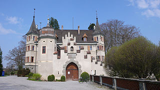
Pfäffikon is the principal town of the Municipality of Freienbach in the canton of Schwyz (SZ) in Switzerland. Together with Wollerau, Pfäffikon is considered the principal town of the district (Bezirk) of Höfe and the center of the region of Ausserschwyz. The former farm town is known today as cultural, economic and service center with its main focus on hedge funds. With 7,200 residents Pfäffikon is the third biggest town of the canton after Küssnacht and Einsiedeln.
Horgen District is a district of Canton of Zürich in Switzerland. The district is located in the Zimmerberg and Sihl Valley region on the left shore of Lake Zürich; its district capital is Horgen. In the northern part of the district, the municipalities have grown together with the city of Zürich, while in the south-western part, the Sihlwald is the largest contiguous natural mixed deciduous forest on the Swiss Plateau. The district consists of 11 municipalities and has a population of 127,263 and an area of 104.16 km2 (40.22 sq mi).

Sursee District is one of the five Ämtern, or districts, of the German-speaking Canton of Lucerne, Switzerland. Its capital is the town of Sursee. It has a population of 76,451. In 2013 the name was changed from Amt Sursee to Wahlkreis Sursee as part of a reorganization of the Canton. A sixth Wahlkreis was created, but in Sursee everything else remained essentially unchanged.

Kemmental is a municipality in the district of Kreuzlingen in the canton of Thurgau in Switzerland.
Kreuzlingen District is one of the five districts of the canton of Thurgau in Switzerland. It has a population of 49,760. Its capital is the city of Kreuzlingen.
Weinfelden District is one of the five districts of the canton of Thurgau, Switzerland. It has a population of 56,677. Its capital is the town of Weinfelden.

Alterswilen is a village and former municipality in the canton of Thurgau, Switzerland.
Altishausen is a village and former municipality in the canton of Thurgau, Switzerland.

Dotnacht is a village and former municipality in the canton of Thurgau, Switzerland.
Lippoldswilen is a village and former municipality in the canton of Thurgau, Switzerland.

Bettwiesen Castle is a castle in the municipality of Bettwiesen of the Canton of Thurgau in Switzerland. It is a Swiss heritage site of national significance.
Hauptwil Castle is a castle in the municipality of Hauptwil-Gottshaus of the Canton of Thurgau in Switzerland. It is a Swiss heritage site of national significance.

Seeburg Castle is a castle in the municipality of Kreuzlingen of the Canton of Thurgau in Switzerland. It is a Swiss heritage site of national significance.

Mammertshofen Castle is a castle in the municipality of Roggwil of the Canton of Thurgau in Switzerland. It is a Swiss heritage site of national significance.

Eugensberg Castle is a castle in the municipality of Salenstein of the Canton of Thurgau in Switzerland. It is a Swiss heritage site of national significance.

Louisenberg Castle is a castle in the municipality of Salenstein of the Canton of Thurgau in Switzerland. It is a Swiss heritage site of national significance.

Bachtobel Castle is a castle in the municipality of Weinfelden of the Canton of Thurgau in Switzerland. It is a Swiss heritage site of national significance.

Bildegg Castle is a castle in the municipality of Zihlschlacht-Sitterdorf of the Canton of Thurgau in Switzerland. It is a Swiss heritage site of national significance.

Salenegg Castle is a castle in the municipality of Maienfeld of the Canton of Graubünden in Switzerland. It is a Swiss heritage site of national significance.

The border between the modern states of Germany and Switzerland extends to 362 kilometres (225 mi), mostly following the High Rhine between Lake Constance and Basel.


