Huisje Mostinckx

Last updated
Huisje Mostinckx

BE-Dilbeek - huis mostinckx 1 - erfgoed nr 39053.jpg

Huisje Mostinckx
General information
Status Flemish monument
Type Farmhouse
Town or city Dilbeek
Country Belgium
Designations Museum
References
Flemish monument listing

Huisje Mostinckx (Dutch: house Mostinckx) is a farm on the village square of Sint-Martens-Bodegem, a subdivision of Dilbeek in Flemish Brabant, Belgium. The date of building is unknown, however mentions on the Ferraris maps of Belgium date it prior to 1777. The house is a Flemish protected monument since 1981. [1]

Dutch language West Germanic language

Dutch(Nederlands ) is a West Germanic language spoken by around 23 million people as a first language and 5 million people as a second language, constituting the majority of people in the Netherlands and Belgium. It is the third most widely spoken Germanic language, after its close relatives English and German.

Sint-Martens-Bodegem section of Dilbeek, Belgium

Sint-Martens-Bodegem is a historic village that is now part of Dilbeek. It has 2638 inhabitants.

Dilbeek Municipality in Flemish Community, Belgium

Dilbeek is a municipality in the province of Flemish Brabant, in Flanders, one of the three regions of Belgium. The municipality comprises the villages of Dilbeek proper, Groot-Bijgaarden, Itterbeek, Schepdaal, Sint-Martens-Bodegem, and Sint-Ulriks-Kapelle. Dilbeek is located just outside the Brussels-Capital Region, in the Pajottenland, hence the local name Poort van het Pajottenland. Even though Dilbeek is located in the Dutch language area of Belgium, there is a French-speaking minority represented by 4 members on the 33-seat local council. It is a mostly residential community with largely preserved rural areas and some industrial zones.

Contents

Name

The name of the farm comes from the last people that lived there: Sofie Mostinckx and her husband Karel de Pauw. The house was property of Sofies family. Karel had moved into Bodegem and was quickly called Karel Mostinckx by the locals. It is unknown how long the farm had been within the family, nor how old the farm is.

A first mention of the house dates back to 1556. The Ferraris maps show a farm on the location of huisje Mostinckx. In 1900 the Mostinckx family build a barn connected to the house. The barn currently houses a museum about hop production.

<i>Humulus lupulus</i> species of plant

Humulus lupulus is a species of flowering plant in the hemp family (Cannabaceae), native to Europe, western Asia and North America. It is a dioecious, perennial, herbaceous climbing plant which sends up new shoots in early spring and dies back to a cold-hardy rhizome in autumn.

Building

Huisje Mostinckx is a small farm made of loam, as was common in Pajottenland. Most of these farms no longer exist, and the house is protected as a Flemish monument since 1981. To conserve the heritage, the house was restored to its original state. The restoration was completed in 2011 and the house has been open to visitation ever since.

Loam Soil composed of similar proportions of sand and silt, and somewhat less clay

Loam is soil composed mostly of sand, silt, and a smaller amount of clay. By weight, its mineral composition is about 40–40–20% concentration of sand-silt-clay, respectively. These proportions can vary to a degree, however, and result in different types of loam soils: sandy loam, silty loam, clay loam, sandy clay loam, silty clay loam, and loam. In the USDA textural classification triangle, the only soil that is not predominantly sand, silt, or clay is called "loam". Loam soils generally contain more nutrients, moisture, and humus than sandy soils, have better drainage and infiltration of water and air than silt and clay-rich soils, and are easier to till than clay soils. The different types of loam soils each have slightly different characteristics, with some draining liquids more efficiently than others. The soil's texture, especially its ability to retain nutrients and water are crucial. Loam soil is suitable for growing most plant varieties.

The Pajottenland is a distinct region within the Flemish Brabant province of Belgium. The region is located west-southwest of Brussels. The Pajottenland is predominantly farmland, with occasional gently rolling hills, and lies mostly between the rivers Dender and Zenne / Senne. The area has historically provided food and drink for the citizens of Brussels, especially Lambic beers, which are only produced here and in the Zenne valley where Brussels is.

The house was built and restored with loam, as was usual in this area. Loam is naturally present in the soil and also all the other necessary building materials are easy to come by. When a family had more money, they would gradually replace the loam of the weakest walls with stone bricks. Because of this only the front of Huisje Mostinckx is made of loam.

Related Research Articles

Flemish Parliament elected legislative body of Flanders (Flemish Community and Flemish Region), Belgium

The Flemish Parliament constitutes the legislative power in Flanders, for matters which fall within the competence of Flanders, both as a geographic region and a cultural community of Belgium.

Redbournbury Mill

Redbournbury Mill, is a Grade II* listed flour mill in Redbournbury, Hertfordshire, England, which is thought to have been first built in the early 11th Century. Having operated as watermill on the River Ver, the mill is now powered by a diesel engine.

Steenwerck Commune in Hauts-de-France, France

Steenwerck is a commune, in French Flanders, in the Nord department in northern France. It is located about 25 km (16 mi) north of Lille and in 2013 had a population of 3519. People from Steenwerck are known as Steenwerckois.

Doel section of Beveren, Belgium

Doel is a subdivision of the municipality of Beveren in the Flemish province of East-Flanders. It is located near the river the Scheldt, in a polder of the Waasland.

Paston Great Barn

Paston Great Barn is a medieval barn near Paston Hall on the southeast edge of the village of Paston, in northeast Norfolk. It is owned by the North Norfolk Historic Buildings Trust. It dates from 1581 and is associated with the Paston family. It is a Scheduled Ancient Monument and a grade II* Listed Building. It is also a 1-hectare (2.5-acre) biological Site of Special Scientific Interest, a National Nature Reserve and a Special Area of Conservation. It is in the Norfolk Coast Area of Outstanding Natural Beauty.

The National Museum of Rural Life, previously known as the Museum of Scottish Country Life, is based at Wester Kittochside farm, lying between the town of East Kilbride in South Lanarkshire and the village of Carmunnock in Glasgow. It is run by National Museums Scotland.

Joseph de Ferraris Austrian cartographer

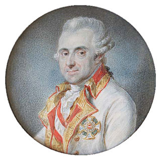
Joseph Jean François, count de Ferraris was an Austrian general and cartographer. He married to the daughter of Charles, 2nd Duke d'Ursel.

Oakhanger, Hampshire village in United Kingdom

Oakhanger is a village in the East Hampshire district of Hampshire, England. Its nearest town is Bordon, which lies 1.7 miles (2.7 km) east, of the B3004 road. The village is part of the parish of Selborne, which covers an area of 7,915 acres (3,203 ha). The nearest railway station is Alton, which is 3.8 miles (6.1 km) northwest of the village, although Oakhanger formerly had its own military railway station, Oakhanger Halt railway station on the Longmoor Military Railway, until its closure.

Bassemberg Commune in Grand Est, France

Bassemberg is a French commune in the Bas-Rhin department in the Alsace region of north-eastern France.

Oxon Cove Park and Oxon Hill Farm park and agricultural museum in Maryland, USA

Oxon Cove Park and Oxon Cove Farm is a national historic district that includes a living farm museum operated by the National Park Service, and located at Oxon Hill, Prince George's County, Maryland. It is part of National Capital Parks-East. It was listed on the National Register of Historic Places in 2003.

Sint-Agatha-Rode Place in Flemish Region, Belgium

Sint-Agatha-Rode, named after the third-century Christian martyr Saint Agatha of Sicily, is a Dutch-speaking village in Belgian province of Flemish Brabant and lies within the district of the town of Huldenberg. Historically Sint-Agatha-Rode was an independent municipality (Gemeente) until the merger of Belgian municipalities in 1977 when it was joined to the town of Huldenberg.

Itterbeek section of Dilbeek, Belgium

Itterbeek is a historical village in the province of Flemish Brabant, Belgium, and since 1977 a submunicipality of Dilbeek.

Great Manson Farm, Monmouth

Great Manson Farm is a property on the northern outskirts of Monmouth, Monmouthshire, Wales, in the Buckholt area. It is in the Manson Lane neighbourhood, within the electoral division of Dixton with Osbaston. During the course of the nineteenth and twentieth centuries, members of the Clarke, Goode, Clark, Dampier, and Morgan families resided at Great Manson Farm, at which time the reported size of the farm varied from 170 to 200 acres. The property is remarkable for the presence of three grade II listed buildings, including a barn with medieval origins.

Schaliehoeve old farmhouse

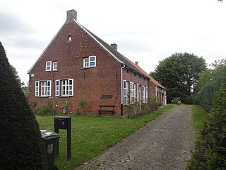
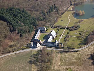
The Schaliehoeve is an old farmhouse in the Flemish village Boechout, located on the Heerbaan.

Taaienberg

The Taaienberg is a hill in the municipality of Maarkedal, in the Belgian province of East Flanders. With its top at 90 m, its is one of many hill formations in the Flemish Ardennes, in the south of East-Flanders. The slopes of the hill are paved in cobbles; in 1993 they were repaved with the original stones. The cobbled climb is one of the regular sites in Flemish cycling races in springtime. In 1995 the road of the Taaienberg was classified as a protected monument.

Grandpré Abbey abbey

Grandpré Abbey is a former Cistercian abbey located at Faulx-les-Tombes, in the province of Namur, Belgium. The only remains of the abbey are the gatehouse and the attached range at the main entrance, the farm buildings and the mill, once powered by the Samson brook, which crosses the site.

Bradfield Dale

Bradfield Dale is a rural valley which lies 12 km west-northwest of the City of Sheffield in England. The valley stands within the north eastern boundary of the Peak District National Park just to the west of the village of Low Bradfield. The dale is drained by the Strines Dike which becomes the Dale Dike lower down the valley, these being the headwaters of the River Loxley. The dale contains two reservoirs Strines and Dale Dike, and a third Agden Reservoir stands in a side valley just above Low Bradfield. The dale is characterised by agricultural land interspersed with farming and residential buildings. It is approximately 5 km in length from its foot at Low Bradfield to its head on Strines Moor.

Château de Beurthé castle in Steinbach (Gouvy), Belgium

Château de Beurthé or Château de Steinbach is a castle situated in the middle of the town centre of Steinbach, overlooking a vast park and the Steinbach river.

Gulliford Farm

Gulliford Farm is a Grade-II listed Tudor manor farm in East Devon, between Exmouth and Topsham. It is situated in the village of Exton, in the parish of Woodbury. Whilst parts of the out-buildings date back to the 14th Century, the majority of outbuildings date from the early 18th Century, and the main residential building dates to the 16th Century with later Georgian and Victorian additions and editions. The house and farm were held as Part of the Nutwell Estate until 1941, when it was bought by its long-term occupants, the Hallett family, under W.B. Hallett. The farm retired in 1989, following the death of the owner, W. Geoffrey Hallett.

References

  1. Monument number 39053, Huisje Mostinckx on the Flemish monument listing at inventaris.onroerenderfgoed.be.

Coordinates: 50°51′42.3″N4°12′44.85″E / 50.861750°N 4.2124583°E / 50.861750; 4.2124583

Geographic coordinate system Coordinate system

A geographic coordinate system is a coordinate system that enables every location on Earth to be specified by a set of numbers, letters or symbols. The coordinates are often chosen such that one of the numbers represents a vertical position and two or three of the numbers represent a horizontal position; alternatively, a geographic position may be expressed in a combined three-dimensional Cartesian vector. A common choice of coordinates is latitude, longitude and elevation. To specify a location on a plane requires a map projection.