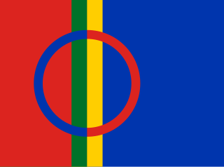
Sápmi is the cultural region traditionally inhabited by the Sámi people. Sápmi includes the northern parts of Fennoscandia, also known as the "Cap of the North".
Tysfjord (Norwegian) or Divtasvuodna (Lule Sami) is a former municipality in Nordland county, Norway. The municipality existed from 1869 until its dissolution in 2020. The area is now part of Narvik Municipality and Hamarøy Municipality in the traditional district of Ofoten. Its administrative centre was the village of Kjøpsvik. Other villages in Tysfjord included Drag, Hundholmen, Korsnes, Musken, Rørvika, Skarberget, and Storå.
Gihtsejiegŋa is one of the largest glaciers in mainland Norway. It is located in Narvik Municipality in Nordland county, about 20 kilometres (12 mi) southeast of the village of Kjøpsvik, on the border with Sweden. The name of the glacier comes from the Lule Sami language. The elevation of the glacier ranges from 1,500 to 870 metres above sea level. The highest point of the glacier sits right below the summit of the 1,520-metre (4,990 ft) tall Bjørntoppen.
Langvatnet (Norwegian) or Tjoaddnejávrre (Lule Sami) is a lake that lies on the border between Norway and Sweden. Almost all of the lake is located in Hamarøy Municipality in Nordland county, Norway with a very small part of the lake in Jokkmokk Municipality in Norrbotten County, Sweden. The 5.46-square-kilometre (2.11 sq mi) lake is located about 20 kilometres (12 mi) southeast of the village of Kjøpsvik in Tysfjord.
Muorkkejávrre (Lule Sami) or Eidevatnet or Eidvatnet (Norwegian) is a lake that lies in Fauske Municipality in Nordland county, Norway. The 5.94-square-kilometre (2.29 sq mi) lake lies about 75 metres (246 ft) west of the border with Sweden and about 10 kilometres (6.2 mi) east of the village of Sulitjelma. The water from the lake flows west into the neighboring lake Låmivatnet. The ending -jávrre is the Lule Sami word for "lake".

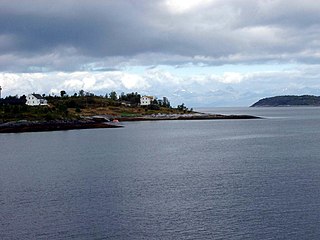
Kjøpsvik (Norwegian) or Gásluokta (Lule Sami) is a village in Narvik Municipality in Nordland county, Norway. The village is located on the eastern shore of the Tysfjorden, north of the small village of Storå. The island of Hulløya lies off the coast of Kjøpsvik. The 0.97-square-kilometre (240-acre) village has a population (2023) of 780 and a population density of 894 inhabitants per square kilometre (2,320/sq mi).

Drag (Norwegian) or Ájluokta (Lule Sami) is a village in Hamarøy Municipality in Nordland county, Norway. It is located along the Tysfjorden, about 180 kilometres (110 mi) northeast of the town of Bodø and about 110 kilometres (68 mi) south of the town of Narvik. The 0.45-square-kilometre (110-acre) village has a population (2023) of 305 and a population density of 678 inhabitants per square kilometre (1,760/sq mi).
Storå (Norwegian) or Jågåsijdda (Lule Sami) is a village in Narvik Municipality in Nordland county, Norway. It is located about 3 kilometres (1.9 mi) south of the village of Kjøpsvik, on the opposite side of the Tysfjorden. The village population has decreased significantly in the last 20 years, so now there are only a few residents living in Storå. The local economy consists of agriculture and fishing. There are ferry connections from here to the villages of Kjøpsvik and Drag.

Stetinden (Norwegian) or Stáddá (Lule Sami) is a mountain in Narvik Municipality in Nordland county, Norway. It is located about 15 kilometres (9 mi) northeast of the village of Kjøpsvik. The mountain has very smooth sides reaching all the way to the fjord. Stetinden has an obelisk-shape which gives it a very distinct look. In 2002 it was voted to be the "National Mountain" of Norway by listeners of NRK.
Finnøya (Norwegian) or Dirvik (Lule Sami) is an island in Hamarøy Municipality in Nordland county, Norway. The island is situated northwest of the village of Innhavet with which it is connected by bridge. The mountainous island has an area of 68 square kilometres (26 sq mi) and the highest point is the 436-metre (1,430 ft) tall mountain Straumfjellet. In 2016, the island of Finnøya had a population of 75.

Bognes (Norwegian) or Bognássje (Lule Sami) is a ferry port in Hamarøy Municipality in Nordland county, Norway. It is located in the outer part of the Tysfjorden on the western side of the fjord. The port is located about 5 kilometres (3.1 mi) south of the village of Korsnes and about 15 kilometres (9.3 mi) north of the village of Rørvika.

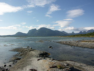
Tysfjorden (Norwegian) or Divtasvuodna (Lule Sami) is a fjord in Nordland county, Norway. The fjord is the border between Narvik Municipality and Hamarøy Municipality. The island of Hulløya is located about halfway through the fjord, right before the fjord splits in to several smaller branches. The Tysfjorden is the deepest fjord in Northern Norway reaching to 897 metres (2,943 ft) below sea level near Hulløya.

Musken (Norwegian) or Måsske (Lule Sami) is a village in Hamarøy Municipality in Nordland county, Norway. It lies halfway along the long and small Hellmofjorden, an arm of the Tysfjorden. The village is not far from Hellemobotn, where mainland Norway is at its narrowest, just 6 kilometres (3.7 mi) wide from the ocean shore to Sweden.
Rørvika (Norwegian) or Ráluokta (Lule Sami) is a village in Hamarøy Municipality in Nordland county, Norway. The village is located on the western side of the Tysfjorden, about 14 kilometres (8.7 mi) south of Bognes. The lake Kilvatnet lies about 2.5 kilometres (1.6 mi) to the west of the village.

Korsnes (Norwegian) or Hierenjárgga (Lule Sami) is a village in Hamarøy Municipality in Nordland county, Norway. The village is located about 5 kilometres (3.1 mi) north of Bognes, along the western shore of the Tysfjorden. Korsnes Church is located in the village.

Korsnes Church is a parish church of the Church of Norway in Hamarøy Municipality in Nordland county, Norway. It is located in the village of Korsnes. It is the church for the Korsnes parish which is part of the Ofoten prosti (deanery) in the Diocese of Sør-Hålogaland. The white, wooden church was built in a long church style in 1888 using plans drawn up by the architect Sigmund Brænne. The church seats about 80 people.

Kjøpsvik Church is a parish church of the Church of Norway in Narvik Municipality in Nordland county, Norway. It is located in the village of Kjøpsvik. It is the church for the Kjøpsvik parish which is part of the Ofoten prosti (deanery) in the Diocese of Sør-Hålogaland. The white, concrete church was built in a long church style in 1975 using plans drawn up by the architect Nils Toft. The church seats about 400 people.

Efjorden (Norwegian) or Áhtávuodna (Lule Sami) is a fjord in Narvik Municipality in Nordland county, Norway. It is an arm off of the main Ofotfjorden, stretching about 35 kilometres (22 mi) to the south. The Efjord Bridges on the European route E06 highway cross the fjord heading east on the way to the town of Narvik. The Norwegian National Road 827 follows the western shore of the fjord from the E6 highway heading south to the Efjord Tunnel which leads towards the village of Kjøpsvik.

Skarberget (Norwegian) or Skárffabákte (Lule Sami) is a ferry port and small village area in Narvik Municipality in Nordland county, Norway. The village is located on the eastern side of the Tysfjorden. Ferries operate from Skarberget across the Tysfjorden to Bognes as part of the European route E6 highway.
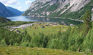
Hellmobotn is a village located in Hamarøy municipality, Norway. The Hellmofjorden is a fjord that runs through the valley, it is an arm off of Tysfjorden in Nordland.
