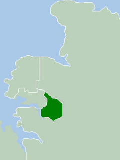
The Hundred of Milne is a cadastral unti of hundred in Palmerston County, Northern Territory, Australia. [2]
A hundred is an administrative division that is geographically part of a larger region. It was formerly used in England, Wales, some parts of the United States, Denmark, Southern Schleswig, Sweden, Finland, Estonia, and Norway. It is still used in other places, including South Australia, and The Northern Territory.

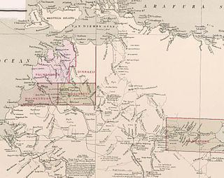
Palmerston County is one of the five counties in the Northern Territory which are part of the Lands administrative divisions of Australia. It contains the city of Darwin. It was proclaimed on 14 September 1871 and divided into hundreds. Being on the northern coast of the territory, it is bounded on the north and west by sea, the Adelaide River on the east and on the south by a line at longitude approximately 13°15' south.

The Northern Territory is an Australian territory in the central and central northern regions of Australia. It shares borders with Western Australia to the west, South Australia to the south, and Queensland to the east. To the north, the territory looks out to the Timor Sea, the Arafura Sea and the Gulf of Carpentaria, including Western New Guinea and other Indonesian islands. The NT covers 1,349,129 square kilometres (520,902 sq mi), making it the third-largest Australian federal division, and the 11th-largest country subdivision in the world. It is sparsely populated, with a population of only 246,700, making it the least-populous of Australia's eight states and major territories, with fewer than half as many people as Tasmania.
Bounded on the north by the Bynoe Harbour, the hundred was one of the first 13 hundreds gazetted in th territory in 1871, and was named after Sir William Milne, a Glasgow-born politician of South Australia. Milne carried a bill in the council authorising the construction of the Australian Overland Telegraph Line from Adelaide to Darwin.
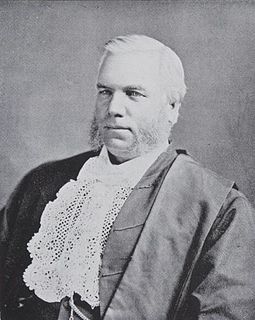
Sir William Milne was an Australian entrepreneur and politician, serving as the member for Onkaparinga in the South Australian House of Assembly from 1857 to 1868. He was elected to the South Australian Legislative Council in 1869, and was President of the South Australian Legislative Council from 25 July 1873 to 1881.

South Australia is a state in the southern central part of Australia. It covers some of the most arid parts of the country. With a total land area of 983,482 square kilometres (379,725 sq mi), it is the fourth-largest of Australia's states and territories by area, and fifth largest by population. It has a total of 1.7 million people, and its population is the second most highly centralised in Australia, after Western Australia, with more than 77 percent of South Australians living in the capital, Adelaide, or its environs. Other population centres in the state are relatively small; Mount Gambier, the second largest centre, has a population of 28,684.

The Australian Overland Telegraph Line was a 3200 km telegraph line that connected Darwin with Port Augusta in South Australia. Completed in 1872, the Overland Telegraph Line allowed fast communication between Australia and the rest of the world. An additional section was added in 1877 with the completion of the Western Australian section of the line. It was one of the great engineering feats of 19th-century Australia and probably the most significant milestone in Australia's telegraphic history.
Coordinates: 12°48′S130°36′E / 12.800°S 130.600°E

A geographic coordinate system is a coordinate system that enables every location on Earth to be specified by a set of numbers, letters or symbols. The coordinates are often chosen such that one of the numbers represents a vertical position and two or three of the numbers represent a horizontal position; alternatively, a geographic position may be expressed in a combined three-dimensional Cartesian vector. A common choice of coordinates is latitude, longitude and elevation. To specify a location on a plane requires a map projection.