
The Hundred of Reynolds is a cadastral hundred of the County of Victoria, South Australia. [1]
The Hundred of Reynolds is a cadastral hundred of the County of Victoria, South Australia. [1]
Hacks Lagoon Conservation Park is a protected area in the Australian state of South Australia located in the locality of Bool Lagoon about 24 kilometres south of the municipal seat of Naracoorte.
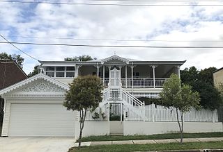
Australian residential architectural styles have evolved significantly over time, from the early days of structures made from relatively cheap and imported corrugated iron to more sophisticated styles borrowed from other countries, such as the Victorian style from the United Kingdom, the Georgian style from North America and Europe and the Californian bungalow from the United States. A common feature of the Australian home is the use of fencing in front gardens, also common in both the United Kingdom and the United States.
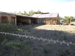
Australian non-residential architectural styles are a set of Australian architectural styles that apply to buildings used for purposes other than residence and have been around only since the first colonial government buildings of early European settlement of Australia in 1788.

Edward Reynolds was a bishop of Norwich in the Church of England and an author. He was born in Holyrood parish in Southampton, the son of Augustine (Austin) Reynolds, one of the customers of the city, and his wife, Bridget.

The Kaiserstuhl Conservation Park is a protected area located in the Australian state of South Australia in the suburb of Flaxman Valley about 80 kilometres (50 mi) north-east of the state capital of Adelaide and about 12 kilometres (7.5 mi) south-east of the town of Tanunda.
Reynolds may refer to:
Dutton is a settlement in South Australia. The small township lies approximately six kilometres (3.7 mi) north of Truro on the Eudunda Road. It was first laid out in 1866 and lots were advertised for sale in the German-language newspaper Südaustralische Zeitung.

Kongorong is a locality in the Australian state of South Australia located southwest of Mount Gambier. It has an Australian rules football team and netball team. Kongorong Primary School had 61 students in 2010.
Beyeria Conservation Park is a protected area in the Australian state of South Australia located on Kangaroo Island in the gazetted locality of Haines, about 16 kilometres south of Kingscote on the northern edge of the MacGillivray Plain.
Bernouilli Conservation Reserve is a protected area located in the Australian state of South Australia in the gazetted locality of Cape Jaffa about 21 kilometres south west of the township of Kingston SE in the state's Limestone Coast region. The conservation reserve was proclaimed under the Crown Lands Act 1929 on 11 November 1993. The name is derived from Cap Bernouilli, the former name of the headland of Cape Jaffa. The conservation reserve is classified as an IUCN Category VI protected area.

The County of Stanley is one of the 49 cadastral counties of South Australia. It was proclaimed by Governor George Grey and named for Edward Stanley, Secretary of State for the Colonies from 1841 to 1845, who, in 1842, had advocated financial support for South Australia. It is roughly bounded by the Wakefield River in the south, the approximate path of the Barrier Highway in the east, latitude 33°28' S in the north and longitudes 138°08' to 138°15' E in the west.

The County of Grey is one of the 49 cadastral counties of South Australia. It was proclaimed in 1846 by Governor Frederick Robe and named for former Governor George Grey. It covers the extreme south-east of the state from Penola and Lake George southwards. This includes the following contemporary local government areas of the state:
Peachna Conservation Park is a protected area in the Australian state of South Australia located on Eyre Peninsula in the gazetted locality of Tooligie about 100 kilometres (62 mi) north of Port Lincoln and about 30 kilometres (19 mi) south of Lock.
Carappee Hill Conservation Park is a protected area in the Australian state of South Australia located on the Eyre Peninsula in the gazetted locality of Darke Peak about 8 kilometres (5.0 mi) north-east of the town centre in Darke Peak.
Mullinger Swamp Conservation Park is a protected area in the Australian state of South Australia located in the state's south-east in the gazetted locality of Kybybolite on the border with the state of Victoria about 25 kilometres (16 mi) north-east of Naracoorte.
The County of Victoria is one of the 49 cadastral counties of South Australia. It was proclaimed by Governor Richard MacDonnell in 1857 and probably named for Queen Victoria. It covers an area of the Spencer Gulf coast and hinterland in the Mid North of the state from Port Pirie in the northwest to near Mount Bryan in the southeast, including most of the Broughton River watershed.
Clements Gap Conservation Park is a protected area located in the Mid North of South Australia about 15 kilometres (9.3 mi) west of Redhill, 20 kilometres (12 mi) north east of Port Broughton and 42 metres above sea level. The park preserves an area of natural bushland and the built remnants of a small historic agricultural township, Clements Gap, about 12 kilometres (7.5 mi) east of the Spencer Gulf coast. Maintained by the South Australian Department of Environment, Water and Natural Resources (DEWNR), the park is classified as an IUCN Category III Natural Monument or Feature. The park is named for the surrounding farming locality of Clements Gap, a reference to the co-located pass through the Barunga Range. The Clements Gap pass in turn is thought to be named after a shepherd in the area prior to 1880, per research by local historian Rodney Cockburn.
Maude is a locality on the Goyder Highway in the Mid North region of South Australia.

The Hundred of Reynolds was a hundred of the County of Gladstone in the Northern Territory of Australia which was created in 1873 and which lapsed in 1976. It is located 600 km south-east of the territorial capital of Darwin.
Sandy Creek Conservation Park, formerly the Sandy Creek National Park, is a protected area located in the Australian state of South Australia in the localities of Lyndoch and Sandy Creek about 42 kilometres (26 mi) north-east of the state capital of Adelaide and about 3 kilometres (1.9 mi) west-south-west of the town centre in Sandy Creek.
Date Named: 18/02/1869; Derivation of NameL Hon T Reynolds MP 1857-73; Other Details: Area 103 square miles.
| | This South Australia geography article is a stub. You can help Wikipedia by expanding it. |