The Hundred of Smith is a hundred in the County of Robe, in the Limestone Coast region of South Australia. [1]

The Hundred of Smith is a hundred in the County of Robe, in the Limestone Coast region of South Australia. [1]

Robe is a town and fishing port located in the Limestone Coast of South Australia. The town's distinctive combination of historical buildings, ocean, fishing fleets, lakes and dense bush is widely appreciated. Robe lies on the southern shore of Guichen Bay, just off the Princes Highway. At the 2016 census, Robe had a population of 998. Robe is the main town in the District Council of Robe local government area. It is in the state electorate of MacKillop and the federal Division of Barker.

The Hundred of Adelaide is a cadastral hundred in the city of Adelaide spanning all the inner suburbs south of River Torrens. It is one of the eleven hundreds of the County of Adelaide, and was one of the first hundreds to be proclaimed. Like the city it surrounds, the Hundred was named after Queen Adelaide, and was named by Governor Frederick Robe in 1846. It is 106 square miles (270 km2); close to but not exactly one hundred square miles as with most of the other hundreds. Its north boundary is the Torrens River and the Sturt River forms the south east boundary, with the hundred extending to the Adelaide foothills.
Victoria was an electorate in the South Australian House of Assembly from 1857 until 1902 and from 1915 to 1993.
Guichen Bay Conservation Park is a protected area in the Australian state of South Australia overlooking Guichen Bay located in the gazetted locality of Mount Benson about 8 kilometres north of the town centre of Robe.
Bernouilli Conservation Reserve is a protected area located in the Australian state of South Australia in the gazetted locality of Cape Jaffa about 21 kilometres south west of the township of Kingston SE in the state's Limestone Coast region. The conservation reserve was proclaimed under the Crown Lands Act 1929 on 11 November 1993. The name is derived from Cap Bernouilli, the former name of the headland of Cape Jaffa. The conservation reserve is classified as an IUCN Category VI protected area.

The County of Grey is one of the 49 cadastral counties of South Australia. It was proclaimed in 1846 by Governor Frederick Robe and named for former Governor George Grey. It covers the extreme south-east of the state from Penola and Lake George southwards. This includes the following contemporary local government areas of the state:

The County of Robe is one of the 49 cadastral counties of South Australia. It was proclaimed by and named for Governor Frederick Robe in 1846. It covers a portion of the state's south-east from the west coast at Robe to the border with Victoria on the east. This includes the following contemporary local government areas of the state:

The Hundred of Kadina is a cadastral unit of hundred located on the north-western Yorke Peninsula in South Australia. It is one of the 16 hundreds of the County of Daly and was proclaimed by Governor Dominick Daly on 12 June 1862.

The Hundred of Talunga is a cadastral hundred of the County of Adelaide, South Australia, spanning the Torrens Valley in the Adelaide Hills. It was proclaimed by Governor Frederick Robe in 1846 and named for an indigenous term thought to mean 'waterhole'.

The Hundred of Waterhouse is a cadastral hundred of the County of Robe, South Australia, established in 1846.

The Hundred of Robertson is a Hundred of the County of Robe in South Australia. The hundred is located on the Limestone Coast region, south east of the state capital of Adelaide. The Hundred is located inland from the coast.

The Hundred of Barossa is a cadastral unit of hundred in South Australia in the northern Adelaide Hills. It lies west of the Barossa Range at the south end of the Barossa Valley and is bounded on the north and south by the North Para and South Para rivers, respectively. It is the most northern of the eleven hundreds of the County of Adelaide and was named in 1846 by Governor Frederick Robe after the Barossa Range.
The Hundred of Onkaparinga is a cadastral hundred of the County of Adelaide, South Australia, in the Adelaide Hills. It was proclaimed by Governor Frederick Robe in 1846 and named for the Onkaparinga River valley, which flows from north east to south west through the hundred.

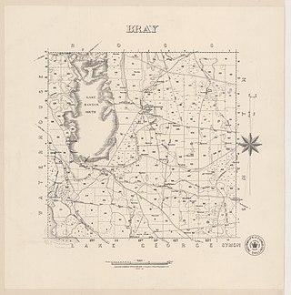
The Hundred of Bray, is a hundred in the County of Robe within the Limestone Coast region of South Australia.
Bray is a locality in South Australia, roughly contiguous with the land administration division, the Hundred of Bray, after which it was named. It is located within the federal division of Barker, the state electoral district of MacKillop and the local government areas of the District Council of Robe and the Wattle Range Council.

The Hundred of Killanoola is a hundred in the County of Robe in the Limestone Coast region of South Australia.

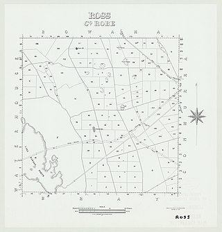
The Hundred of Ross, is a hundred in the County of Robe in the Limestone Coast region of South Australia.

The Hundred of Bowaka, is a hundred in the County of Robe, within the Limestone Coast region of South Australia. The hundred is located at 36°55′38″S 140°1′33″E.

The Hundred of Mount Benson, is a hundred in the County of Robe, within the Limestone Coast region of South Australia.
Woakwine Conservation Park is a protected area located in the Australian state of South Australia in the locality of Robe about 272 kilometres (169 mi) south-east of the state capital of Adelaide and about 8 kilometres (5.0 mi) east of the town centre in Robe.