
The Hundred of Waroonee is a hundred of the County of Herbert, South Australia, [1] [2] [3] founded in 1880. [4]
Waroonee covers an area of 470 square kilometres (183 sq mi) and its name is derived from an Aboriginal word meaning ‘place of burning'.
The Hundred of Waroonee is a hundred of the County of Herbert, South Australia, [1] [2] [3] founded in 1880. [4]
Waroonee covers an area of 470 square kilometres (183 sq mi) and its name is derived from an Aboriginal word meaning ‘place of burning'.

Billiatt Conservation Park, formerly the Billiatt National Park, is a protected area in the Australian state of South Australia located in the locality of Sandalwood about 200 kilometres (120 mi) east of the state capital of Adelaide.

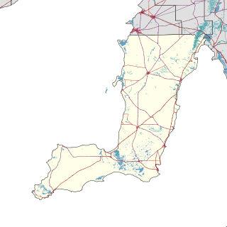
The District Council of Lower Eyre Peninsula is a local government area located on Eyre Peninsula in South Australia. The district covers the southern tip of the peninsula, except for the small area taken up by the City of Port Lincoln.
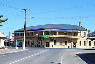
Yorketown is a town and a locality in the Australian state of South Australia located in the southern Yorke Peninsula about 91 kilometres (57 mi) west of the state capital of Adelaide and about 70 kilometres (43 mi) south of the municipal seat of Maitland. At the 2016 census, the locality had a population of 969 of which 642 lived in its town centre.
Arthurton is a town and locality in the Australian state of South Australia. At the 2016 census, Arthurton had a population of 148.

Kongorong is a locality in the Australian state of South Australia located southwest of Mount Gambier. It has an Australian rules football team and netball team. Kongorong Primary School had 61 students in 2010.

Price is a town and locality on Yorke Peninsula in South Australia. It is within the Yorke Peninsula Council local government area and is 131 kilometres (81 mi) north west of the centre of state capital, Adelaide.

The County of Hindmarsh is one of the 49 cadastral counties of South Australia. It was proclaimed by Governor George Grey in 1842 and named for Governor John Hindmarsh.

The Hundred of Dudley is a cadastral unit of hundred located in the Australian state of South Australia on Kangaroo Island and which covers an area of 300 square kilometres (117 sq mi) including the full extent of the Dudley Peninsula and some land to the west of the peninsula.

Pine Creek is a rural locality in the Mid North region of South Australia, situated in the Regional Council of Goyder. It was established in August 2000 when boundaries were formalised for the long established local name.

County of Burra is a cadastral unit located in the Australian state of South Australia which covers land located in the state’s east associated with the town of Burra. It was proclaimed in 1851 by Governor Young and named after the town of Burra.

County of Buxton is a cadastral unit located in the Australian state of South Australia that covers land located in the centre of Eyre Peninsula. It was proclaimed in 1896 and named after Thomas Buxton who was the Governor of South Australia from 29 October 1895 to 29 March 1899. It has been divided into thirteen sub-divisions known as hundreds, with the most recent being created in 1928.

Yalpara is a locality in the Australian state of South Australia located about 265 kilometres (165 mi) north of the state capital of Adelaide and about 29 kilometres (18 mi) north-east of the municipal seat in Orroroo.

County of Taunton is a cadastral unit located in the Australian state of South Australia on land on the east coast of Lake Torrens about 160 kilometres (99 mi) from the city of Port Augusta. It was proclaimed in 1877 and named after Lord Taunton who was the Secretary for the Colonies from 1855 to 1858. It has been partially divided in the following sub-units of hundreds – Bunyeroo, Carr, Edeowie, Nilpena, Oratunga and Parachilna.
Maude is a locality on the Goyder Highway in the Mid North region of South Australia.

County of Blachford is a cadastral unit located in the Australian state of South Australia that covers land between the east coast of Lake Torrens and the western side of the Flinders Ranges about 90 kilometres (56 mi) north-east of the city of Port Augusta. It was proclaimed in 1877 and named after Frederic Rogers, 1st Baron Blachford who was the Under Secretary of State for the Colonies from 1860 to 1871. It has been partially divided in the following sub-units of hundreds – Barndioota, Cotabena, Warrakimbo, Wonoka and Woolyana.

County of Herbert is a cadastral unit located in the Australian state of South Australia that covers land to the east of the Flinders Ranges about 55 kilometres (34 mi) north-east of the town of Peterborough. It was proclaimed in 1877 and named after a prominent man of the time with either a title or a surname containing the name ‘Herbert’. It has been partially divided in the following sub-units of hundreds – Cavenagh, Coglin, Minburra, Nackara, Paratoo and Waroonee.
Moockra is a locality in the Australian state of South Australia located on the eastern side of the Flinders Ranges about 274 kilometres (170 mi) north of the state capital of Adelaide and about 47 kilometres (29 mi) north-east and 36 kilometres (22 mi) south-east respectively of the municipal seats of Melrose and Quorn.
Ramco Point Conservation Park is a protected area located in the Australian state of South Australia in the locality of Sunlands about 150 kilometres (93 mi) north-east of the state capital of Adelaide and about 7 kilometres (4.3 mi) north-west of the municipal seat of Waikerie.

County of Kimberley is a cadastral unit located in the Australian state of South Australia that covers land to the east of the Flinders Ranges about 45 kilometres (28 mi) east of the town of Peterborough. It was proclaimed in 1871 and named after John Wodehouse, 1st Earl of Kimberley, a British Secretary of State for the Colonies. It has been partially divided in the following sub-units of hundreds – Gumbowie, Hardy, Ketchowla, Parnaroo, Terowie and Wonna.

County of Hanson is a cadastral unit located in the Australian state of South Australia that covers land in the Flinders Ranges immediately east of the town of Hawker. It was proclaimed on 20 July 1877 and is named after Sir Richard Davies Hanson who served as Premier, Administrator and Chief Justice of South Australia. It has been partially divided in the following sub-units of hundreds – Adams, Arkaba, French, Moralana and Warcowie.
| | This South Australia geography article is a stub. You can help Wikipedia by expanding it. |