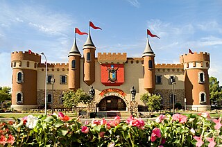
Tavernier is a census-designated place (CDP) and unincorporated community in Monroe County, Florida, United States on Key Largo, the largest island in the upper Florida Keys. Tavernier's population was 2,173 at the 2000 census.

Yates City is a village in Knox County, Illinois, United States. The population was 693 at the 2010 census. It is part of the Galesburg Micropolitan Statistical Area.

Pleasantville, also known as Alum Bank, is a borough in Bedford County, Pennsylvania, United States. The population was 198 at the 2010 census.
The West Branch of the Little Dead Diamond River is a 2.5-mile (4.0 km) long river in northern New Hampshire in the United States. It is a tributary of the Little Dead Diamond River, located in the Androscoggin River watershed of Maine and New Hampshire.
Huis ter Heide is a hamlet in the Netherlands and it is part of the Noordenveld municipality in Drenthe. Its population was 124 in 2006.
Muddy Creek is a tributary of Slippery Rock Creek in Butler and Lawrence Counties in Pennsylvania in the United States. The run is 23.2 miles (37.3 km) long, flows generally west, and its watershed is 58.2 square miles (150.7 km2) in area. Muddy Creek is the main water source for Lake Arthur in Moraine State Park.
Bayanjargalan is a sum of Töv Province in Mongolia.

Conavalla is a mountain in Wicklow Mountains in County Wicklow, Ireland.

Ogilville is an unincorporated community in Ohio Township, Bartholomew County, Indiana. The community is located along State Road 58 close to where it crosses over East Fork White Creek. It is located southwest on SR 58 of North Ogilville.
Royal is an unincorporated community on U.S. Route 401, in southeastern Franklin County, North Carolina. It lies at an elevation of 377 feet. The primary cross roads where the community is located are U.S. Highway 401, Flat Rock Church Road and Clifton Pond Road.

Vanderbilt Reef is a rocky outcropping in Lynn Canal, a fjord in Alaska, United States at 58°35′31″N135°0′55″W. The outcropping is visible just above the water's surface.

Tsaghkunk is a town in the Armavir Province of Armenia. The town's church dates from the 19th century.
Nouga is a commune in the Cercle of Kangaba in the Koulikoro Region of south-western Mali. The principal town lies at Keliegoue. As of 1998 the commune had a population of 7736.

Oroleve is an unincorporated community in Butte County, California. It lies at an elevation of 3337 feet.

Walsh is an unincorporated community located in the town of Porterfield, in Marinette County, Wisconsin, United States.

Golfland Entertainment Centers are a chain of family amusement centers, miniature golf courses, and water parks located in California and Arizona. The company was founded in 1953.
Sexton Hill is an unincorporated community in Richmond County, in the U.S. state of Virginia.
Koigi is a village in Saaremaa Parish, Saare County in western Estonia.
Shadehill is an unincorporated community in Perkins County, in the U.S. state of South Dakota.
Millett is an extinct town in Nye County, in the U.S. state of Nevada. The GNIS classifies it as a populated place.


