Related Research Articles

Tippah County is a county located on the northern border of the U.S. state of Mississippi. As of the 2020 census, the population was 21,815. Its county seat is Ripley. The name "Tippah" is derived from a Chickasaw language word meaning "cut off." It was taken from the creek of the same name that flows across much of the original county from northeast to southwest before emptying into the Tallahatchie River. The creek probably was so named because it, and the ridges on either side, "cut off" the western part of the region from the eastern portion.

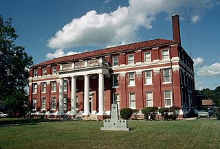
Tallahatchie County is a county in the U.S. state of Mississippi. At the 2020 census, the population was 12,715. Its county seats are Charleston and Sumner.

Prentiss County is a county located in the U.S. state of Mississippi. As of the 2020 census, the population was 25,008. Its county seat is Booneville. The county is named for Seargent Smith Prentiss, a noted speaker and US Congressman from Natchez.
Lawrence County is a county located in the U.S. state of Mississippi. As of the 2020 census, the population was 12,016. Its county seat is Monticello. The county is named for the naval hero James Lawrence.

Calhoun County is a county located in the U.S. state of Mississippi. As of the 2020 census, the population was 13,266. Its county seat is Pittsboro. The county is named after John C. Calhoun, the U.S. Vice President and U.S. Senator from South Carolina.

Silver Creek is a town in Lawrence County, Mississippi, United States. The population was 210 at the 2010 census. Silver Creek is accessed from U.S. Route 84 and Mississippi Highway 43. The film Jesse James' Women (1954) was filmed in Silver Creek.
The Sunflower River is one of the main tributaries of the Yazoo River in the U.S. state of Mississippi. It is navigable by barge for 50 miles. It rises in DeSoto County, Mississippi near the Tennessee border and flows south for 100 miles to the Yazoo River, a major tributary of the Mississippi River. At Clarksdale, the county seat of Coahoma County, the annual Sunflower River Blues & Gospel Festival is held.

The Tennessee–Tombigbee Waterway is a 234-mile (377 km) artificial U.S. waterway built in the 20th century from the Tennessee River to the junction of the Black Warrior-Tombigbee River system near Demopolis, Alabama. The Tennessee–Tombigbee Waterway links commercial navigation from the nation's midsection to the Gulf of Mexico. The major features of the waterway are 234 miles (377 km) of navigation channels, a 175-foot-deep (53 m) cut between the watersheds of the Tombigbee and Tennessee rivers, and ten locks and dams. The locks are 9 by 110 by 600 feet, the same dimension as those on the Mississippi above Lock and Dam 26 at Alton, Illinois. Under construction for 12 years by the U.S. Army Corps of Engineers, the Tennessee–Tombigbee Waterway was completed in December 1984 at a total cost of nearly $2 billion.

The Yalobusha River is a river, 165 miles (266 km) long, in north-central Mississippi in the United States. It is a principal tributary of the Yazoo River, via which it is part of the watershed of the Mississippi River.
Sulphur Springs is an unincorporated community in eastern Jefferson County, Missouri, United States. It is located near Barnhart, bordering the banks of Glaize Creek and the Mississippi River.
There are several lakes named Mud Lake within the U.S. state of Mississippi.

Hushpuckena is an unincorporated community located in Bolivar County, Mississippi, United States along U.S. Route 61. Hushpuckena is located approximately 3 miles (4.8 km) south of Duncan and approximately 4 miles (6.4 km) north of Shelby. Hushpuckena is located on the former Yazoo and Mississippi Valley Railroad. Hushpuckena was named after the Hushpuckena River.
Establishment Creek is a stream in Ste. Genevieve County in the U.S. state of Missouri. It is a tributary of the Mississippi River.
Arkabutla Creek is a stream in the U.S. state of Mississippi. It is a tributary to the Coldwater River.
Chiwapa Creek is a stream in the U.S. state of Mississippi. It is a tributary to Town Creek.
Chuquatonchee Creek is a stream in Chickasaw, Clay and Pontotoc counties in the U.S. state of Mississippi. It is a tributary to Tibbee Creek.
Hickahala Creek is a stream in the U.S. state of Mississippi.
Old Fannegusha Creek is a stream in Holmes County the U.S. state of Mississippi. It is a tributary to Tchula Lake.
Tillatoba Creek is a stream in the U.S. state of Mississippi. It is a tributary to the Tallahatchie River.
Topisaw is an unincorporated community in Pike County, in the U.S. state of Mississippi.
References
- 1 2 U.S. Geological Survey Geographic Names Information System: Hushpuckena Creek
- ↑ Baca, Keith A. (2007). Native American Place Names in Mississippi. University Press of Mississippi. p. 43. ISBN 978-1-60473-483-6.
34°10′24″N90°48′09″W / 34.1734398°N 90.8026046°W