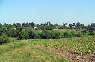
The Southern Bug, also called Southern Buh, and sometimes Boh River, is a navigable river located in Ukraine. It is the second-longest river in Ukraine.

The Khumbu Glacier is located in the Khumbu region of northeastern Nepal between Mount Everest and the Lhotse-Nuptse ridge. With elevations of 4,900 m (16,100 ft) at its terminus to 7,600 m (24,900 ft) at its source, it is the world's highest glacier. The Khumbu Glacier is followed for the final part of the trail to one of the Everest Base Camps. The start of the glacier is in the Western Cwm near Everest. The glacier has a large icefall, the Khumbu Icefall, at the west end of the lower Western Cwm. This icefall is the first major obstacle—and among the more dangerous—on the standard south col route to the Everest summit. It is also the largest glacier of Nepal.

The Mahi is a river in western India. It rises in Madhya Pradesh and, after flowing through the Vagad region of Rajasthan, enters Gujarat and flows into the Arabian Sea. It is one of the many west-flowing rivers in India, along with Tapti River, Sabarmati River, Luni River and the Narmada River. Most peninsular rivers in India flow in an easterly direction into the Bay of Bengal.

Ungheni is a commune in the southwestern part of Argeș County, Romania. It is composed of six villages: Colțu, Găujani, Goia, Humele, Satu Nou and Ungheni.

Vĩnh Long is a city and the capital of Vĩnh Long Province in Vietnam's Mekong Delta. Vĩnh Long covers 48.1 kilometres (29.89 mi) and has a population of 147,039.
Kampong Svay is a khum (commune) of Serei Saophoan District in Banteay Meanchey Province in north-western Cambodia.
Hiệp Hòa is one of nine rural districts of Bắc Giang Province in the Northeast region of Vietnam. As of 2003 the district had a population of 210,980. The district covers an area of 201 km2. The district capital lies at Thắng. This is the home country of Trạng nguyên Đoàn Xuân Lôi of the Trần Dynasty, Tiến sĩ Trịnh Ngô Dụng of the Lê Dynasty, Đình nguyên Nguyễn Đình Tuân of the Nguyễn Dynasty.
Balia, Bangladesh may refer to the following locations in Bangladesh:

Jinfeng Township is a mountain indigenous township in Taitung County, Taiwan. The main population is the Paiwan people of the Taiwanese aborigines.

Smólsk is a village in the administrative district of Gmina Włocławek, within Włocławek County, Kuyavian-Pomeranian Voivodeship, in north-central Poland. It lies approximately 8 kilometres (5 mi) south-west of Włocławek and 54 km (34 mi) south-east of Toruń.
Capel Bangor is a small village in Ceredigion, in Wales. Its population is around 600-1000, and it is also approximately five miles from the seaside and university town of Aberystwyth.

Przesiadłów is a village in the administrative district of Gmina Ujazd, within Tomaszów Mazowiecki County, Łódź Voivodeship, in central Poland. It lies approximately 10 kilometres (6 mi) north of Tomaszów Mazowiecki and 41 km (25 mi) south-east of the regional capital Łódź.

Karuah River, an open semi-mature tide dominated drowned valley estuary is located in the Mid North Coast and Hunter regions of New South Wales, Australia.

Zbiroża is a village in the administrative district of Gmina Mszczonów, within Żyrardów County, Masovian Voivodeship, in east-central Poland. It lies approximately 6 kilometres (4 mi) east of Mszczonów, 15 km (9 mi) south-east of Żyrardów, and 39 km (24 mi) south-west of Warsaw.

Savitri River is one of the 5 rivers which originate from Mahabaleshwar in Maharashtra state in India.It originates at Savitri point near Mahabaleshwar and flows through Raigad district and eventually meets Arabian Sea at Harehareshwar. It passes through rocky and hilly terrain of western ghats till Poladpur and further through the towns of Mahad, Mangaon and Shrivardhan Tehsil (taluka). There are a number of Shiva temples along the banks of river Savitri. Many other small rivers get merged into it at Kapade, Poladpur and Birwadi. Its major tributary is the Kal River which enters from the right (north) near Dasgaon.
The Kodavanar, is a river in the Palni Hills in Tamil Nadu.
Lokur is a village in Athni tehsil, Belgaum district, in the state of Karnataka, India. According to Census 2011 information the location code or village code of Lokur village is 597287. It is 32 kilometres (20 mi) from the sub-district headquarters at Athni and 122 kilometres (76 mi) from the district headquarters at Belgaum. As per 2009 stats, Mangasuli is the gram panchayat of Lokur village.
Nattar is a river flowing in the Tiruvarur district of the Indian state of Tamil Nadu.
Felsőtold is a village in Nógrád County, Hungary with 175 inhabitants (2001).


