Related Research Articles

Tippah County is a county located on the northern border of the U.S. state of Mississippi. As of the 2020 census, the population was 21,815. Its county seat is Ripley. The name "Tippah" is derived from a Chickasaw language word meaning "cut off." It was taken from the creek of the same name that flows across much of the original county from northeast to southwest before emptying into the Tallahatchie River. The creek probably was so named because it, and the ridges on either side, "cut off" the western part of the region from the eastern portion.

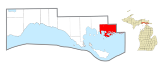
Comstock Charter Township is a charter township of Kalamazoo County in the U.S. state of Michigan, located east of the city of Kalamazoo and is part of the Kalamazoo–Portage Metropolitan Area. The 2020 census recorded the population within the township at 15,231.
Clark Township is a civil township of Mackinac County in the U.S. state of Michigan. As of the 2020 census, the population was 1,917, down from 2,256 in 2010.

Rayburn Township is a township that is located in Armstrong County, Pennsylvania, United States. The population was 1,766 at the time of the 2020 census, a decrease from the figure of 1,907 that was tabulated in 2010.

The Tombigbee River is a tributary of the Mobile River, approximately 200 mi (325 km) long, in the U.S. states of Mississippi and Alabama. Together with the Alabama, it merges to form the short Mobile River before the latter empties into Mobile Bay on the Gulf of Mexico. The Tombigbee watershed encompasses much of the rural coastal plain of western Alabama and northeastern Mississippi, flowing generally southward. The river provides one of the principal routes of commercial navigation in the southern United States, as it is navigable along much of its length through locks and connected in its upper reaches to the Tennessee River via the Tennessee-Tombigbee Waterway.
The Obey River is a 47.8-mile-long (76.9 km) tributary of the Cumberland River in the U.S. state of Tennessee. It joins the Cumberland River near the town of Celina, which is generally considered to be the Cumberland's head of navigation. Via the Cumberland and Ohio rivers, the Obey River is part of the Mississippi River watershed.
The Strong River is a 95.2-mile-long (153.2 km) river in south-central Mississippi in the United States. It is a tributary of the Pearl River, which flows to the Gulf of Mexico.

Sugar Creek is an 82.4-mile-long (132.6 km) tributary of the Driftwood River in east-central Indiana in the United States. Via the Driftwood, White, Wabash and Ohio rivers, it is part of the watershed of the Mississippi River.
Cottonwood River Provincial Park is a provincial park in British Columbia, Canada, located northeast of the confluence of the Fraser and Cottonwood Rivers in that province's North Cariboo region.
Plantation Key, Florida is a former census-designated place on Plantation Key in the Florida Keys, in Monroe County, Florida, United States. It is located just South of the Tavernier bridge and North of the Snake Creek bridge and was reported to have a population of 4,405 in 1990. It became part of the Village of Islamorada when the latter incorporated in 1997.
Coldwater River is a 29.5-mile-long (47.5 km) stream in the U.S. state of Michigan. Located in Branch County, the river rises in Ovid Township at 41°50′14″N84°59′13″W as the outflow of Coldwater Lake. Flowing north and west, it is joined by the outflow from the Lake of the Woods and continues north for several miles. West of the city of Coldwater, it flows through a series of lakes: South Lake, Messenger Lake, Cemetery Lake, North Lake, Randall Lake, Morrison Lake, Craig Lake, and Hodunk Pond. It then continues to the northwest and empties into the St. Joseph River in the village of Union City at 42°03′58″N85°07′48″W.
The Nickel District Conservation Authority is a conservation authority in Greater Sudbury, Ontario. Formed in 1973 by the merger of two former conservation authorities in the region, the Junction Creek Conservation Authority in Sudbury and the Whitson Valley Conservation Authority in Valley East, the authority oversees the conservation, restoration, development and management of natural resources in the Sudbury area.

The Betsie River is a 54.0-mile-long (86.9 km) river in the U.S. state of Michigan. The river is located in the northwestern Lower Peninsula of the state, flowing into Lake Michigan at Frankfort. The river's course is mostly within Benzie County,, although the river rises in western Grand Traverse County and flows briefly through northern Manistee County.
Vallecito Creek is a tributary stream of Carrizo Creek, in San Diego County, California.
Vallecito Wash is a wash part of Vallecito Creek, a tributary stream of Carrizo Creek, in San Diego County, California.
Finn Creek is a stream in the U.S. state of Washington.
Indian Creek is a stream in Cape Girardeau County in the U.S. state of Missouri. It is a tributary of the Mississippi River.
Twelvemile Creek is a stream in Madison County in the U.S. state of Missouri. It is a tributary of St. Francis River.
North River is an unincorporated community in Marion County, in the U.S. state of Missouri.
References
- 1 2 U.S. Geological Survey Geographic Names Information System: Ichusa Creek
- ↑ Baca, Keith A. (2007). Native American Place Names in Mississippi. University Press of Mississippi. p. 43. ISBN 978-1-60473-483-6.
31°59′05″N85°29′23″W / 31.98472°N 85.48972°W