
Whatcom County is a county located in the northwestern corner of the U.S. state of Washington, bordered by the Lower Mainland of British Columbia to the north, Okanogan County to the east, Skagit County to the south, San Juan County across Rosario Strait to the southwest, and the Strait of Georgia to the west. Its county seat and largest population center is the coastal city of Bellingham, comprising the Bellingham, WA Metropolitan Statistical Area, and as of the 2020 census, the county's population was 226,847.

Snohomish County is a county located in the U.S. state of Washington. With a population of 827,957 as of the 2020 census, it is the third-most populous county in Washington, after nearby King and Pierce counties, and the 72nd-most populous in the United States. The county seat and largest city is Everett. The county forms part of the Seattle metropolitan area, which also includes King and Pierce counties to the south.
Skagit County is a county in the U.S. state of Washington. As of the 2020 census, the population was 129,523. The county seat and largest city is Mount Vernon. The county was formed in 1883 from Whatcom County and is named for the Skagit Indian tribe, which has been indigenous to the area prior to European-American settlement.
San Juan County is a county in the Salish Sea in the far northwestern corner of the U.S. state of Washington. As of the 2020 census, its population was 17,788. The county seat and only incorporated town is Friday Harbor, on San Juan Island. The county was formed on October 31, 1873, from Whatcom County and is named for the San Juan Islands, which are in turn named for Juan Vicente de Güemes, 2nd Count of Revillagigedo, the Viceroy of New Spain.

Island County is a county located in the U.S. state of Washington. As of the 2020 census, its population was 86,857. Its county seat is Coupeville, while its largest city is Oak Harbor.

Alger is a census-designated place (CDP) in Skagit County, Washington, United States. The population was 507 at the 2020 census. It is included in the Mount Vernon–Anacortes, Washington Metropolitan Statistical Area.
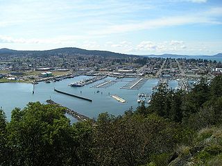
Anacortes is a city in Skagit County, Washington, United States. The name "Anacortes" is an adaptation of the name of Anne Curtis Bowman, who was the wife of early Fidalgo Island settler Amos Bowman. Anacortes' population was 17,637 at the time of the 2020 census. It is one of two principal cities of and included in the Mount Vernon-Anacortes Metropolitan Statistical Area.

Burlington is a city in Skagit County, Washington, United States. Its population was recorded as 9,152 in the 2020 census. Burlington is located approximately halfway between Seattle and Vancouver, Canada. The city is included in the Mount Vernon–Anacortes, Washington Metropolitan Statistical Area.

Clear Lake is a census-designated place (CDP) in Skagit County, Washington, United States. The population was 1,228 at the 2020 census. It is included in the Mount Vernon–Anacortes, Washington Metropolitan Statistical Area.

Concrete is a town in north-central Skagit County, Washington, United States. It is part of the Mount Vernon-Anacortes, Washington Metropolitan Statistical Area, and had a population of 801 at the 2020 census.

La Conner is a town in Skagit County, Washington, United States with a population of 965 at the 2020 census. It is included in the Mount Vernon–Anacortes, Washington Metropolitan Statistical Area. The town hosts several events as part of the annual Skagit Valley Tulip Festival held in April.

Marblemount is a census-designated place in Skagit County, Washington, United States. The population was 286 at the 2020 census. It is included in the Mount Vernon–Anacortes, Washington Metropolitan Statistical Area.
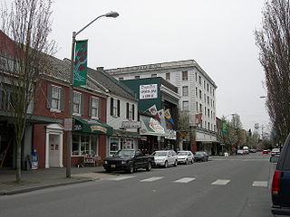
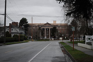
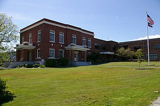
Mount Vernon is the most populous city in, and county seat of, Skagit County, Washington, United States. A central location in the Skagit River Valley, the city is located 51 miles (82 km) south of the U.S.–Canada border and in between Vancouver, British Columbia and Seattle. The population was 35,219 at the 2020 census, making it the 35th most-populous city in Washington, with a larger 62,966 people living in its urban area. It is one of two principal cities of and included in the Mount Vernon-Anacortes, Washington Metropolitan Statistical Area, covering most of Skagit County.

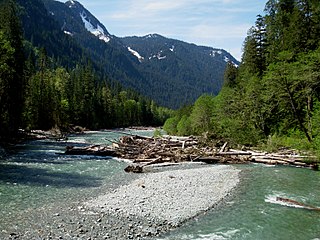
The Skagit River is a river in southwestern British Columbia in Canada and northwestern Washington in the United States, approximately 150 mi (240 km) long. The river and its tributaries drain an area of 1.7 million acres (690,000 hectares) of the Cascade Range along the northern end of Puget Sound and flows into the sound.
The Baker River is an approximately 30-mile (48 km), southward-flowing tributary of the Skagit River in northwestern Washington in the United States. It drains an area of the high North Cascades in the watershed of Puget Sound north of Seattle, and east of Mount Baker. With a watershed of approximately 270 square miles (700 km2) in a complex of deep valleys partially inside North Cascades National Park, it is the last major tributary of the Skagit before the larger river reaches its mouth on Skagit Bay. The river flows through Concrete, Washington, near its mouth and has two hydroelectric dams owned by Puget Sound Energy.

The Samish River is approximately 25 miles (40 km) long, in northwestern Washington in the United States. The river drains an area of 139 square miles (360 km2) between the Skagit River basin on the south and the Nooksack River basin on the north. The Samish River originates on a low divide in Whatcom County, and its tributary, Friday Creek, originates in the hills south of Bellingham. The river continues its southwesterly flow through Skagit County and outlets into Samish Bay in Puget Sound.
Skagit Island Marine State Park is a public recreation area comprising 25-acre (10 ha) Skagit Island in Skagit County, Washington. It is located one mile (1.6 km) east of Hoypus Point and 1.5 miles (2.4 km) east of Cornet Bay in Deception Pass State Park and is accessible only by boat. The island is wooded with occasional meadows, rock outcrops, beach, and a land trail.
The Swinomish Indian Tribal Community, also known as the Swinomish Tribe, is a federally recognized tribe located on Puget Sound in Washington state. Swinomish is a legal successor to signatories of the 1855 Treaty of Point Elliott. Its Reservation is located 65 miles North of Seattle, Washington on Fidalgo Island.The tribe's population is primarily composed of Swinomish, Lower Skagit, Kikiallus, and Samish peoples and their descendants. Other populations on the reservation include the Suquamish and Upper Skagit.

Hat Island, also known as Gedney Island, is a small island in Possession Sound in the U.S. state of Washington. The island is covered by a census-designated place (CDP) that is part of Snohomish County. The population was 41 at the 2010 census. The island lies between the mainland city of Everett, Washington, and the southern part of Whidbey Island; it has a land area of 1.768 km2.

Craft Island is a small island located in Skagit Bay, part of the larger Puget Sound in Washington State, United States. It covers an area of approximately 0.16 square miles and is situated in Skagit County.


